TopoQuest Logo
Do you find TopoQuest useful?
Help keep TopoQuest running and adding new maps/features by donating!
Bitcoin:  19c7KJd3qBynnjoSw5npx9KScwjBe4ifkT
Litecoin:  LXs6TkuXGGXo1vDsWCkWVdjQX94eUKd6ui
Home View Maps Find Maps Find Places Resources & Links


Raid Lake, Wyoming Topographic Map

USGS Map Title: Raid Lake, WY
USGS Map MRC: 42109G4
DRG (GeoTIFF) Download: o42109g4.tif


Neighboring USGS Topographic Map Quads:


  Horseshoe Lake, WY  
42109H5
 

  Halls Mountain, WY  
42109H4
 

  Roberts Mountain, WY  
42109H3
 

  Scab Creek, WY  
42109G5
 

  Raid Lake, WY  
42109G4
 

  Mount Bonneville, WY  
42109G3
 

  Fremont Butte, WY  
42109F5
 

  Pocket Creek Lake, WY  
42109F4
 

  Big Sandy Opening, WY  
42109F3


Map MRC Location:

N43°
W110°
N43°
W109°
H8 H7 H6 H5 H4 H3 H2 H1
G8 G7 G6 G5 G4 G3 G2 G1
F8 F7 F6 F5 F4 F3 F2 F1
E8 E7 E6 E5 E4 E3 E2 E1
D8 D7 D6 D5 D4 D3 D2 D1
C8 C7 C6 C5 C4 C3 C2 C1
B8 B7 B6 B5 B4 B3 B2 B1
A8 A7 A6 A5 A4 A3 A2 A1
N42°
W110°
N42°
W109°

Raid Lake, WY USGS 1:24K Topographic Map Preview:
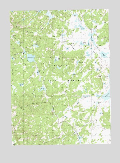
Raid Lake, WY USGS Topographic Map
Click on map above to begin viewing in our Map Viewer.

This topographic map contains these locations and features:
Feature Name Type Latitude Longitude GNIS ID View Map
Bobs LakeLakeN42.8709°W109.4177°1598281View Map
Chilcoot TrailTrailN42.7752°W109.4315°1598729View Map
Cottonwood TrailTrailN42.7655°W109.4126°1598946View Map
Crescent LakeLakeN42.8518°W109.4329°1599018View Map
Cross LakeLakeN42.8329°W109.3823°1599040View Map
Divide DamDamN42.8300°W109.4740°1607881View Map
Divide LakeLakeN42.8305°W109.4743°1599270View Map
Divide ReservoirReservoirN42.8300°W109.4740°1607882View Map
Dream CreekStreamN42.8502°W109.4221°1599316View Map
Dream LakeLakeN42.8587°W109.4112°1599317View Map
Dream Lake TrailTrailN42.8558°W109.4212°1604891View Map
Full Moon LakeLakeN42.8743°W109.4624°1599881View Map
Halls CreekStreamN42.8738°W109.4504°1600179View Map
Jessie LakeLakeN42.7785°W109.3877°1600611View Map
Junction LakeLakeN42.8689°W109.4503°1600668View Map
Knob LakesLakeN42.8287°W109.4433°1600751View Map
Lightning LakesLakeN42.8417°W109.4660°1600909View Map
Little Divide LakeLakeN42.8366°W109.4817°1600969View Map
Lower Sylvan LakeLakeN42.8153°W109.4209°1601182View Map
Lowline TrailTrailN42.7980°W109.4549°1604419View Map
Middle Fork Boulder CreekStreamN42.8550°W109.4660°1601388View Map
Mitchells NippleSummitN42.8130°W109.3893°1601502View Map
Monroe CreekStreamN42.7849°W109.4871°1601513View Map
Monroe LakeLakeN42.8175°W109.4658°1601514View Map
Moose LakeLakeN42.8215°W109.4396°1601543View Map
North Fork Silver CreekStreamN42.7522°W109.4957°1601813View Map
Pine Island LakeLakeN42.8455°W109.4900°1602163View Map
Raid CreekStreamN42.8405°W109.3915°1602360View Map
Raid LakeLakeN42.8477°W109.3974°1602361View Map
Sage Basin TrailTrailN42.8091°W109.4876°1602672View Map
Scab Creek TrailTrailN42.8408°W109.4093°1602754View Map
Scab LakeLakeN42.8063°W109.4865°1602755View Map
Scab Sage TrailTrailN42.8163°W109.4974°1602756View Map
Sheep CreekStreamN42.8405°W109.3915°1602835View Map
Shoestring LakeLakeN42.7878°W109.3921°1602900View Map
Silver Creek CanyonValleyN42.7522°W109.4957°1594337View Map
Silver LakeLakeN42.7947°W109.3786°1602926View Map
Silver LakeReservoirN42.7933°W109.3757°1607834View Map
Silver Lake DamDamN42.7933°W109.3757°1607833View Map
Silver Lake TrailTrailN42.8138°W109.3799°1604723View Map
South Fork Boulder CreekStreamN42.8550°W109.4660°1603120View Map
South Fork LakeLakeN42.8434°W109.4099°1603149View Map
South Fork Silver CreekStreamN42.7522°W109.4957°1603173View Map
Star CreekStreamN42.7883°W109.4760°1603334View Map
Star LakeLakeN42.8024°W109.4599°1603336View Map
Sylvan CreekStreamN42.7911°W109.4537°1603496View Map
Sylvan Lake TrailTrailN42.8136°W109.4226°1604722View Map
Three Elk LakeLakeN42.8510°W109.4977°1603654View Map
Toboggan LakeLakeN42.8308°W109.4972°1603685View Map
Upper Silver LakesLakeN42.8131°W109.3764°1604522View Map
Upper Sylvan LakeLakeN42.8266°W109.4146°1603890View Map
Warbonnet LakeLakeN42.8190°W109.3910°1603977View Map
Whisky CreekStreamN42.7611°W109.4171°1604133View Map
Willow BasinBasinN42.7508°W109.4860°1604193View Map
Wolf LakeLakeN42.7552°W109.4142°1604265View Map

Note: Coordinates in the location and feature list above are referenced to NAD83 datum.


Copyright (C) 2008-2024 Ryan Niemi / Sunset Dynamics ... All Rights Reserved