TopoQuest Logo
Do you find TopoQuest useful?
Help keep TopoQuest running and adding new maps/features by donating!
Bitcoin:  19c7KJd3qBynnjoSw5npx9KScwjBe4ifkT
Litecoin:  LXs6TkuXGGXo1vDsWCkWVdjQX94eUKd6ui
Home View Maps Find Maps Find Places Resources & Links


Pryor, Oklahoma Topographic Map

USGS Map Title: Pryor, OK
USGS Map MRC: 36095C3
DRG (GeoTIFF) Download: o36095c3.tif


Neighboring USGS Topographic Map Quads:


  Bushyhead, OK  
36095D4
 

  Adair, OK  
36095D3
 

  Strang, OK  
36095D2
 

  Osage Hills, OK  
36095C4
 

  Pryor, OK  
36095C3
 

  Salina, OK  
36095C2
 

  Chouteau NW, OK  
36095B4
 

  Chouteau, OK  
36095B3
 

  Locust Grove, OK  
36095B2


Map MRC Location:

N37°
W96°
N37°
W95°
H8 H7 H6 H5 H4 H3 H2 H1
G8 G7 G6 G5 G4 G3 G2 G1
F8 F7 F6 F5 F4 F3 F2 F1
E8 E7 E6 E5 E4 E3 E2 E1
D8 D7 D6 D5 D4 D3 D2 D1
C8 C7 C6 C5 C4 C3 C2 C1
B8 B7 B6 B5 B4 B3 B2 B1
A8 A7 A6 A5 A4 A3 A2 A1
N36°
W96°
N36°
W95°

Pryor, OK USGS 1:24K Topographic Map Preview:
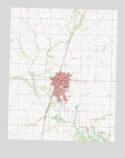
Pryor, OK USGS Topographic Map
Click on map above to begin viewing in our Map Viewer.

This topographic map contains these locations and features:
Feature Name Type Latitude Longitude GNIS ID View Map
Center 69LocaleN36.2982°W95.3255°1763833View Map
Church of ChristChurchN36.2984°W95.3155°1809843View Map
Church of GodChurchN36.3095°W95.3100°1809844View Map
Church of the Nazarene FirstChurchN36.3037°W95.3158°1809845View Map
City of Pryor CreekCivilN36.2999°W95.3101°2411500View Map
County Home CemeteryCemeteryN36.2936°W95.3252°1091750View Map
Dr Williams Pond Number 5ReservoirN36.3458°W95.3295°1755760View Map
Dr Williams Pond Number 5 DamDamN36.3451°W95.3302°1755759View Map
Fairview CemeteryCemeteryN36.3083°W95.2977°1092716View Map
First Baptist ChurchChurchN36.3070°W95.3122°1809846View Map
First Christian Disciples ChurchChurchN36.3095°W95.3152°1809847View Map
First Church of GodChurchN36.3062°W95.3164°1809848View Map
First Free Will Baptist ChurchChurchN36.3034°W95.3061°1809849View Map
First United Methodist ChurchChurchN36.3073°W95.3144°1809850View Map
Graham Memorial CemeteryCemeteryN36.3052°W95.2972°1093293View Map
Immanuel Baptist ChurchChurchN36.3076°W95.3233°1809851View Map
Integris Mayes County Medical CenterHospitalN36.3084°W95.3042°2695772View Map
Jefferson Elementary SchoolSchoolN36.2962°W95.3149°1094200View Map
Kingdom Hall Jehovahs WitnessesChurchN36.3181°W95.3097°1809852View Map
KMYZ-AM (Pryor)TowerN36.3012°W95.3250°1102217View Map
Lincoln Elementary SchoolSchoolN36.2862°W95.3087°1094678View Map
Longs Airport NorthAirportN36.3350°W95.3066°1102645View Map
Mayes County Sheriff's OfficeBuildingN36.3090°W95.3155°2757451View Map
Mud CreekStreamN36.3112°W95.3483°1095680View Map
Presybterian ChurchChurchN36.2901°W95.3097°1809853View Map
PryorPopulated PlaceN36.3084°W95.3169°1102850View Map
Pryor Apostolic ChurchChurchN36.3095°W95.3222°1809855View Map
Pryor Beauty CollegeSchoolN36.3094°W95.3248°2713071View Map
Pryor Fire Department Station 1 HeadquartersBuildingN36.2932°W95.3095°2656921View Map
Pryor Fire Department Station 2BuildingN36.3094°W95.3168°2657129View Map
Pryor First Assembly of GodChurchN36.3126°W95.3155°1809854View Map
Pryor High SchoolSchoolN36.2913°W95.3052°1819296View Map
Pryor Junior High SchoolSchoolN36.3048°W95.3116°1096950View Map
Pryor Missionary Baptist ChurchChurchN36.2820°W95.3097°1809856View Map
Pryor Police DepartmentBuildingN36.3029°W95.3207°2757521View Map
Pryor Post OfficePost OfficeN36.3052°W95.3178°1818359View Map
Roosevelt Lower Elementary SchoolSchoolN36.3135°W95.3079°1097417View Map
Saint Johns Lutheran ChurchChurchN36.2937°W95.3130°1809858View Map
Saint Marks SchoolSchoolN36.2868°W95.3183°1097625View Map
Saint Martin Tours Episcopal ChurchChurchN36.3045°W95.3125°1809859View Map
Salt BranchStreamN36.3159°W95.3327°1097667View Map
Scarbow LakeReservoirN36.2830°W95.2948°1097864View Map
Scarbow Lake DamDamN36.2801°W95.2952°1755757View Map
Seminole CreekStreamN36.3004°W95.3452°1097911View Map
Southside Christian PreschoolSchoolN36.2826°W95.3102°1809857View Map
Squaw CreekStreamN36.3528°W95.3056°1803754View Map
Squaw HollowValleyN36.3576°W95.2975°1098474View Map
Sulphur CreekStreamN36.2548°W95.2705°1098628View Map
Tiger PlazaLocaleN36.2926°W95.3239°1763834View Map
Township of HoganCivilN36.3001°W95.3252°1824565View Map
Victory Baptist ChurchChurchN36.3151°W95.3175°1809860View Map
Washington Elementary SchoolSchoolN36.3080°W95.3249°1099404View Map
Westside Freewill Baptist ChurchChurchN36.3037°W95.3286°1809861View Map
Westside ParkParkN36.3062°W95.3244°1099636View Map
Whitaker Home PondReservoirN36.2952°W95.2836°1755762View Map
Whitaker Home Pond DamDamN36.2934°W95.2836°1755761View Map
Whitaker ParkParkN36.3009°W95.3139°1099689View Map
Whitaker State Childrens HomeBuildingN36.2979°W95.3066°1102101View Map
Whittaker Army HeliportAirportN36.2965°W95.3058°1102644View Map
William Bradford Christian SchoolSchoolN36.3045°W95.2823°2712952View Map

Note: Coordinates in the location and feature list above are referenced to NAD83 datum.


Copyright (C) 2008-2024 Ryan Niemi / Sunset Dynamics ... All Rights Reserved