TopoQuest Logo
Do you find TopoQuest useful?
Help keep TopoQuest running and adding new maps/features by donating!
Bitcoin:  19c7KJd3qBynnjoSw5npx9KScwjBe4ifkT
Litecoin:  LXs6TkuXGGXo1vDsWCkWVdjQX94eUKd6ui
Home View Maps Find Maps Find Places Resources & Links


Providence Forge, Virginia Topographic Map

USGS Map Title: Providence Forge, VA
USGS Map MRC: 37077D1
DRG (GeoTIFF) Download: o37077d1.tif


Neighboring USGS Topographic Map Quads:


  Quinton, VA  
37077E2
 

  Tunstall, VA  
37077E1
 

  New Kent, VA  
37076E8
 

  Roxbury, VA  
37077D2
 

  Providence Forge, VA  
37077D1
 

  Walkers, VA  
37076D8
 

  Westover, VA  
37077C2
 

  Charles City, VA  
37077C1
 

  Brandon, VA  
37076C8


Map MRC Location:

N38°
W78°
N38°
W77°
H8 H7 H6 H5 H4 H3 H2 H1
G8 G7 G6 G5 G4 G3 G2 G1
F8 F7 F6 F5 F4 F3 F2 F1
E8 E7 E6 E5 E4 E3 E2 E1
D8 D7 D6 D5 D4 D3 D2 D1
C8 C7 C6 C5 C4 C3 C2 C1
B8 B7 B6 B5 B4 B3 B2 B1
A8 A7 A6 A5 A4 A3 A2 A1
N37°
W78°
N37°
W77°

Providence Forge, VA USGS 1:24K Topographic Map Preview:
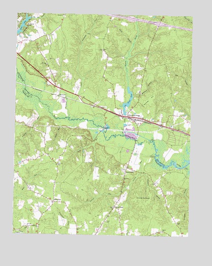
Providence Forge, VA USGS Topographic Map
Click on map above to begin viewing in our Map Viewer.

This topographic map contains these locations and features:
Feature Name Type Latitude Longitude GNIS ID View Map
Adkins StoreLocaleN37.3940°W77.0961°1478096View Map
Allens RunStreamN37.4996°W77.1177°1462417View Map
Bethany ChurchChurchN37.3793°W77.1072°1478188View Map
Bradley RunStreamN37.4449°W77.1089°1478254View Map
Cedar Grove CemeteryCemeteryN37.4860°W77.1161°1464608View Map
Cedar Grove ChurchChurchN37.4149°W77.0936°1478349View Map
Chapel CemeteryCemeteryN37.3824°W77.0083°1478362View Map
Charles City LandfillLocaleN37.4326°W77.1230°2518623View Map
Charles City Volunteer Fire Department Station 1BuildingN37.3923°W77.0966°2086329View Map
Chickahominy Wastewater Treatment PlantLocaleN37.4814°W77.0080°2520556View Map
Collins RunStreamN37.4213°W77.0241°1478408View Map
District 2CivilN37.3810°W77.1143°1986428View Map
District 4CivilN37.4490°W77.0912°1927246View Map
Dockman SwampStreamN37.4110°W77.0341°1478494View Map
Emmaus ChurchChurchN37.4990°W77.0916°1466300View Map
Evans Evergreen NurseryBuildingN37.4689°W77.1022°2677726View Map
Heritage Public LibraryBuildingN37.4416°W77.0439°2519907View Map
Holly LandingLocaleN37.4296°W77.0283°1499571View Map
Interchange 214CrossingN37.4954°W77.0233°1739800View Map
Jerdones Big WoodsWoodsN37.3954°W77.0330°1478852View Map
Jones RunStreamN37.4318°W77.0464°1468859View Map
Kent LakeReservoirN37.4893°W77.1237°1468961View Map
Little Elam ChurchChurchN37.3796°W77.1152°1478972View Map
Menoah CemeteryCemeteryN37.3776°W77.0189°1479087View Map
Minitree BranchStreamN37.4535°W77.0405°1470605View Map
Minitree HillSummitN37.4524°W77.0289°1499750View Map
Mount Calvary ChurchChurchN37.4715°W77.1027°1470827View Map
Mount Stirling ChurchChurchN37.4071°W77.0469°1479159View Map
MountcastlePopulated PlaceN37.4535°W77.0939°1477563View Map
New Kent Fire - Rescue Station 1 / Providence Forge Volunteer Fire - RescueBuildingN37.4567°W77.0354°2086132View Map
Old Forge PondReservoirN37.4495°W77.0453°1502087View Map
Old Forge Pond DamDamN37.4435°W77.0455°1490460View Map
Oldhouse LandingLocaleN37.4199°W77.0250°1499822View Map
Olivet ChurchChurchN37.4804°W77.0625°1471914View Map
Piney BranchStreamN37.4832°W77.0411°1472379View Map
Possum RunStreamN37.4632°W77.1227°1479372View Map
Potato RunStreamN37.4388°W77.0927°1479373View Map
Providence ForgePopulated PlaceN37.4418°W77.0436°1499920View Map
Providence Forge FirefightersBuildingN37.4436°W77.0479°2331883View Map
Providence Forge Post OfficePost OfficeN37.4432°W77.0439°2766488View Map
Providence Forge Presbyterian ChurchChurchN37.4388°W77.0372°1739815View Map
Providence Forge Volunteer Rescue SquadBuildingN37.4406°W77.0295°2331710View Map
Roaches CornerPopulated PlaceN37.3910°W77.0527°1479439View Map
Rumley MarshStreamN37.4596°W77.0439°1473627View Map
SandybottomPopulated PlaceN37.4132°W77.0444°1479550View Map
Schiminoe CreekStreamN37.4415°W77.0866°1474096View Map
Stony RunStreamN37.4313°W77.0608°1479684View Map
The Fellowship ChurchChurchN37.4748°W77.0536°2519840View Map
Union CemeteryCemeteryN37.3821°W77.0586°1479778View Map
Winns LandingLocaleN37.4140°W77.0036°1500334View Map

Note: Coordinates in the location and feature list above are referenced to NAD83 datum.


Copyright (C) 2008-2024 Ryan Niemi / Sunset Dynamics ... All Rights Reserved