TopoQuest Logo
Do you find TopoQuest useful?
Help keep TopoQuest running and adding new maps/features by donating!
Bitcoin:  19c7KJd3qBynnjoSw5npx9KScwjBe4ifkT
Litecoin:  LXs6TkuXGGXo1vDsWCkWVdjQX94eUKd6ui
Home View Maps Find Maps Find Places Resources & Links


Prospect Crossroads, South Carolina Topographic Map

USGS Map Title: Prospect Crossroads, SC
USGS Map MRC: 33079G5
DRG (GeoTIFF) Download: o33079g5.tif


Neighboring USGS Topographic Map Quads:


  Scranton, SC  
33079H6
 

  Pamplico South, SC  
33079H5
 

  Gresham, SC  
33079H4
 

  Lake City East, SC  
33079G6
 

  Prospect Crossroads, SC  
33079G5
 

  Johnsonville, SC  
33079G4
 

  Fowler, SC  
33079F6
 

  Indiantown, SC  
33079F5
 

  Henry, SC  
33079F4


Map MRC Location:

N34°
W80°
N34°
W79°
H8 H7 H6 H5 H4 H3 H2 H1
G8 G7 G6 G5 G4 G3 G2 G1
F8 F7 F6 F5 F4 F3 F2 F1
E8 E7 E6 E5 E4 E3 E2 E1
D8 D7 D6 D5 D4 D3 D2 D1
C8 C7 C6 C5 C4 C3 C2 C1
B8 B7 B6 B5 B4 B3 B2 B1
A8 A7 A6 A5 A4 A3 A2 A1
N33°
W80°
N33°
W79°

Prospect Crossroads, SC USGS 1:24K Topographic Map Preview:
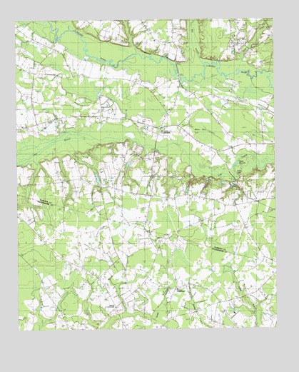
Prospect Crossroads, SC USGS Topographic Map
Click on map above to begin viewing in our Map Viewer.

This topographic map contains these locations and features:
Feature Name Type Latitude Longitude GNIS ID View Map
Bartell CrossroadsPopulated PlaceN33.7593°W79.5784°1244972View Map
Baxley CemeteryCemeteryN33.8324°W79.5414°1242308View Map
Bens LakeLakeN33.8132°W79.5337°1220501View Map
Beulah ChurchChurchN33.7907°W79.5134°1246850View Map
Big Swamp BranchStreamN33.8577°W79.5328°1220738View Map
Carter CemeteryCemeteryN33.8649°W79.6084°1242346View Map
Cooper SchoolSchoolN33.7704°W79.5012°1221742View Map
Deep CreekStreamN33.8574°W79.5156°1221978View Map
Eaddy - Ford CemeteryCemeteryN33.8068°W79.5164°1241852View Map
Eaddy Big LakeLakeN33.8161°W79.5189°1222172View Map
Eaddy CemeteryCemeteryN33.8232°W79.5209°1241851View Map
Gaskins CemeteryCemeteryN33.8585°W79.6151°1241923View Map
Gaskins CemeteryCemeteryN33.8677°W79.5759°1241924View Map
Gum BranchStreamN33.8257°W79.6198°1222942View Map
Half Moon (historical)Populated PlaceN33.8502°W79.5456°1241946View Map
Hanna CemeteryCemeteryN33.8199°W79.5776°1241956View Map
Hannah ChapelChurchN33.8054°W79.5639°1223021View Map
Holiness ChurchChurchN33.8357°W79.5531°1241967View Map
House of Prayer (historical)ChurchN33.8518°W79.5892°1241972View Map
Indiantown DivisionCivilN33.7519°W79.6116°1938304View Map
Jeremiah ChurchChurchN33.7716°W79.5003°1223546View Map
Johnsonville Fire Department Station 2BuildingN33.8188°W79.5588°2368339View Map
LeoPopulated PlaceN33.8335°W79.6151°1227935View Map
Leo CemeteryCemeteryN33.8374°W79.6156°1242021View Map
Leo Hanna PondReservoirN33.8135°W79.5831°1240119View Map
Leo Hanna Pond Dam D-3567DamN33.8135°W79.5831°1240118View Map
Leo SchoolSchoolN33.8396°W79.6173°1223878View Map
Little Bethel ChurchChurchN33.8118°W79.5595°1246387View Map
Little Star ChurchChurchN33.8354°W79.5853°1246433View Map
Macs BayBasinN33.8307°W79.5323°1246514View Map
Midway Baptist ChurchChurchN33.7663°W79.5478°1241462View Map
Midway CemeteryCemeteryN33.7663°W79.5473°1241463View Map
Midway CrossroadsPopulated PlaceN33.7671°W79.5481°1224485View Map
Midway SchoolSchoolN33.7616°W79.5231°1224486View Map
New Prospect Christian SchoolSchoolN33.8665°W79.5565°2486453View Map
New Prospect ChurchChurchN33.8668°W79.5573°1225017View Map
Ninevah School (historical)SchoolN33.8421°W79.6076°1249877View Map
Nineveh ChurchChurchN33.8371°W79.6159°1249876View Map
Ola Neck CemeteryCemeteryN33.8624°W79.5531°1242103View Map
Powell CemeteryCemeteryN33.8340°W79.5676°1242135View Map
Power - DuRant CemeteryCemeteryN33.8057°W79.5442°1242137View Map
Prospect ChurchChurchN33.8321°W79.5531°1242140View Map
Prospect CrossroadsPopulated PlaceN33.8313°W79.5548°1250258View Map
Prospect School (historical)SchoolN33.8310°W79.5531°1242141View Map
Raccoon LakeLakeN33.8124°W79.5387°1225734View Map
Saint James ChurchChurchN33.8027°W79.5487°1226118View Map
Saint Marks ChurchChurchN33.7677°W79.5837°1226195View Map
Saint Marks SchoolSchoolN33.7718°W79.5884°1226199View Map
Saint Marys ChurchChurchN33.7568°W79.5759°1226206View Map
Saint Paul SchoolSchoolN33.8118°W79.5948°1226232View Map
Spring LakeLakeN33.8132°W79.5190°1226827View Map
Turner CemeteryCemeteryN33.8668°W79.5798°1242229View Map
Vox ChurchChurchN33.8035°W79.5401°1242232View Map
Vox SchoolSchoolN33.8046°W79.5398°1227352View Map

Note: Coordinates in the location and feature list above are referenced to NAD83 datum.


Copyright (C) 2008-2024 Ryan Niemi / Sunset Dynamics ... All Rights Reserved