TopoQuest Logo
Do you find TopoQuest useful?
Help keep TopoQuest running and adding new maps/features by donating!
Bitcoin:  19c7KJd3qBynnjoSw5npx9KScwjBe4ifkT
Litecoin:  LXs6TkuXGGXo1vDsWCkWVdjQX94eUKd6ui
Home View Maps Find Maps Find Places Resources & Links


Portland North, Michigan Topographic Map

USGS Map Title: Portland North, MI
USGS Map MRC: 42084H8
DRG (GeoTIFF) Download: o42084h8.tif


Neighboring USGS Topographic Map Quads:


  Shiloh, MI  
43085A1
 

  Palo, MI  
43084A8
 

  Hubbardston, MI  
43084A7
 

  Ionia, MI  
42085H1
 

  Portland North, MI  
42084H8
 

  Westphalia, MI  
42084H7
 

  Woodbury, MI  
42085G1
 

  Portland South, MI  
42084G8
 

  Eagle, MI  
42084G7


Map MRC Location:

N43°
W85°
N43°
W84°
H8 H7 H6 H5 H4 H3 H2 H1
G8 G7 G6 G5 G4 G3 G2 G1
F8 F7 F6 F5 F4 F3 F2 F1
E8 E7 E6 E5 E4 E3 E2 E1
D8 D7 D6 D5 D4 D3 D2 D1
C8 C7 C6 C5 C4 C3 C2 C1
B8 B7 B6 B5 B4 B3 B2 B1
A8 A7 A6 A5 A4 A3 A2 A1
N42°
W85°
N42°
W84°

Portland North, MI USGS 1:24K Topographic Map Preview:
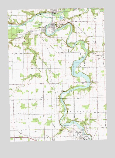
Portland North, MI USGS Topographic Map
Click on map above to begin viewing in our Map Viewer.

This topographic map contains these locations and features:
Feature Name Type Latitude Longitude GNIS ID View Map
Ayers BranchStreamN42.9436°W84.9500°620395View Map
Balderson DrainCanalN42.8945°W84.8842°620505View Map
Bogue Flats Recreation AreaParkN42.8778°W84.9006°2581652View Map
Brown GraveCemeteryN42.9292°W84.9139°2581776View Map
Carbaugh DrainCanalN42.8820°W84.9775°622707View Map
Church of Christ Historical MarkerParkN42.9995°W84.9413°2567819View Map
CollinsPopulated PlaceN42.9292°W84.9439°623614View Map
Collins Post Office (historical)Post OfficeN42.9292°W84.9439°2581753View Map
Collins Station (historical)LocaleN42.9292°W84.9447°2581720View Map
First Christian ChurchChurchN42.9997°W84.9267°2582377View Map
Friend BrookStreamN42.8878°W84.9308°626498View Map
Goose CreekStreamN42.9575°W84.8983°626959View Map
Hidden Valley Mobile Home CommunityPopulated PlaceN42.9925°W84.9992°2582309View Map
Joe Tichvon ParkParkN42.8767°W84.9097°2581653View Map
Keefer CemeteryCemeteryN42.9364°W84.9567°629494View Map
Kossuth Post Office (historical)Post OfficeN42.9008°W84.9375°2581745View Map
Libhart CreekStreamN42.9867°W84.9775°630369View Map
Little Libhart CreekStreamN42.9589°W84.9664°630678View Map
LyonsPopulated PlaceN42.9820°W84.9469°631245View Map
Lyons - Muir Fire DepartmentBuildingN42.9831°W84.9464°2636077View Map
Lyons Clinic Family MedicineHospitalN42.9819°W84.9453°2582383View Map
Lyons Post OfficePost OfficeN42.9819°W84.9469°2582381View Map
Lyons Public LibraryBuildingN42.9819°W84.9472°2582382View Map
Lyons Station (historical)LocaleN42.9822°W84.9531°2582380View Map
Lyons Township CemeteryCemeteryN42.9861°W84.9333°2581779View Map
Maple Post Office (historical)Post OfficeN42.9436°W84.8875°2581744View Map
Maple RiverStreamN42.9959°W84.9550°631491View Map
Mount Hope Church PortlandChurchN42.8789°W84.9111°2582334View Map
MuirPopulated PlaceN42.9959°W84.9425°633093View Map
Muir Post OfficePost OfficeN42.9958°W84.9392°2582378View Map
Muir Station (historical)LocaleN42.9967°W84.9417°2582379View Map
Musser CemeteryCemeteryN42.8944°W84.9556°2581778View Map
Portland Country ClubLocaleN42.9164°W84.8861°1623582View Map
Portland High SchoolSchoolN42.8806°W84.9186°2582335View Map
Portland Municipal DamDamN42.8892°W84.9306°635313View Map
Portland Station (historical)LocaleN42.8758°W84.9042°2582313View Map
Stoney Creek PitMineN42.9967°W84.9100°2725139View Map
Township of LyonsCivilN42.9881°W84.8969°1626652View Map
Township of PortlandCivilN42.9028°W84.8965°1626935View Map
Village of LyonsCivilN42.9834°W84.9456°2399213View Map
Village of MuirCivilN42.9973°W84.9359°2399423View Map
Wagar DamDamN42.9656°W84.9139°1615653View Map
Weber DamDamN42.9531°W84.9025°1615933View Map
Westwood Elementary SchoolSchoolN42.8819°W84.9139°2582336View Map

Note: Coordinates in the location and feature list above are referenced to NAD83 datum.


Copyright (C) 2008-2024 Ryan Niemi / Sunset Dynamics ... All Rights Reserved