TopoQuest Logo
Do you find TopoQuest useful?
Help keep TopoQuest running and adding new maps/features by donating!
Bitcoin:  19c7KJd3qBynnjoSw5npx9KScwjBe4ifkT
Litecoin:  LXs6TkuXGGXo1vDsWCkWVdjQX94eUKd6ui
Home View Maps Find Maps Find Places Resources & Links


Panamint, California Topographic Map

USGS Map Title: Panamint, CA
USGS Map MRC: 36117A1
DRG (GeoTIFF) Download: o36117a1.tif


Neighboring USGS Topographic Map Quads:


  Jail Canyon, CA  
36117B2
 

  Telescope Peak, CA  
36117B1
 

  Hanaupah Canyon, CA  
36116B8
 

  Ballarat, CA  
36117A2
 

  Panamint, CA  
36117A1
 

  Galena Canyon, CA  
36116A8
 

  Manly Fall, CA  
35117H2
 

  Manly Peak, CA  
35117H1
 

  Anvil Spring Canyon West, CA  
35116H8


Map MRC Location:

N37°
W118°
N37°
W117°
H8 H7 H6 H5 H4 H3 H2 H1
G8 G7 G6 G5 G4 G3 G2 G1
F8 F7 F6 F5 F4 F3 F2 F1
E8 E7 E6 E5 E4 E3 E2 E1
D8 D7 D6 D5 D4 D3 D2 D1
C8 C7 C6 C5 C4 C3 C2 C1
B8 B7 B6 B5 B4 B3 B2 B1
A8 A7 A6 A5 A4 A3 A2 A1
N36°
W118°
N36°
W117°

Panamint, CA USGS 1:24K Topographic Map Preview:
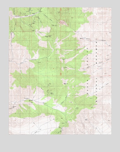
Panamint, CA USGS Topographic Map
Click on map above to begin viewing in our Map Viewer.

This topographic map contains these locations and features:
Feature Name Type Latitude Longitude GNIS ID View Map
Arrastre SpringSpringN36.0143°W117.0302°238728View Map
Cannon CanyonValleyN36.1150°W117.1184°240202View Map
Cooper MineMineN36.0400°W117.0759°240895View Map
Frenchmans CanyonValleyN36.1198°W117.0895°242501View Map
Hemlock MineMineN36.1027°W117.0978°243357View Map
Hudson River MineMineN36.0958°W117.1101°243714View Map
Hungry Bills RanchLocaleN36.0944°W117.0376°243733View Map
Magazine CanyonValleyN36.1179°W117.0941°245365View Map
Marvel CanyonValleyN36.1148°W117.1121°245578View Map
Middle ParkBasinN36.0055°W117.0878°245872View Map
Mormon GulchValleyN36.0263°W117.0643°246203View Map
PanamintPopulated PlaceN36.1183°W117.0953°1661185View Map
Panamint PassGapN36.1072°W117.0698°247212View Map
Panamint Post Office (historical)Post OfficeN36.1183°W117.0953°2026825View Map
Porter MineMineN36.0491°W117.0762°247696View Map
Porter PeakSummitN36.0498°W117.0563°247698View Map
Sourdough CanyonValleyN36.1177°W117.0992°249673View Map
Stone CorralLocaleN36.0338°W117.0964°249952View Map
Thompson CampLocaleN36.1222°W117.0876°250442View Map
Water CanyonValleyN36.1206°W117.0891°251250View Map
Woodpecker CanyonValleyN36.1166°W117.1194°251791View Map
World Beater MineMineN36.0263°W117.1214°251814View Map
Wyoming MineMineN36.1091°W117.0962°251833View Map

Note: Coordinates in the location and feature list above are referenced to NAD83 datum.


Copyright (C) 2008-2024 Ryan Niemi / Sunset Dynamics ... All Rights Reserved