TopoQuest Logo
Do you find TopoQuest useful?
Help keep TopoQuest running and adding new maps/features by donating!
Bitcoin:  19c7KJd3qBynnjoSw5npx9KScwjBe4ifkT
Litecoin:  LXs6TkuXGGXo1vDsWCkWVdjQX94eUKd6ui
Home View Maps Find Maps Find Places Resources & Links


Manly Peak, California Topographic Map

USGS Map Title: Manly Peak, CA
USGS Map MRC: 35117H1
DRG (GeoTIFF) Download: o35117h1.tif


Neighboring USGS Topographic Map Quads:


  Ballarat, CA  
36117A2
 

  Panamint, CA  
36117A1
 

  Galena Canyon, CA  
36116A8
 

  Manly Fall, CA  
35117H2
 

  Manly Peak, CA  
35117H1
 

  Anvil Spring Canyon West, CA  
35116H8
 

  Copper Queen Canyon, CA  
35117G2
 

  Sourdough Spring, CA  
35117G1
 

  Wingate Wash West, CA  
35116G8


Map MRC Location:

N36°
W118°
N36°
W117°
H8 H7 H6 H5 H4 H3 H2 H1
G8 G7 G6 G5 G4 G3 G2 G1
F8 F7 F6 F5 F4 F3 F2 F1
E8 E7 E6 E5 E4 E3 E2 E1
D8 D7 D6 D5 D4 D3 D2 D1
C8 C7 C6 C5 C4 C3 C2 C1
B8 B7 B6 B5 B4 B3 B2 B1
A8 A7 A6 A5 A4 A3 A2 A1
N35°
W118°
N35°
W117°

Manly Peak, CA USGS 1:24K Topographic Map Preview:
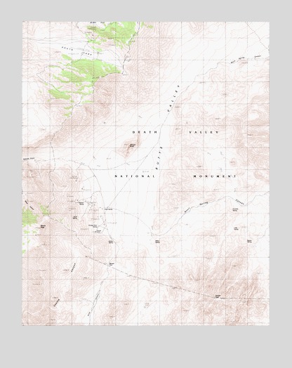
Manly Peak, CA USGS Topographic Map
Click on map above to begin viewing in our Map Viewer.

This topographic map contains these locations and features:
Feature Name Type Latitude Longitude GNIS ID View Map
Anvil SpringSpringN35.9231°W117.0849°238657View Map
Butte ValleyValleyN35.9018°W117.0593°255385View Map
Fivemile SpringSpringN35.9227°W117.0200°242289View Map
Greater View SpringSpringN35.9163°W117.0876°242977View Map
Hatchet SpringSpringN35.9256°W117.0944°1666951View Map
Jubilee SpringSpringN35.9094°W117.0795°1666956View Map
Little SpringSpringN35.9148°W117.0190°1666962View Map
Manly PeakSummitN35.9152°W117.1171°245441View Map
Mengel PassGapN35.9005°W117.0820°245772View Map
Needle PeakSummitN35.8861°W117.0285°246453View Map
Quail SpringSpringN35.9198°W117.0977°1666986View Map
Russell CampLocaleN35.9136°W117.0887°248475View Map
South ParkBasinN35.9869°W117.0987°249742View Map
Squaw SpringSpringN35.9102°W117.0096°249843View Map
Striped ButteSummitN35.9486°W117.0720°254311View Map
Willow SpringSpringN35.9106°W117.0589°251641View Map

Note: Coordinates in the location and feature list above are referenced to NAD83 datum.


Copyright (C) 2008-2024 Ryan Niemi / Sunset Dynamics ... All Rights Reserved