TopoQuest Logo
Do you find TopoQuest useful?
Help keep TopoQuest running and adding new maps/features by donating!
Bitcoin:  19c7KJd3qBynnjoSw5npx9KScwjBe4ifkT
Litecoin:  LXs6TkuXGGXo1vDsWCkWVdjQX94eUKd6ui
Home View Maps Find Maps Find Places Resources & Links


Palmer, Nebraska Topographic Map

USGS Map Title: Palmer, NE
USGS Map MRC: 41098B3
DRG (GeoTIFF) Download: o41098b3.tif


Neighboring USGS Topographic Map Quads:


  Wolbach SW, NE  
41098C4
 

  Cushing, NE  
41098C3
 

  Belgrade SW, NE  
41098C2
 

  Saint Paul, NE  
41098B4
 

  Palmer, NE  
41098B3
 

  Archer, NE  
41098B2
 

  Saint Paul SW, NE  
41098A4
 

  Saint Libory, NE  
41098A3
 

  Chapman, NE  
41098A2


Map MRC Location:

N42°
W99°
N42°
W98°
H8 H7 H6 H5 H4 H3 H2 H1
G8 G7 G6 G5 G4 G3 G2 G1
F8 F7 F6 F5 F4 F3 F2 F1
E8 E7 E6 E5 E4 E3 E2 E1
D8 D7 D6 D5 D4 D3 D2 D1
C8 C7 C6 C5 C4 C3 C2 C1
B8 B7 B6 B5 B4 B3 B2 B1
A8 A7 A6 A5 A4 A3 A2 A1
N41°
W99°
N41°
W98°

Palmer, NE USGS 1:24K Topographic Map Preview:
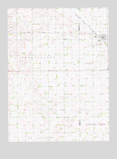
Palmer, NE USGS Topographic Map
Click on map above to begin viewing in our Map Viewer.

This topographic map contains these locations and features:
Feature Name Type Latitude Longitude GNIS ID View Map
Coolidge Center Nursing HomeHospitalN41.2222°W98.2573°1881319View Map
First Church of ChristChurchN41.2222°W98.2573°1881320View Map
Gage Valley Election PrecinctCivilN41.1985°W98.3386°1928886View Map
PalmerPopulated PlaceN41.2222°W98.2573°831956View Map
PalmerLocaleN41.2197°W98.2576°1881327View Map
Palmer Post OfficePost OfficeN41.2219°W98.2578°1881325View Map
Palmer Public LibraryBuildingN41.2222°W98.2573°1881322View Map
Palmer Public SchoolsSchoolN41.2220°W98.2578°1881326View Map
Palmer Rural Fire DistrictBuildingN41.2224°W98.2565°1881321View Map
Rose Hill CemeteryCemeteryN41.2256°W98.2695°832691View Map
Saint Johns Lutheran ChurchChurchN41.2222°W98.2573°1881318View Map
School Number 19SchoolN41.1914°W98.3251°836349View Map
School Number 39SchoolN41.1542°W98.3065°836669View Map
School Number 64SchoolN41.2208°W98.3059°836976View Map
Township of Gage ValleyCivilN41.2083°W98.3337°1874743View Map
United Methodist ChurchChurchN41.2222°W98.2573°1881323View Map
Village of PalmerCivilN41.2224°W98.2598°2399613View Map
Wesleyan ChurchChurchN41.2222°W98.2573°1881324View Map

Note: Coordinates in the location and feature list above are referenced to NAD83 datum.


Copyright (C) 2008-2024 Ryan Niemi / Sunset Dynamics ... All Rights Reserved