TopoQuest Logo
Do you find TopoQuest useful?
Help keep TopoQuest running and adding new maps/features by donating!
Bitcoin:  19c7KJd3qBynnjoSw5npx9KScwjBe4ifkT
Litecoin:  LXs6TkuXGGXo1vDsWCkWVdjQX94eUKd6ui
Home View Maps Find Maps Find Places Resources & Links


Palmer, Texas Topographic Map

USGS Map Title: Palmer, TX
USGS Map MRC: 32096D6
DRG (GeoTIFF) Download: o32096d6.tif


Neighboring USGS Topographic Map Quads:


  Lancaster, TX  
32096E7
 

  Ferris, TX  
32096E6
 

  India, TX  
32096E5
 

  Waxahachie, TX  
32096D7
 

  Palmer, TX  
32096D6
 

  Bristol, TX  
32096D5
 

  Forreston, TX  
32096C7
 

  Ennis West, TX  
32096C6
 

  Ennis East, TX  
32096C5


Map MRC Location:

N33°
W97°
N33°
W96°
H8 H7 H6 H5 H4 H3 H2 H1
G8 G7 G6 G5 G4 G3 G2 G1
F8 F7 F6 F5 F4 F3 F2 F1
E8 E7 E6 E5 E4 E3 E2 E1
D8 D7 D6 D5 D4 D3 D2 D1
C8 C7 C6 C5 C4 C3 C2 C1
B8 B7 B6 B5 B4 B3 B2 B1
A8 A7 A6 A5 A4 A3 A2 A1
N32°
W97°
N32°
W96°

Palmer, TX USGS 1:24K Topographic Map Preview:
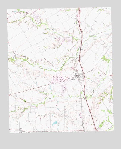
Palmer, TX USGS Topographic Map
Click on map above to begin viewing in our Map Viewer.

This topographic map contains these locations and features:
Feature Name Type Latitude Longitude GNIS ID View Map
Bone BranchStreamN32.4099°W96.6897°1331037View Map
BoycePopulated PlaceN32.3782°W96.7378°1331152View Map
Boyce CreekStreamN32.4026°W96.7214°1331153View Map
Brushy CreekStreamN32.4707°W96.6517°1372133View Map
Cedar Grove ChurchChurchN32.4960°W96.7269°1332434View Map
Cottonwood CreekStreamN32.4085°W96.6630°1333446View Map
Cottonwood CreekStreamN32.4929°W96.7253°1333470View Map
Dallas South Port AirportAirportN32.4783°W96.6842°2675922View Map
Douglas CemeteryCemeteryN32.4929°W96.7267°1334552View Map
Ferris DivisionCivilN32.4869°W96.6389°1938739View Map
Fundamental Baptist ChurchChurchN32.4313°W96.6669°2019002View Map
Griffith DamDamN32.3835°W96.6969°1856784View Map
Griffith ReservoirReservoirN32.3843°W96.6957°1856785View Map
Harper Airport (historical)AirportN32.4264°W96.7170°1387284View Map
Lucille CemeteryCemeteryN32.4363°W96.6503°1340721View Map
PalmerPopulated PlaceN32.4313°W96.6678°1343466View Map
Palmer CemeteryCemeteryN32.4604°W96.6333°1343469View Map
Palmer Elementary SchoolSchoolN32.4268°W96.6750°2005908View Map
Palmer Police DepartmentBuildingN32.4312°W96.6690°2739053View Map
Palmer Post OfficePost OfficeN32.4332°W96.6623°2731316View Map
Palmer Town HallBuildingN32.4309°W96.6687°2753439View Map
Palmer Volunteer Fire DepartmentBuildingN32.4309°W96.6690°2551775View Map
Prude Hyde CemeteryCemeteryN32.4574°W96.7414°1344608View Map
Smith CemeteryCemeteryN32.4415°W96.7389°1347258View Map
Town of PalmerCivilN32.4251°W96.6733°2413102View Map
TrumbullPopulated PlaceN32.4904°W96.6655°1348818View Map

Note: Coordinates in the location and feature list above are referenced to NAD83 datum.


Copyright (C) 2008-2024 Ryan Niemi / Sunset Dynamics ... All Rights Reserved