TopoQuest Logo
Do you find TopoQuest useful?
Help keep TopoQuest running and adding new maps/features by donating!
Bitcoin:  19c7KJd3qBynnjoSw5npx9KScwjBe4ifkT
Litecoin:  LXs6TkuXGGXo1vDsWCkWVdjQX94eUKd6ui
Home View Maps Find Maps Find Places Resources & Links


Benton, Iowa Topographic Map

USGS Map Title: Benton, IA
USGS Map MRC: 40094F3
DRG (GeoTIFF) Download: o40094f3.tif


Neighboring USGS Topographic Map Quads:


  Clearfield, IA  
40094G4
 

  Diagonal, IA  
40094G3
 

  Tingley, IA  
40094G2
 

  Maloy, IA  
40094F4
 

  Benton, IA  
40094F3
 

  Mount Ayr, IA  
40094F2
 

  Blockton, IA  
40094E4
 

  Blockton SE, MO  
40094E3
 

  Hatfield, MO  
40094E2


Map MRC Location:

N41°
W95°
N41°
W94°
H8 H7 H6 H5 H4 H3 H2 H1
G8 G7 G6 G5 G4 G3 G2 G1
F8 F7 F6 F5 F4 F3 F2 F1
E8 E7 E6 E5 E4 E3 E2 E1
D8 D7 D6 D5 D4 D3 D2 D1
C8 C7 C6 C5 C4 C3 C2 C1
B8 B7 B6 B5 B4 B3 B2 B1
A8 A7 A6 A5 A4 A3 A2 A1
N40°
W95°
N40°
W94°

Benton, IA USGS 1:24K Topographic Map Preview:
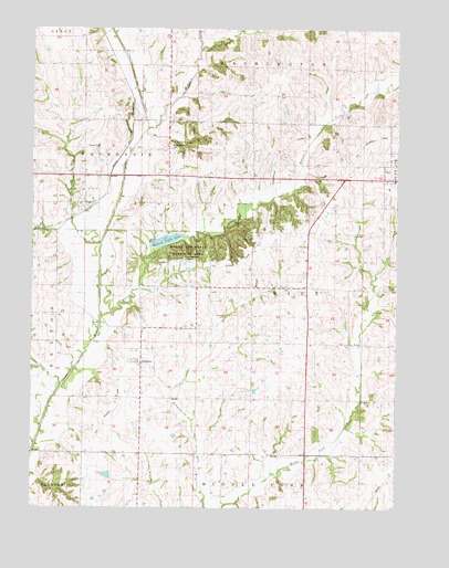
Benton, IA USGS Topographic Map
Click on map above to begin viewing in our Map Viewer.

This topographic map contains these locations and features:
Feature Name Type Latitude Longitude GNIS ID View Map
BentonPopulated PlaceN40.7033°W94.3583°454519View Map
Benton (historical)LocaleN40.7028°W94.3572°1969444View Map
Benton CemeteryCemeteryN40.7194°W94.3569°1822834View Map
Benton Post OfficePost OfficeN40.7033°W94.3583°1969445View Map
Brush CreekStreamN40.7447°W94.3177°1822908View Map
City of BentonCivilN40.7041°W94.3612°2394141View Map
City of DelphosCivilN40.6632°W94.3403°2394509View Map
Crooked CreekStreamN40.7239°W94.3358°455733View Map
DelphosPopulated PlaceN40.6636°W94.3394°455876View Map
Delphos (historical)LocaleN40.6636°W94.3419°1969442View Map
Delphos Post OfficePost OfficeN40.6630°W94.3391°1969443View Map
Estella Post Office (historical)Post OfficeN40.7083°W94.3586°1969380View Map
Marshall (historical)Populated PlaceN40.7250°W94.3280°465452View Map
Marshalltown CemeteryCemeteryN40.7194°W94.3280°1822833View Map
Mount Ayr State Wildlife AreaAreaN40.6922°W94.3216°464354View Map
Township of RiceCivilN40.6762°W94.2938°468597View Map
Township of WaubonsieCivilN40.7122°W94.3595°468953View Map
Walnut CreekStreamN40.6753°W94.3505°462632View Map
Walnut Creek Duck Marsh DamDamN40.6917°W94.3336°463525View Map
Walnut Creek LakeReservoirN40.6947°W94.3291°463434View Map

Note: Coordinates in the location and feature list above are referenced to NAD83 datum.


Copyright (C) 2008-2024 Ryan Niemi / Sunset Dynamics ... All Rights Reserved