TopoQuest Logo
Do you find TopoQuest useful?
Help keep TopoQuest running and adding new maps/features by donating!
Bitcoin:  19c7KJd3qBynnjoSw5npx9KScwjBe4ifkT
Litecoin:  LXs6TkuXGGXo1vDsWCkWVdjQX94eUKd6ui
Home View Maps Find Maps Find Places Resources & Links


Otisville, New York Topographic Map

USGS Map Title: Otisville, NY
USGS Map MRC: 41074D5
DRG (GeoTIFF) Download: o41074d5.tif


Neighboring USGS Topographic Map Quads:


  Hartwood, NY  
41074E6
 

  Yankee Lake, NY  
41074E5
 

  Wurtsboro, NY  
41074E4
 

  Port Jervis North, NY  
41074D6
 

  Otisville, NY  
41074D5
 

  Middletown, NY  
41074D4
 

  Port Jervis South, NY  
41074C6
 

  Unionville, NY  
41074C5
 

  Pine Island, NY  
41074C4


Map MRC Location:

N42°
W75°
N42°
W74°
H8 H7 H6 H5 H4 H3 H2 H1
G8 G7 G6 G5 G4 G3 G2 G1
F8 F7 F6 F5 F4 F3 F2 F1
E8 E7 E6 E5 E4 E3 E2 E1
D8 D7 D6 D5 D4 D3 D2 D1
C8 C7 C6 C5 C4 C3 C2 C1
B8 B7 B6 B5 B4 B3 B2 B1
A8 A7 A6 A5 A4 A3 A2 A1
N41°
W75°
N41°
W74°

Otisville, NY USGS 1:24K Topographic Map Preview:
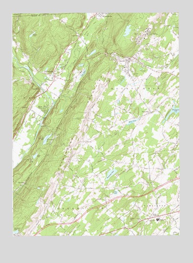
Otisville, NY USGS Topographic Map
Click on map above to begin viewing in our Map Viewer.

This topographic map contains these locations and features:
Feature Name Type Latitude Longitude GNIS ID View Map
Basher KillStreamN41.4495°W74.5929°974184View Map
Binnewater PondLakeN41.4099°W74.5513°943989View Map
Birch Ridge CampLocaleN41.4681°W74.5274°944010View Map
Camp Ackvah (historical)LocaleN41.4439°W74.6047°2095493View Map
Camp HayesLocaleN41.4181°W74.6116°945591View Map
Castle High EstatesPopulated PlaceN41.3767°W74.5497°2416826View Map
Castle HillSummitN41.3843°W74.5377°945991View Map
CuddebackvillePopulated PlaceN41.4673°W74.5938°947921View Map
Cuddebackville Fire District StationBuildingN41.4644°W74.5922°2716025View Map
Cuddleback Schoolhouse (historical)SchoolN41.4642°W74.5928°2416839View Map
Delaware And Hudson Canal County ParkParkN41.4600°W74.6011°2416835View Map
Eaton School (historical)SchoolN41.3964°W74.5553°2095497View Map
Elm LakeLakeN41.3991°W74.5480°949548View Map
Federal Correctional Institution OtisvilleBuildingN41.4965°W74.5271°2416831View Map
FinchvillePopulated PlaceN41.4279°W74.5713°972470View Map
Finchville School (historical)SchoolN41.4311°W74.5622°2095498View Map
GodeffroyPopulated PlaceN41.4468°W74.6124°951272View Map
Godeffroy School Number 12 (historical)SchoolN41.4442°W74.6092°2095500View Map
Graham Station (historical)LocaleN41.4264°W74.5967°2095494View Map
GuymardPopulated PlaceN41.4290°W74.5988°951959View Map
Guymard LakeLakeN41.4295°W74.5996°951960View Map
Hawthorne LakeLakeN41.3768°W74.6241°952431View Map
Holleys PondLakeN41.4879°W74.6100°952997View Map
Holy Cross Catholic ChurchChurchN41.3834°W74.5226°953050View Map
Holy Name of Jesus ChurchChurchN41.4695°W74.5370°2714674View Map
Kirby FarmLocaleN41.4044°W74.5017°2559690View Map
Lake HelenLakeN41.4664°W74.5714°952537View Map
Lewis LandingAirportN41.4074°W74.5321°978302View Map
Metro-North Otisville StationLocaleN41.4717°W74.5289°2416830View Map
Mill PondLakeN41.4391°W74.5350°957263View Map
Minisink Valley Central SchoolSchoolN41.3845°W74.5171°957409View Map
Mount HopePopulated PlaceN41.4445°W74.5218°957833View Map
Mount Hope Plains CemeteryCemeteryN41.4651°W74.5357°957837View Map
Mount Hope Presbyterian ChurchChurchN41.4733°W74.5399°2714675View Map
Mount Hope ReservoirReservoirN41.4922°W74.5378°2416833View Map
Myers GrovePopulated PlaceN41.4465°W74.6015°958229View Map
Neversink Valley Area MuseumBuildingN41.4586°W74.6031°2416836View Map
New York Board of Health Research Laboratory (historical)BuildingN41.4856°W74.5183°2091733View Map
New York City Municipal Sanitorium (historical)HospitalN41.4864°W74.5275°2091734View Map
Nial A Hamilton Bicentennial SchoolSchoolN41.4567°W74.5997°2416834View Map
Oak Ridge ParkPopulated PlaceN41.4694°W74.5864°2416838View Map
Oakland Valley CampgroundLocaleN41.4792°W74.6213°2715121View Map
Oakland Valley Race ParkParkN41.4742°W74.6156°2416840View Map
OtisvillePopulated PlaceN41.4734°W74.5385°959548View Map
Otisville Correctional FacilityBuildingN41.4871°W74.5253°2416832View Map
Otisville Country FairLocaleN41.4622°W74.5361°2416827View Map
Otisville Elementary SchoolSchoolN41.4692°W74.5408°2416829View Map
Otisville Fire DepartmentBuildingN41.4748°W74.5369°2715981View Map
Otisville Post OfficePost OfficeN41.4734°W74.5392°2713509View Map
Otisville Village HallBuildingN41.4664°W74.5383°2416828View Map
Piersons Evergreen FarmLocaleN41.4672°W74.5064°2559693View Map
Pine GrovePopulated PlaceN41.4742°W74.5867°2416837View Map
Pine KillStreamN41.4998°W74.5532°960492View Map
Port OrangePopulated PlaceN41.4868°W74.5752°972962View Map
Roses PointPopulated PlaceN41.4579°W74.6043°973023View Map
Seokwang Korean Presbyterian ChurchChurchN41.3855°W74.5496°2714383View Map
Shawangunk LakeReservoirN41.4457°W74.5008°964982View Map
Shin HollowPopulated PlaceN41.4048°W74.6154°973062View Map
South CentervillePopulated PlaceN41.3856°W74.5221°965721View Map
Town of Mount HopeCivilN41.4600°W74.5280°979241View Map
Valley Junction (historical)LocaleN41.4508°W74.6003°2095495View Map
Village of OtisvilleCivilN41.4714°W74.5397°2391043View Map
Walls PondLakeN41.4200°W74.6081°968709View Map
West Brookville StationLocaleN41.4992°W74.5542°2095496View Map
WestbrookvillePopulated PlaceN41.4987°W74.5585°970894View Map
WXHD-FM (Mount Hope)TowerN41.4348°W74.5757°977759View Map

Note: Coordinates in the location and feature list above are referenced to NAD83 datum.


Copyright (C) 2008-2024 Ryan Niemi / Sunset Dynamics ... All Rights Reserved