TopoQuest Logo
Do you find TopoQuest useful?
Help keep TopoQuest running and adding new maps/features by donating!
Bitcoin:  19c7KJd3qBynnjoSw5npx9KScwjBe4ifkT
Litecoin:  LXs6TkuXGGXo1vDsWCkWVdjQX94eUKd6ui
Home View Maps Find Maps Find Places Resources & Links


Omaha, Missouri Topographic Map

USGS Map Title: Omaha, MO
USGS Map MRC: 40092E7
DRG (GeoTIFF) Download: o40092e7.tif


Neighboring USGS Topographic Map Quads:


  Centerville West, IA  
40092F8
 

  Centerville East, IA  
40092F7
 

  Moulton, IA  
40092F6
 

  Mendota, MO  
40092E8
 

  Omaha, MO  
40092E7
 

  Coatsville, MO  
40092E6
 

  Unionville East, MO  
40092D8
 

  Graysville, MO  
40092D7
 

  Livonia, MO  
40092D6


Map MRC Location:

N41°
W93°
N41°
W92°
H8 H7 H6 H5 H4 H3 H2 H1
G8 G7 G6 G5 G4 G3 G2 G1
F8 F7 F6 F5 F4 F3 F2 F1
E8 E7 E6 E5 E4 E3 E2 E1
D8 D7 D6 D5 D4 D3 D2 D1
C8 C7 C6 C5 C4 C3 C2 C1
B8 B7 B6 B5 B4 B3 B2 B1
A8 A7 A6 A5 A4 A3 A2 A1
N40°
W93°
N40°
W92°

Omaha, MO USGS 1:24K Topographic Map Preview:
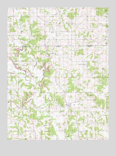
Omaha, MO USGS Topographic Map
Click on map above to begin viewing in our Map Viewer.

This topographic map contains these locations and features:
Feature Name Type Latitude Longitude GNIS ID View Map
Abbott School (historical)SchoolN40.5059°W92.8058°733763View Map
Berry CemeteryCemeteryN40.5375°W92.7688°713994View Map
Berry School (historical)SchoolN40.5381°W92.7705°733762View Map
CharitonPopulated PlaceN40.5703°W92.7813°740738View Map
EsperPopulated PlaceN40.5289°W92.8521°739479View Map
Friendship CemeteryCemeteryN40.5745°W92.8657°718232View Map
Friendship School (historical)SchoolN40.5703°W92.8558°733759View Map
Liberty Township Fire Protection DistrictBuildingN40.5317°W92.8003°2621575View Map
Little Shoal CreekStreamN40.5503°W92.8410°458501View Map
Mitchell CemeteryCemeteryN40.5420°W92.7741°722490View Map
Mount Hermon ChurchChurchN40.5711°W92.7819°722762View Map
OmahaPopulated PlaceN40.5325°W92.8008°741120View Map
Petty School (historical)SchoolN40.5295°W92.8596°733760View Map
Sand CreekStreamN40.5920°W92.8496°461390View Map
Shipley CemeteryCemeteryN40.5136°W92.8257°726386View Map
Shoney CemeteryCemeteryN40.5817°W92.8219°726402View Map
Shoney School (historical)SchoolN40.5709°W92.8210°733758View Map
Summers CemeteryCemeteryN40.5075°W92.7866°727286View Map
Township of LibertyCivilN40.5302°W92.8049°767241View Map
Union CemeteryCemeteryN40.5950°W92.7808°462418View Map
Wells School (historical)SchoolN40.5742°W92.7810°733761View Map
Zoar CemeteryCemeteryN40.6092°W92.7964°463286View Map

Note: Coordinates in the location and feature list above are referenced to NAD83 datum.


Copyright (C) 2008-2024 Ryan Niemi / Sunset Dynamics ... All Rights Reserved