TopoQuest Logo
Do you find TopoQuest useful?
Help keep TopoQuest running and adding new maps/features by donating!
Bitcoin:  19c7KJd3qBynnjoSw5npx9KScwjBe4ifkT
Litecoin:  LXs6TkuXGGXo1vDsWCkWVdjQX94eUKd6ui
Home View Maps Find Maps Find Places Resources & Links


Moulton, Iowa Topographic Map

USGS Map Title: Moulton, IA
USGS Map MRC: 40092F6
DRG (GeoTIFF) Download: o40092f6.tif


Neighboring USGS Topographic Map Quads:


  Hiattsville, IA  
40092G7
 

  Unionville, IA  
40092G6
 

  Paris, IA  
40092G5
 

  Centerville East, IA  
40092F7
 

  Moulton, IA  
40092F6
 

  West Grove, IA  
40092F5
 

  Omaha, MO  
40092E7
 

  Coatsville, MO  
40092E6
 

  Lancaster, MO  
40092E5


Map MRC Location:

N41°
W93°
N41°
W92°
H8 H7 H6 H5 H4 H3 H2 H1
G8 G7 G6 G5 G4 G3 G2 G1
F8 F7 F6 F5 F4 F3 F2 F1
E8 E7 E6 E5 E4 E3 E2 E1
D8 D7 D6 D5 D4 D3 D2 D1
C8 C7 C6 C5 C4 C3 C2 C1
B8 B7 B6 B5 B4 B3 B2 B1
A8 A7 A6 A5 A4 A3 A2 A1
N40°
W93°
N40°
W92°

Moulton, IA USGS 1:24K Topographic Map Preview:
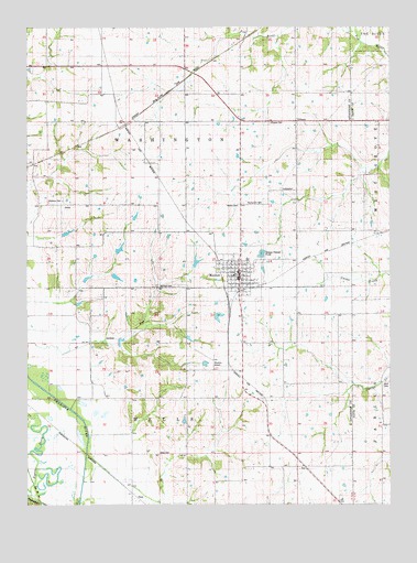
Moulton, IA USGS Topographic Map
Click on map above to begin viewing in our Map Viewer.

This topographic map contains these locations and features:
Feature Name Type Latitude Longitude GNIS ID View Map
Beetrace Post Office (historical)Post OfficeN40.7339°W92.7252°466526View Map
Christian ChurchChurchN40.6850°W92.6785°1970263View Map
City of MoultonCivilN40.6854°W92.6765°2395419View Map
Croft CemeteryCemeteryN40.6611°W92.7057°1970314View Map
Davis CemeteryCemeteryN40.6385°W92.7049°455803View Map
DeanPopulated PlaceN40.6275°W92.7141°464513View Map
Dean (historical)LocaleN40.6275°W92.7141°1970156View Map
Dean Post Office (historical)Post OfficeN40.6275°W92.7141°1970155View Map
Garland CemeteryCemeteryN40.6822°W92.6971°456841View Map
Garrett Memorial LibraryBuildingN40.6859°W92.6774°1970259View Map
Hardin CemeteryCemeteryN40.7036°W92.6771°457247View Map
Holiness Church of GodChurchN40.6870°W92.6741°1970264View Map
Horn CemeteryCemeteryN40.6568°W92.6253°457661View Map
Methodist ChurchChurchN40.6850°W92.6755°1970262View Map
MoultonPopulated PlaceN40.6859°W92.6774°459266View Map
MoultonLocaleN40.6795°W92.6807°1970267View Map
Moulton - Udell Elementary SchoolSchoolN40.6893°W92.6743°1970265View Map
Moulton - Udell Junior / Senior High SchoolSchoolN40.6890°W92.6739°2719707View Map
Moulton Airport (historical)AirportN40.6628°W92.6857°1823293View Map
Moulton Baptist ChurchChurchN40.6850°W92.6807°1970261View Map
Moulton City HallBuildingN40.6859°W92.6774°1970260View Map
Moulton Fire DepartmentBuildingN40.6837°W92.6769°1970256View Map
Moulton Historical Society MuseumBuildingN40.6917°W92.6766°1970266View Map
Moulton LibraryBuildingN40.6859°W92.6774°1970258View Map
Moulton Post OfficePost OfficeN40.6853°W92.6769°1970257View Map
Moulton Volunteer Ambulance ServiceBuildingN40.6846°W92.6768°2599933View Map
OrleansPopulated PlaceN40.7256°W92.6574°459896View Map
Orleans CemeteryCemeteryN40.7249°W92.6664°1823294View Map
Orleans ChurchChurchN40.7242°W92.6580°459899View Map
Orleans Post Office (historical)Post OfficeN40.7264°W92.6585°466527View Map
Otterbein South CemeteryCemeteryN40.7039°W92.7363°1970315View Map
Otterbien CemeteryCemeteryN40.7045°W92.7380°459948View Map
Pigeon CreekStreamN40.6267°W92.7485°460134View Map
Shinn CemeteryCemeteryN40.7042°W92.6280°1976119View Map
Staten CemeteryCemeteryN40.6459°W92.6474°1970313View Map
Sunnyview CemeteryCemeteryN40.7042°W92.6755°462108View Map
Township of WashingtonCivilN40.7254°W92.6958°468901View Map
Township of WellsCivilN40.6358°W92.6958°468967View Map
Williamston Post Office (historical)Post OfficeN40.7259°W92.6610°1970143View Map

Note: Coordinates in the location and feature list above are referenced to NAD83 datum.


Copyright (C) 2008-2024 Ryan Niemi / Sunset Dynamics ... All Rights Reserved