TopoQuest Logo
Do you find TopoQuest useful?
Help keep TopoQuest running and adding new maps/features by donating!
Bitcoin:  19c7KJd3qBynnjoSw5npx9KScwjBe4ifkT
Litecoin:  LXs6TkuXGGXo1vDsWCkWVdjQX94eUKd6ui
Home View Maps Find Maps Find Places Resources & Links


Nott Branch, Texas Topographic Map

USGS Map Title: Nott Branch, TX
USGS Map MRC: 30099B2
DRG (GeoTIFF) Download: o30099b2.tif


Neighboring USGS Topographic Map Quads:


  Harper West, TX  
30099C3
 

  Harper East, TX  
30099C2
 

  Roundhead, TX  
30099C1
 

  Mountain Home, TX  
30099B3
 

  Nott Branch, TX  
30099B2
 

  Morris Ranch, TX  
30099B1
 

  Hunt, TX  
30099A3
 

  Kerrville, TX  
30099A2
 

  Legion, TX  
30099A1


Map MRC Location:

N31°
W100°
N31°
W99°
H8 H7 H6 H5 H4 H3 H2 H1
G8 G7 G6 G5 G4 G3 G2 G1
F8 F7 F6 F5 F4 F3 F2 F1
E8 E7 E6 E5 E4 E3 E2 E1
D8 D7 D6 D5 D4 D3 D2 D1
C8 C7 C6 C5 C4 C3 C2 C1
B8 B7 B6 B5 B4 B3 B2 B1
A8 A7 A6 A5 A4 A3 A2 A1
N30°
W100°
N30°
W99°

Nott Branch, TX USGS 1:24K Topographic Map Preview:
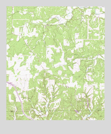
Nott Branch, TX USGS Topographic Map
Click on map above to begin viewing in our Map Viewer.

This topographic map contains these locations and features:
Feature Name Type Latitude Longitude GNIS ID View Map
Barnett BranchStreamN30.2149°W99.2028°1330065View Map
Bear HollowValleyN30.1259°W99.1524°1330237View Map
Centipede BranchStreamN30.1521°W99.1900°1332558View Map
Circle D RanchLocaleN30.2494°W99.1309°1332848View Map
Cottonwood RanchLocaleN30.1605°W99.1359°1333487View Map
Flag CreekStreamN30.2480°W99.1431°1335870View Map
Hains BranchStreamN30.1458°W99.2187°1337227View Map
Indian BranchStreamN30.1324°W99.1425°1338395View Map
Johnson BottomBasinN30.1499°W99.1912°1338772View Map
Klein BranchStreamN30.2496°W99.1664°1374394View Map
North CreekStreamN30.2433°W99.1256°1342714View Map
Nott BranchStreamN30.2308°W99.1820°1342898View Map
Peril CemeteryCemeteryN30.1766°W99.1959°1343857View Map
Pillar RockPillarN30.1488°W99.2225°1344010View Map
Poole LakeReservoirN30.1419°W99.1587°1864076View Map
Poole Lake DamDamN30.1419°W99.1587°1864075View Map
Reid SpringsSpringN30.1419°W99.1253°1998561View Map
Rocky Ridge RanchLocaleN30.1291°W99.1314°1345491View Map
Silver Wings AirportAirportN30.2196°W99.1408°2676540View Map
Spanish Oak CreekStreamN30.1919°W99.1381°1347627View Map
Spring BranchStreamN30.1463°W99.1959°1347683View Map
Stevens CreekStreamN30.2324°W99.2187°1347907View Map
Tierra Linda Lower DamDamN30.1402°W99.1470°1862729View Map
Tierra Linda Lower ReservoirReservoirN30.1411°W99.1464°1862730View Map
Tierra Linda Ranch AirportAirportN30.1451°W99.1514°1387013View Map
Tierra Linda Upper DamDamN30.1452°W99.1470°1862731View Map
Tierra Linda Upper ReservoirReservoirN30.1470°W99.1472°1862732View Map
Tierra Linda Volunteer Fire DepartmentBuildingN30.1613°W99.1466°2551343View Map
Town Creek Dam Number 1DamN30.1285°W99.1470°1862733View Map
Town Creek Reservoir Number 1ReservoirN30.1307°W99.1449°1862734View Map
Trails End RanchLocaleN30.1344°W99.2070°1348694View Map

Note: Coordinates in the location and feature list above are referenced to NAD83 datum.


Copyright (C) 2008-2024 Ryan Niemi / Sunset Dynamics ... All Rights Reserved