TopoQuest Logo
Do you find TopoQuest useful?
Help keep TopoQuest running and adding new maps/features by donating!
Bitcoin:  19c7KJd3qBynnjoSw5npx9KScwjBe4ifkT
Litecoin:  LXs6TkuXGGXo1vDsWCkWVdjQX94eUKd6ui
Home View Maps Find Maps Find Places Resources & Links


Kerrville, Texas Topographic Map

USGS Map Title: Kerrville, TX
USGS Map MRC: 30099A2
DRG (GeoTIFF) Download: o30099a2.tif


Neighboring USGS Topographic Map Quads:


  Mountain Home, TX  
30099B3
 

  Nott Branch, TX  
30099B2
 

  Morris Ranch, TX  
30099B1
 

  Hunt, TX  
30099A3
 

  Kerrville, TX  
30099A2
 

  Legion, TX  
30099A1
 

  Echo Hill Ranch, TX  
29099H3
 

  Fall Creek, TX  
29099H2
 

  Center Point, TX  
29099H1


Map MRC Location:

N31°
W100°
N31°
W99°
H8 H7 H6 H5 H4 H3 H2 H1
G8 G7 G6 G5 G4 G3 G2 G1
F8 F7 F6 F5 F4 F3 F2 F1
E8 E7 E6 E5 E4 E3 E2 E1
D8 D7 D6 D5 D4 D3 D2 D1
C8 C7 C6 C5 C4 C3 C2 C1
B8 B7 B6 B5 B4 B3 B2 B1
A8 A7 A6 A5 A4 A3 A2 A1
N30°
W100°
N30°
W99°

Kerrville, TX USGS 1:24K Topographic Map Preview:
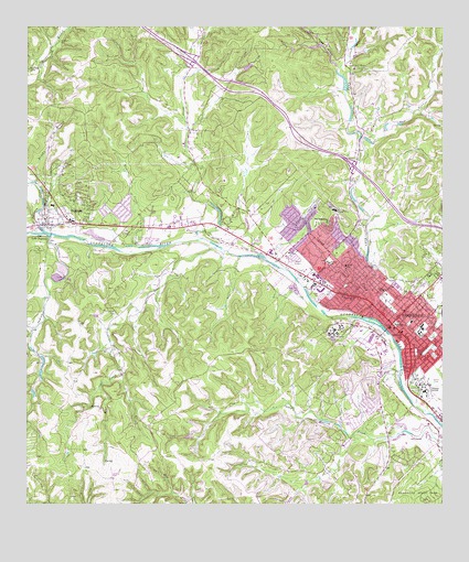
Kerrville, TX USGS Topographic Map
Click on map above to begin viewing in our Map Viewer.

This topographic map contains these locations and features:
Feature Name Type Latitude Longitude GNIS ID View Map
Air - Evac Lifeteam KerrvilleBuildingN30.0476°W99.1422°2656214View Map
Bear CreekStreamN30.0677°W99.1937°1330208View Map
Brushy BranchStreamN30.0844°W99.2481°1331410View Map
Camp Meeting Creek DamDamN30.0185°W99.1353°1862913View Map
Camp Meeting Creek ReservoirReservoirN30.0195°W99.1376°1862914View Map
Camp Pearl WheatLocaleN30.1147°W99.1537°1331997View Map
Captain Charles Schreiner MansionBuildingN30.0463°W99.1400°2031458View Map
Carver ParkParkN30.0602°W99.1450°2028668View Map
Carver ParkParkN30.0583°W99.1414°1332245View Map
Church of Christ Junction HighwayChurchN30.0733°W99.2003°2022647View Map
City of IngramCivilN30.0772°W99.2382°2410107View Map
City of KerrvilleCivilN30.0407°W99.1323°2411538View Map
Colbarth SpringsSpringN30.0585°W99.2253°1998488View Map
Colbath CemeteryCemeteryN30.0506°W99.2244°1333071View Map
Cow Head HollowValleyN30.1146°W99.1569°1333550View Map
Cowboy Artists of America MuseumBuildingN30.0272°W99.1378°2014542View Map
Crossroads Baptist ChurchChurchN30.0702°W99.1823°2022645View Map
Doyle SchoolSchoolN30.0563°W99.1428°1334591View Map
East Town CreekStreamN30.0894°W99.1503°1335009View Map
George HollowValleyN30.1211°W99.2000°1336479View Map
Glen Rose CemeteryCemeteryN30.0302°W99.1334°1336584View Map
Goat CreekStreamN30.0697°W99.1973°1336607View Map
Goat SpringsSpringN30.1085°W99.2087°1998492View Map
Guadalupe CemeteryCemeteryN30.0622°W99.1456°1337063View Map
Henderson CemeteryCemeteryN30.1213°W99.2406°1337595View Map
Hill Top Village HomeBuildingN30.0772°W99.1575°1337791View Map
Holy Cross Lutheran ChurchChurchN30.0544°W99.1514°2022648View Map
Holy Cross SchoolSchoolN30.0541°W99.1520°1337990View Map
Indian CreekStreamN30.0699°W99.2434°1338410View Map
Indian Creek CampLocaleN30.0672°W99.2467°1338420View Map
IngramPopulated PlaceN30.0774°W99.2403°1338473View Map
Ingram - Tom Moore High SchoolSchoolN30.0735°W99.2473°2006979View Map
Ingram City HallBuildingN30.0738°W99.2406°2753541View Map
Ingram City Marshal's OfficeBuildingN30.0738°W99.2406°2750602View Map
Ingram Elementary SchoolSchoolN30.0777°W99.2412°2006977View Map
Ingram Middle SchoolSchoolN30.0735°W99.2473°2006978View Map
Ingram Post OfficePost OfficeN30.0738°W99.2275°2731603View Map
Ingram Volunteer Fire DepartmentBuildingN30.0732°W99.2392°2552078View Map
Johnson CreekStreamN30.0713°W99.2448°1338792View Map
Kerr County Constable's Office Precinct 1BuildingN30.0478°W99.1391°2750609View Map
Kerr County Constable's Office Precinct 2BuildingN30.0476°W99.1392°2750553View Map
Kerr County Constable's Office Precinct 3BuildingN30.0480°W99.1388°2750610View Map
Kerr County Constable's Office Precinct 4BuildingN30.0764°W99.2392°2750698View Map
Kerr County CourthouseBuildingN30.0477°W99.1398°2030537View Map
Kerr County JailBuildingN30.0280°W99.1257°2738768View Map
Kerr County Sheriff's OfficeBuildingN30.0278°W99.1255°2750339View Map
KerrvillePopulated PlaceN30.0474°W99.1403°1339058View Map
Kerrville City HallBuildingN30.0465°W99.1409°2753731View Map
Kerrville Fire Department Station 1BuildingN30.0423°W99.1367°2551880View Map
Kerrville Fire Department Station 2BuildingN30.0681°W99.1771°2551235View Map
Kerrville Mentoring and Learning CenterSchoolN30.0560°W99.1309°2006980View Map
Kerrville Police DepartmentBuildingN30.0490°W99.1384°2750319View Map
Kerrville Ponding DamDamN30.0532°W99.1653°1863363View Map
Kerrville Ponding LakeReservoirN30.0618°W99.1737°1863364View Map
Kerrville Post OfficePost OfficeN30.0446°W99.1484°2732333View Map
Kerrville State HospitalHospitalN30.0471°W99.1566°2718152View Map
Kerrville State ParkParkN30.0022°W99.1320°1339059View Map
KERV-AM (Kerrville)TowerN30.0708°W99.1856°1385605View Map
KITE-FM (Kerrville)TowerN30.1180°W99.1948°1385900View Map
KRVL-FM (Kerrville)TowerN30.0644°W99.1381°1385898View Map
Lake Old IngramReservoirN30.0710°W99.2476°1343168View Map
Lions ParkParkN30.0722°W99.2470°1339995View Map
Louise Hays ParkParkN30.0438°W99.1417°1340652View Map
Masonic BuildingBuildingN30.0458°W99.1400°2030790View Map
Mount WesleyPopulated PlaceN30.0747°W99.1595°1378710View Map
Mountain View CemeteryCemeteryN30.0555°W99.1331°1342173View Map
Nichols CemeteryCemeteryN30.0697°W99.2173°1342586View Map
Nichols CreekStreamN30.0677°W99.2181°1342588View Map
Nimitz Elementary SchoolSchoolN30.0244°W99.1503°2006981View Map
Notre Dame SchoolSchoolN30.0449°W99.1378°1342896View Map
Peterson Middle SchoolSchoolN30.0463°W99.1337°2006982View Map
Peterson Regional Medical CenterHospitalN30.0439°W99.1528°2015805View Map
Quinlan CreekStreamN30.0238°W99.1289°1344665View Map
Richard ParkParkN30.0391°W99.1273°1345169View Map
Riverside Nature CenterBuildingN30.0505°W99.1473°2014543View Map
Saint Paul ChurchChurchN30.0660°W99.1717°1346068View Map
Schreiner UniversitySchoolN30.0305°W99.1289°1346786View Map
Schultz ParkParkN30.0749°W99.1631°2029366View Map
South DamDamN30.1135°W99.1853°1863726View Map
South LakeReservoirN30.1147°W99.1840°1863727View Map
Starkey Elementary SchoolSchoolN30.0630°W99.1592°2006983View Map
Starkey SchoolSchoolN30.0635°W99.1592°1347819View Map
Sunrise Baptist ChurchChurchN30.0416°W99.1350°2022646View Map
Texas Department of Public Safety Highway Patrol OfficeBuildingN30.0397°W99.1455°2750699View Map
Texas Parks and Wildlife Department Law Enforcement DivisionBuildingN30.0401°W99.1457°2750730View Map
Tivy High SchoolSchoolN30.0449°W99.1323°1348602View Map
Tivy Upper Elementary SchoolSchoolN30.0469°W99.1325°2006984View Map
Town CreekStreamN30.0488°W99.1489°1348680View Map
Town Creek Dam Number 4DamN30.1085°W99.1537°1862735View Map
Town Creek Reservoir Number 4ReservoirN30.1085°W99.1537°1862736View Map
Trinity ChurchChurchN30.0627°W99.1545°1348782View Map
Tulahteka MansionBuildingN30.0380°W99.1434°2032530View Map
West Goat CreekStreamN30.1244°W99.2003°1349743View Map

Note: Coordinates in the location and feature list above are referenced to NAD83 datum.


Copyright (C) 2008-2024 Ryan Niemi / Sunset Dynamics ... All Rights Reserved