TopoQuest Logo
Do you find TopoQuest useful?
Help keep TopoQuest running and adding new maps/features by donating!
Bitcoin:  19c7KJd3qBynnjoSw5npx9KScwjBe4ifkT
Litecoin:  LXs6TkuXGGXo1vDsWCkWVdjQX94eUKd6ui
Home View Maps Find Maps Find Places Resources & Links


North Star, Minnesota Topographic Map

USGS Map Title: North Star, MN
USGS Map MRC: 44094C1
DRG (GeoTIFF) Download: o44094c1.tif


Neighboring USGS Topographic Map Quads:


  New Sweden, MN  
44094D2
 

  Norseland, MN  
44094D1
 

  Le Sueur, MN  
44093D8
 

  Nicollet, MN  
44094C2
 

  North Star, MN  
44094C1
 

  Saint Peter, MN  
44093C8
 

  Judson, MN  
44094B2
 

  Mankato West, MN  
44094B1
 

  Mankato East, MN  
44093B8


Map MRC Location:

N45°
W95°
N45°
W94°
H8 H7 H6 H5 H4 H3 H2 H1
G8 G7 G6 G5 G4 G3 G2 G1
F8 F7 F6 F5 F4 F3 F2 F1
E8 E7 E6 E5 E4 E3 E2 E1
D8 D7 D6 D5 D4 D3 D2 D1
C8 C7 C6 C5 C4 C3 C2 C1
B8 B7 B6 B5 B4 B3 B2 B1
A8 A7 A6 A5 A4 A3 A2 A1
N44°
W95°
N44°
W94°

North Star, MN USGS 1:24K Topographic Map Preview:
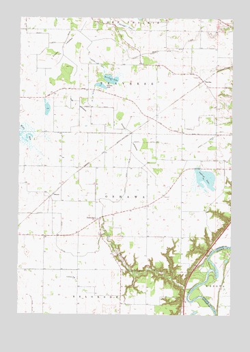
North Star, MN USGS Topographic Map
Click on map above to begin viewing in our Map Viewer.

This topographic map contains these locations and features:
Feature Name Type Latitude Longitude GNIS ID View Map
Brinkman Airport (historical)AirportN44.2622°W94.0697°660405View Map
Campfire Girls CampLocaleN44.2683°W94.0608°640859View Map
County Ditch Number FiftyoneCanalN44.3261°W94.0100°642168View Map
County Ditch Number Fortysix ACanalN44.2925°W94.1183°642121View Map
County Ditch Number SeventyeightCanalN44.3600°W94.0625°642310View Map
County Ditch Number SeventyeightCanalN44.3658°W94.1086°642311View Map
County Ditch Number SixCanalN44.3227°W94.0491°642214View Map
County Ditch Number Thirteen ACanalN44.3205°W94.0597°641662View Map
County Ditch Number ThirtysevenCanalN44.3419°W94.0825°642011View Map
County Ditch Number Thirtythree ACanalN44.3308°W94.0197°641979View Map
County Ditch Number TwentyoneCanalN44.3561°W94.0814°641808View Map
Cullen Trading Post CemeteryCemeteryN44.3500°W94.1000°2063901View Map
Erickson LakeLakeN44.3493°W94.0715°643394View Map
Fox LakebedFlatN44.3397°W94.0914°643867View Map
Goose LakebedFlatN44.3250°W94.0614°644265View Map
North StarPopulated PlaceN44.2905°W94.0794°654851View Map
Oakleaf LakeLakeN44.3080°W94.0156°648877View Map
OshawaPopulated PlaceN44.3002°W94.1052°654862View Map
Oshawa (historical)LocaleN44.3028°W94.1050°2063787View Map
Oshawa Post Office (historical)Post OfficeN44.3003°W94.1050°2063786View Map
Overson LakeLakeN44.3464°W94.0777°649092View Map
Saint Michael CemeteryCemeteryN44.2653°W94.0925°2063917View Map
Saint Michael ChurchChurchN44.2652°W94.0916°650910View Map
Sevenmile CreekStreamN44.2614°W94.0233°651864View Map
Timber LakebedFlatN44.3619°W94.1000°653207View Map
Township of OshawaCivilN44.2997°W94.0644°665229View Map
Township of TraverseCivilN44.3490°W94.0514°665805View Map
TraversePopulated PlaceN44.3486°W94.0175°654978View Map
Traverse (historical)LocaleN44.3486°W94.0172°2063780View Map
Traverse Post Office (historical)Post OfficeN44.3486°W94.0172°2063781View Map
Zwinggi LakeSwampN44.3711°W94.0636°654513View Map

Note: Coordinates in the location and feature list above are referenced to NAD83 datum.


Copyright (C) 2008-2024 Ryan Niemi / Sunset Dynamics ... All Rights Reserved