TopoQuest Logo
Do you find TopoQuest useful?
Help keep TopoQuest running and adding new maps/features by donating!
Bitcoin:  19c7KJd3qBynnjoSw5npx9KScwjBe4ifkT
Litecoin:  LXs6TkuXGGXo1vDsWCkWVdjQX94eUKd6ui
Home View Maps Find Maps Find Places Resources & Links


Noble, Kentucky Topographic Map

USGS Map Title: Noble, KY
USGS Map MRC: 37083D2
DRG (GeoTIFF) Download: o37083d2.tif


Neighboring USGS Topographic Map Quads:


  Quicksand, KY  
37083E3
 

  Guage, KY  
37083E2
 

  Tiptop, KY  
37083E1
 

  Haddix, KY  
37083D3
 

  Noble, KY  
37083D2
 

  Vest, KY  
37083D1
 

  Krypton, KY  
37083C3
 

  Hazard North, KY  
37083C2
 

  Carrie, KY  
37083C1


Map MRC Location:

N38°
W84°
N38°
W83°
H8 H7 H6 H5 H4 H3 H2 H1
G8 G7 G6 G5 G4 G3 G2 G1
F8 F7 F6 F5 F4 F3 F2 F1
E8 E7 E6 E5 E4 E3 E2 E1
D8 D7 D6 D5 D4 D3 D2 D1
C8 C7 C6 C5 C4 C3 C2 C1
B8 B7 B6 B5 B4 B3 B2 B1
A8 A7 A6 A5 A4 A3 A2 A1
N37°
W84°
N37°
W83°

Noble, KY USGS 1:24K Topographic Map Preview:
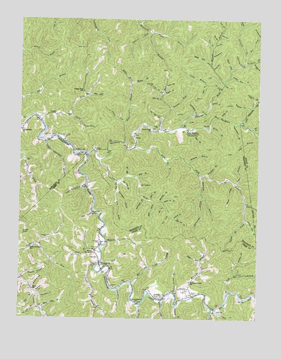
Noble, KY USGS Topographic Map
Click on map above to begin viewing in our Map Viewer.

This topographic map contains these locations and features:
Feature Name Type Latitude Longitude GNIS ID View Map
Allen CemeteryCemeteryN37.3940°W83.2060°485857View Map
Ary Post OfficePost OfficeN37.3782°W83.1466°486064View Map
Ball BranchStreamN37.3779°W83.1479°486285View Map
Ball SchoolSchoolN37.3834°W83.1318°486293View Map
Balls ForkStreamN37.3793°W83.1477°486305View Map
Balls Fork SchoolSchoolN37.3797°W83.1451°2557384View Map
Bear BranchStreamN37.4487°W83.1946°486523View Map
Bearwallow BranchStreamN37.4287°W83.1982°486591View Map
Bee BranchStreamN37.4415°W83.1721°486660View Map
Bee CreekStreamN37.4548°W83.1277°486668View Map
Bethel Childrens HomeBuildingN37.4459°W83.2091°486954View Map
Big BranchStreamN37.3756°W83.2363°487135View Map
Big HollowValleyN37.4216°W83.1737°487187View Map
Blueford HollowValleyN37.3889°W83.2426°487561View Map
Boardinghouse BranchStreamN37.4604°W83.1582°487581View Map
Booker ForkStreamN37.4793°W83.1396°487677View Map
Bowman BranchStreamN37.4404°W83.1616°487748View Map
Buck ForkStreamN37.3998°W83.1538°488221View Map
Buck Post Office (historical)Post OfficeN37.4519°W83.1260°2337582View Map
Buckeye HollowValleyN37.4934°W83.1253°488253View Map
Buckhorn ChurchChurchN37.4445°W83.2177°488265View Map
Buckhorn CreekStreamN37.4434°W83.2138°488268View Map
Bucklick BranchStreamN37.4695°W83.1735°488277View Map
Bucklick HollowValleyN37.3855°W83.2403°488279View Map
Bucklick HollowValleyN37.4636°W83.1318°488280View Map
Camp BranchStreamN37.3856°W83.2430°488670View Map
Camp Robinson University of Kentucky Engineering CampLocaleN37.4543°W83.1613°488715View Map
Campbell CemeteryCemeteryN37.3881°W83.1996°488733View Map
Campbell CemeteryCemeteryN37.4068°W83.2079°488734View Map
Cat HollowValleyN37.4191°W83.2113°489086View Map
Chestnut Gap BranchStreamN37.4168°W83.1307°489432View Map
Chestnut Gap CemeteryCemeteryN37.4045°W83.1410°489433View Map
Cinder KnobSummitN37.4106°W83.2485°489518View Map
Clemons ForkStreamN37.4551°W83.1649°489661View Map
Cockerell Fork CemeteryCemeteryN37.4084°W83.2349°489760View Map
Cockerell Fork SchoolSchoolN37.4045°W83.2443°489761View Map
Coles ForkStreamN37.4573°W83.1343°489833View Map
Coon HollowValleyN37.4722°W83.1734°490041View Map
Core BranchStreamN37.4887°W83.1485°490095View Map
Cotton HollowValleyN37.4815°W83.1355°490146View Map
Dark BranchStreamN37.4248°W83.1805°490591View Map
Deadmans HollowValleyN37.4821°W83.1279°490733View Map
Durg BranchStreamN37.3870°W83.1974°491343View Map
Falling Rock BranchStreamN37.4765°W83.1396°491954View Map
Field BranchStreamN37.4734°W83.1521°492059View Map
Fishtrap BranchStreamN37.3801°W83.1668°492136View Map
Francis BranchStreamN37.3912°W83.2493°492434View Map
Francis BranchStreamN37.4081°W83.2043°492435View Map
Franks ForkStreamN37.4943°W83.1793°492465View Map
Fugate CemeteryCemeteryN37.4406°W83.2466°492597View Map
Fugate ForkStreamN37.4587°W83.2402°492599View Map
Fugate Fork SchoolSchoolN37.4701°W83.2163°492600View Map
Gin HollowValleyN37.4894°W83.1479°492862View Map
Goff HollowValleyN37.4826°W83.1264°509709View Map
Grassy Gap CemeteryCemeteryN37.4729°W83.1813°493160View Map
Grassy Gap ForkStreamN37.4687°W83.1743°493161View Map
Grassy HollowValleyN37.4602°W83.1440°493162View Map
Guy CoveValleyN37.4189°W83.1710°493508View Map
Haddix CemeteryCemeteryN37.4548°W83.1768°493526View Map
Hardshell DivisionCivilN37.4677°W83.2321°1937044View Map
Harvey CemeteryCemeteryN37.4581°W83.2488°493850View Map
Hays CemeteryCemeteryN37.4043°W83.2099°493934View Map
Hickory Log BranchStreamN37.4237°W83.1738°494141View Map
Homeplace Community CenterBuildingN37.3870°W83.1616°494464View Map
Improvement BranchStreamN37.4570°W83.1379°494897View Map
Jake ForkStreamN37.4240°W83.1788°495145View Map
Jenny ForkStreamN37.4573°W83.1949°495214View Map
John Carpenter ForkStreamN37.4820°W83.1327°495322View Map
John Noble ForkStreamN37.4684°W83.2138°485686View Map
John Noble ForkStreamN37.4593°W83.1746°495331View Map
Jones CemeteryCemeteryN37.4512°W83.2368°495478View Map
Kitchen ForkStreamN37.3940°W83.1368°495821View Map
Laurel ForkStreamN37.4412°W83.2077°496032View Map
Laurel ForkStreamN37.4601°W83.2232°496033View Map
Lewis ForkStreamN37.4545°W83.1760°496329View Map
Lewis Fork ChurchChurchN37.4537°W83.1796°496331View Map
Lick BranchStreamN37.3859°W83.1388°496456View Map
Little Millseat BranchStreamN37.4723°W83.1454°496802View Map
Long ForkStreamN37.4468°W83.1888°497111View Map
Low Gap BranchStreamN37.3798°W83.2405°497234View Map
Lower Beaverdam BranchStreamN37.4490°W83.2366°497259View Map
Lower Laurel BranchStreamN37.3862°W83.1682°497291View Map
Mac and Nellie BranchStreamN37.3893°W83.1899°497401View Map
Maple HollowValleyN37.4981°W83.1338°497513View Map
Mart BranchStreamN37.4537°W83.1599°497587View Map
McGilton BranchStreamN37.3823°W83.1749°497861View Map
Mill BranchStreamN37.4348°W83.1930°498204View Map
Miller (historical)Populated PlaceN37.3870°W83.2422°2557388View Map
Miller BranchStreamN37.4551°W83.1499°498310View Map
Miller BranchStreamN37.4734°W83.1905°498312View Map
Miller CemeteryCemeteryN37.4881°W83.2199°498327View Map
Miller SchoolSchoolN37.3868°W83.2432°498352View Map
Millseat BranchStreamN37.4745°W83.1432°498379View Map
Mulberry BranchStreamN37.4648°W83.1499°499068View Map
Mullins ForkStreamN37.4737°W83.1907°499095View Map
Napier CemeteriesCemeteryN37.3968°W83.2074°499166View Map
New Life ChurchChurchN37.4056°W83.2074°499370View Map
Nighway BranchStreamN37.4354°W83.1513°499480View Map
NoblePopulated PlaceN37.4509°W83.1888°508711View Map
Noble BranchStreamN37.4029°W83.2068°499493View Map
Noble CemeteriesCemeteryN37.4004°W83.2082°499494View Map
Noble CemeteryCemeteryN37.4509°W83.2252°499495View Map
Old Cove BranchStreamN37.4323°W83.1960°499817View Map
Old Cove HollowValleyN37.4671°W83.1275°499818View Map
Orthodox ChurchChurchN37.3843°W83.1766°500003View Map
Pad BranchStreamN37.4326°W83.1991°500099View Map
Pawpaw HollowValleyN37.4846°W83.1491°500285View Map
Philadelphia ChurchChurchN37.4534°W83.2491°500521View Map
Pine HollowValleyN37.4797°W83.1486°500696View Map
Rattlesnake BranchStreamN37.4259°W83.1524°501589View Map
Rich HollowValleyN37.4968°W83.1439°501792View Map
Riverside ChurchChurchN37.3973°W83.2077°501990View Map
Roaring ForkStreamN37.4634°W83.1696°502039View Map
Rowdy BranchStreamN37.3979°W83.2080°502423View Map
Rowdy Post OfficePost OfficeN37.4031°W83.2102°1721344View Map
Rye HollowValleyN37.4918°W83.1476°502541View Map
Sam HollowValleyN37.4935°W83.1452°502877View Map
Shelly Rock ForkStreamN37.4818°W83.1496°503329View Map
Shop BranchStreamN37.4340°W83.1874°503414View Map
Smith CemeteryCemeteryN37.3834°W83.1746°503760View Map
Smoky HollowValleyN37.3888°W83.2469°503820View Map
Smoky HollowValleyN37.4314°W83.1375°503821View Map
Spicewood BranchStreamN37.4256°W83.1838°504069View Map
Spring Gap BranchStreamN37.4234°W83.1307°504139View Map
Squirrel ForkStreamN37.4954°W83.1802°504204View Map
StacyPopulated PlaceN37.4031°W83.2102°504214View Map
Stacy Post Office (historical)Post OfficeN37.4033°W83.2109°2557389View Map
Stacy School (historical)SchoolN37.4054°W83.2078°2557390View Map
Steve BranchStreamN37.3984°W83.2071°504354View Map
Stillrock BranchStreamN37.4176°W83.1680°504425View Map
Sugar Camp BranchStreamN37.3837°W83.2396°504634View Map
Sweet Anise BranchStreamN37.3793°W83.2388°504846View Map
Toms BranchStreamN37.4315°W83.1360°505343View Map
Toms BranchStreamN37.4732°W83.1427°505344View Map
Toms BranchStreamN37.3807°W83.1866°505347View Map
Toms Branch SchoolSchoolN37.3815°W83.1868°505350View Map
Troublesome Post Office (historical)Post OfficeN37.3851°W83.1582°2557386View Map
Twin HollowsValleyN37.4308°W83.1867°505712View Map
Upper Beaverdam BranchStreamN37.4304°W83.2138°505857View Map
Wet ForkStreamN37.4854°W83.1313°506508View Map
Wharton BranchStreamN37.4243°W83.1757°506513View Map
White Oak ForkStreamN37.4162°W83.1674°506627View Map
White Oak ForkStreamN37.4668°W83.1749°506628View Map
Will ForkStreamN37.4287°W83.1980°506769View Map
Williams BranchStreamN37.3843°W83.1582°506785View Map
Williams Branch SchoolSchoolN37.3901°W83.1599°506795View Map
Williams CemeteryCemeteryN37.3854°W83.1571°506799View Map
Williams ForkStreamN37.4351°W83.1538°506822View Map

Note: Coordinates in the location and feature list above are referenced to NAD83 datum.


Copyright (C) 2008-2024 Ryan Niemi / Sunset Dynamics ... All Rights Reserved