TopoQuest Logo
Do you find TopoQuest useful?
Help keep TopoQuest running and adding new maps/features by donating!
Bitcoin:  19c7KJd3qBynnjoSw5npx9KScwjBe4ifkT
Litecoin:  LXs6TkuXGGXo1vDsWCkWVdjQX94eUKd6ui
Home View Maps Find Maps Find Places Resources & Links


New Haven, Iowa Topographic Map

USGS Map Title: New Haven, IA
USGS Map MRC: 43092C6
DRG (GeoTIFF) Download: o43092c6.tif


Neighboring USGS Topographic Map Quads:


  Stacyville, IA  
43092D7
 

  Little Cedar, IA  
43092D6
 

  McIntire, IA  
43092D5
 

  Osage, IA  
43092C7
 

  New Haven, IA  
43092C6
 

  Riceville, IA  
43092C5
 

  Orchard, IA  
43092B7
 

  Floyd, IA  
43092B6
 

  Colwell, IA  
43092B5


Map MRC Location:

N44°
W93°
N44°
W92°
H8 H7 H6 H5 H4 H3 H2 H1
G8 G7 G6 G5 G4 G3 G2 G1
F8 F7 F6 F5 F4 F3 F2 F1
E8 E7 E6 E5 E4 E3 E2 E1
D8 D7 D6 D5 D4 D3 D2 D1
C8 C7 C6 C5 C4 C3 C2 C1
B8 B7 B6 B5 B4 B3 B2 B1
A8 A7 A6 A5 A4 A3 A2 A1
N43°
W93°
N43°
W92°

New Haven, IA USGS 1:24K Topographic Map Preview:
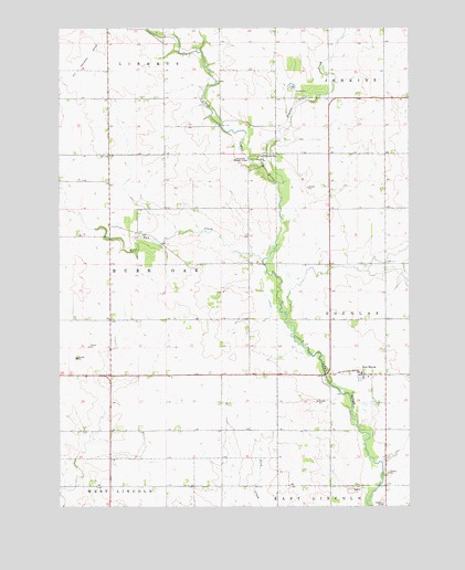
New Haven, IA USGS Topographic Map
Click on map above to begin viewing in our Map Viewer.

This topographic map contains these locations and features:
Feature Name Type Latitude Longitude GNIS ID View Map
Beaver CreekStreamN43.3344°W92.6702°454452View Map
BrownvillePopulated PlaceN43.3422°W92.6760°464474View Map
Brownville CemeteryCemeteryN43.3409°W92.6730°1944948View Map
Brownville Post Office (historical)Post OfficeN43.3422°W92.6760°1944843View Map
Brownville Wildlife AreaParkN43.3361°W92.6613°1944860View Map
Burr Oak CreekStreamN43.3144°W92.6771°455002View Map
Cardiff Post Office (historical)Post OfficeN43.3239°W92.7327°466429View Map
Lincoln Centre Post Office (historical)Post OfficeN43.2647°W92.6738°1944835View Map
Little Cedar Census Designated PlaceCensusN43.3698°W92.7236°2583485View Map
Melrose Pond AccessLocaleN43.2839°W92.6544°1944857View Map
New HavenPopulated PlaceN43.2844°W92.6421°459476View Map
New Haven Census Designated PlaceCensusN43.2839°W92.6422°2583490View Map
New Haven Post Office (historical)Post OfficeN43.2847°W92.6419°1944829View Map
New Haven PotholesParkN43.3105°W92.6752°1944859View Map
North Haven Wildlife AreaParkN43.2902°W92.6571°1944858View Map
Pioneer State ParkParkN43.3411°W92.6796°460191View Map
Saint Peters Catholic CemeteryCemeteryN43.2858°W92.6430°1944947View Map
Saint Peters ChurchChurchN43.2847°W92.6424°1944957View Map
Township of Burr OakCivilN43.3149°W92.7249°467510View Map

Note: Coordinates in the location and feature list above are referenced to NAD83 datum.


Copyright (C) 2008-2024 Ryan Niemi / Sunset Dynamics ... All Rights Reserved