TopoQuest Logo
Do you find TopoQuest useful?
Help keep TopoQuest running and adding new maps/features by donating!
Bitcoin:  19c7KJd3qBynnjoSw5npx9KScwjBe4ifkT
Litecoin:  LXs6TkuXGGXo1vDsWCkWVdjQX94eUKd6ui
Home View Maps Find Maps Find Places Resources & Links


Little Cedar, Iowa Topographic Map

USGS Map Title: Little Cedar, IA
USGS Map MRC: 43092D6
DRG (GeoTIFF) Download: o43092d6.tif


Neighboring USGS Topographic Map Quads:


  Rose Creek, MN  
43092E7
 

  Adams, MN  
43092E6
 

  Le Roy, MN  
43092E5
 

  Stacyville, IA  
43092D7
 

  Little Cedar, IA  
43092D6
 

  McIntire, IA  
43092D5
 

  Osage, IA  
43092C7
 

  New Haven, IA  
43092C6
 

  Riceville, IA  
43092C5


Map MRC Location:

N44°
W93°
N44°
W92°
H8 H7 H6 H5 H4 H3 H2 H1
G8 G7 G6 G5 G4 G3 G2 G1
F8 F7 F6 F5 F4 F3 F2 F1
E8 E7 E6 E5 E4 E3 E2 E1
D8 D7 D6 D5 D4 D3 D2 D1
C8 C7 C6 C5 C4 C3 C2 C1
B8 B7 B6 B5 B4 B3 B2 B1
A8 A7 A6 A5 A4 A3 A2 A1
N43°
W93°
N43°
W92°

Little Cedar, IA USGS 1:24K Topographic Map Preview:
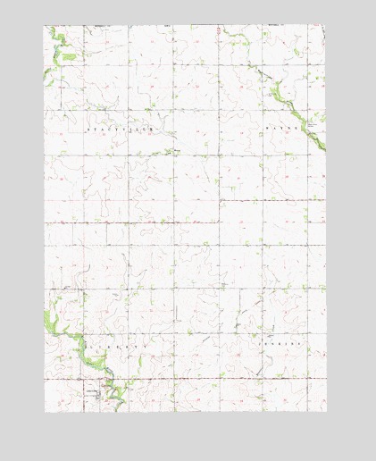
Little Cedar, IA USGS Topographic Map
Click on map above to begin viewing in our Map Viewer.

This topographic map contains these locations and features:
Feature Name Type Latitude Longitude GNIS ID View Map
David (historical)LocaleN43.4064°W92.6641°1944842View Map
David ChurchChurchN43.4027°W92.6655°455801View Map
David Post Office (historical)Post OfficeN43.4064°W92.6641°1944841View Map
Liberty CemeteryCemeteryN43.3855°W92.7232°458321View Map
Little CedarPopulated PlaceN43.3802°W92.7257°458449View Map
Little Cedar (historical)LocaleN43.3802°W92.7257°1944929View Map
Little Cedar Co-op ElevatorLocaleN43.3802°W92.7257°1944931View Map
Little Cedar Post Office (historical)Post OfficeN43.3869°W92.7224°466418View Map
Little Cedar River BridgeBridgeN43.3994°W92.7335°1944954View Map
McCarthy FarmsLocaleN43.4642°W92.6542°2702373View Map
Methodist ChurchChurchN43.3802°W92.7257°1944930View Map
MeyerPopulated PlaceN43.4577°W92.6927°459016View Map
Meyer Census Designated PlaceCensusN43.4618°W92.7011°2583487View Map
Meyer Post Office (historical)Post OfficeN43.4577°W92.6927°1944833View Map
Pronet FarmsLocaleN43.4897°W92.7294°2702375View Map
Robbins CemeteryCemeteryN43.4151°W92.6721°460691View Map
Sacred Heart CemeteryCemeteryN43.4584°W92.7015°1944949View Map
Sacred Heart ChurchChurchN43.4589°W92.7016°1944928View Map
Saint Patrick CemeteryCemeteryN43.4773°W92.6511°461238View Map
Township of LibertyCivilN43.3919°W92.7297°468225View Map
Township of StacyvilleCivilN43.4612°W92.7359°468748View Map
Wapsi River AccessParkN43.4650°W92.6332°462666View Map
Winkels FarmLocaleN43.4294°W92.6600°2702372View Map

Note: Coordinates in the location and feature list above are referenced to NAD83 datum.


Copyright (C) 2008-2024 Ryan Niemi / Sunset Dynamics ... All Rights Reserved