TopoQuest Logo
Do you find TopoQuest useful?
Help keep TopoQuest running and adding new maps/features by donating!
Bitcoin:  19c7KJd3qBynnjoSw5npx9KScwjBe4ifkT
Litecoin:  LXs6TkuXGGXo1vDsWCkWVdjQX94eUKd6ui
Home View Maps Find Maps Find Places Resources & Links


Namorf, Oregon Topographic Map

USGS Map Title: Namorf, OR
USGS Map MRC: 43117G6
DRG (GeoTIFF) Download: o43117g6.tif


Neighboring USGS Topographic Map Quads:


  Little Black Canyon, OR  
43117H7
 

  Westfall, OR  
43117H6
 

  Little Valley, OR  
43117H5
 

  South Mountain, OR  
43117G7
 

  Namorf, OR  
43117G6
 

  Harper, OR  
43117G5
 

  Tims Peak, OR  
43117F7
 

  Avery Creek, OR  
43117F6
 

  Keeney Ridge, OR  
43117F5


Map MRC Location:

N44°
W118°
N44°
W117°
H8 H7 H6 H5 H4 H3 H2 H1
G8 G7 G6 G5 G4 G3 G2 G1
F8 F7 F6 F5 F4 F3 F2 F1
E8 E7 E6 E5 E4 E3 E2 E1
D8 D7 D6 D5 D4 D3 D2 D1
C8 C7 C6 C5 C4 C3 C2 C1
B8 B7 B6 B5 B4 B3 B2 B1
A8 A7 A6 A5 A4 A3 A2 A1
N43°
W118°
N43°
W117°

Namorf, OR USGS 1:24K Topographic Map Preview:
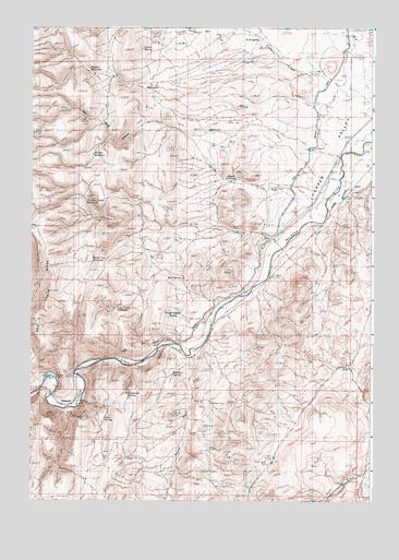
Namorf, OR USGS Topographic Map
Click on map above to begin viewing in our Map Viewer.

This topographic map contains these locations and features:
Feature Name Type Latitude Longitude GNIS ID View Map
Black CanyonValleyN43.7510°W117.6421°1117755View Map
Brown ReservoirReservoirN43.8332°W117.6718°1131804View Map
Bull SpringSpringN43.8087°W117.6951°1118282View Map
Chicken CreekStreamN43.8199°W117.6641°1118877View Map
Chicken Creek ReservoirReservoirN43.8298°W117.7307°1118883View Map
Corbett CreekStreamN43.8515°W117.6341°1131816View Map
Corral SpringSpringN43.8693°W117.7102°1119302View Map
Harper Airstrip (historical)AirportN43.8707°W117.6399°1638813View Map
Harper Census Designated PlaceCensusN43.8570°W117.6265°2611734View Map
Harper DamDamN43.7824°W117.7409°1161206View Map
Hog Creek RidgeRidgeN43.8057°W117.7432°1143640View Map
Hollow ReservoirReservoirN43.8414°W117.7278°1131818View Map
Horse Trail ReservoirReservoirN43.8147°W117.7273°1131819View Map
Howard CreekStreamN43.8679°W117.6607°1154069View Map
Kime (historical)LocaleN43.7985°W117.6857°1161643View Map
Lost Creek ReservoirReservoirN43.8007°W117.7189°1123498View Map
Lower Black Canyon ReservoirReservoirN43.8480°W117.6855°1638814View Map
Medlin ReservoirReservoirN43.8631°W117.7292°1133933View Map
Namorf (historical)LocaleN43.7785°W117.7324°1161455View Map
R W SpringSpringN43.8717°W117.6671°1125759View Map
Red Rock CanyonValleyN43.8465°W117.6927°1148280View Map
Shaw SpringSpringN43.7716°W117.7232°1161204View Map
Sheep Trough SpringSpringN43.7982°W117.6986°1131820View Map
Stinger SpringSpringN43.7835°W117.6983°1133934View Map
Tumbleweed SpringSpringN43.7788°W117.7140°1131806View Map
Tunnel SpringSpringN43.7874°W117.6955°1131805View Map
Yapaa CreekStreamN43.7893°W117.6907°1127487View Map

Note: Coordinates in the location and feature list above are referenced to NAD83 datum.


Copyright (C) 2008-2024 Ryan Niemi / Sunset Dynamics ... All Rights Reserved