TopoQuest Logo
Do you find TopoQuest useful?
Help keep TopoQuest running and adding new maps/features by donating!
Bitcoin:  19c7KJd3qBynnjoSw5npx9KScwjBe4ifkT
Litecoin:  LXs6TkuXGGXo1vDsWCkWVdjQX94eUKd6ui
Home View Maps Find Maps Find Places Resources & Links


Keeney Ridge, Oregon Topographic Map

USGS Map Title: Keeney Ridge, OR
USGS Map MRC: 43117F5
DRG (GeoTIFF) Download: o43117f5.tif


Neighboring USGS Topographic Map Quads:


  Namorf, OR  
43117G6
 

  Harper, OR  
43117G5
 

  Kane Spring Gulch, OR  
43117G4
 

  Avery Creek, OR  
43117F6
 

  Keeney Ridge, OR  
43117F5
 

  Sourdough Spring, OR  
43117F4
 

  Rufino Butte, OR  
43117E6
 

  Hurley Flat, OR  
43117E5
 

  Twin Springs, OR  
43117E4


Map MRC Location:

N44°
W118°
N44°
W117°
H8 H7 H6 H5 H4 H3 H2 H1
G8 G7 G6 G5 G4 G3 G2 G1
F8 F7 F6 F5 F4 F3 F2 F1
E8 E7 E6 E5 E4 E3 E2 E1
D8 D7 D6 D5 D4 D3 D2 D1
C8 C7 C6 C5 C4 C3 C2 C1
B8 B7 B6 B5 B4 B3 B2 B1
A8 A7 A6 A5 A4 A3 A2 A1
N43°
W118°
N43°
W117°

Keeney Ridge, OR USGS 1:24K Topographic Map Preview:
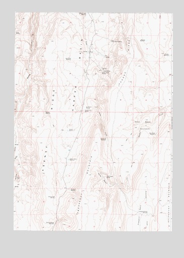
Keeney Ridge, OR USGS Topographic Map
Click on map above to begin viewing in our Map Viewer.

This topographic map contains these locations and features:
Feature Name Type Latitude Longitude GNIS ID View Map
Biley SpringSpringN43.7381°W117.6243°1117693View Map
Box CanyonValleyN43.6677°W117.6218°1118004View Map
Conway ReservoirReservoirN43.7258°W117.5032°1119212View Map
Daisy BasinBasinN43.6560°W117.5543°1119667View Map
Daisy Basin SpringSpringN43.6557°W117.5521°1119668View Map
Deep Draw ReservoirReservoirN43.6808°W117.5135°1119798View Map
East Harper Basin SpringSpringN43.7337°W117.5490°1120337View Map
Freezeout BasinBasinN43.6343°W117.5255°1120970View Map
Freezeout ReservoirReservoirN43.6484°W117.5802°1120975View Map
Freezeout Summit ReservoirReservoirN43.6353°W117.5191°1120978View Map
Harper Basin ReservoirReservoirN43.6658°W117.5817°1121608View Map
Harper Basin SpringSpringN43.7158°W117.5559°1121609View Map
Head of Hoodoo ReservoirReservoirN43.6835°W117.5259°1121717View Map
Hog Leg ReservoirReservoirN43.7343°W117.5212°1121877View Map
Hoodoo RidgeRidgeN43.7360°W117.5343°1160866View Map
Hunter Creek ReservoirReservoirN43.7492°W117.5684°1122150View Map
Indian CampLocaleN43.6554°W117.6232°1160865View Map
Keeney Creek Reservoir Number FourReservoirN43.6442°W117.5923°1122648View Map
Keeney Creek SpringSpringN43.6936°W117.5695°1122649View Map
Keeney RidgeRidgeN43.6577°W117.6018°1122650View Map
Quick Fill ReservoirReservoirN43.7234°W117.5803°1125749View Map
Quicksand ReservoirReservoirN43.6776°W117.5518°1125750View Map
Quicksand SpringSpringN43.6957°W117.5684°1125751View Map
Refuge SpringSpringN43.7164°W117.5551°1125935View Map
Sage Hen PenLocaleN43.7177°W117.5560°1126438View Map
Skyline ReservoirReservoirN43.6926°W117.6005°1127053View Map
Slim and Fatty ReservoirReservoirN43.6287°W117.5932°1127085View Map
Snow BasinBasinN43.6865°W117.5221°1127163View Map
Stacey Reservoir Number OneReservoirN43.6826°W117.5824°1127504View Map
Winter CampLocaleN43.7274°W117.5657°1129242View Map

Note: Coordinates in the location and feature list above are referenced to NAD83 datum.


Copyright (C) 2008-2024 Ryan Niemi / Sunset Dynamics ... All Rights Reserved