TopoQuest Logo
Do you find TopoQuest useful?
Help keep TopoQuest running and adding new maps/features by donating!
Bitcoin:  19c7KJd3qBynnjoSw5npx9KScwjBe4ifkT
Litecoin:  LXs6TkuXGGXo1vDsWCkWVdjQX94eUKd6ui
Home View Maps Find Maps Find Places Resources & Links


Murchinson West, Texas Topographic Map

USGS Map Title: Murchinson West, TX
USGS Map MRC: 32095C7
DRG (GeoTIFF) Download: o32095c7.tif


Neighboring USGS Topographic Map Quads:


  Phalba, TX  
32095D8
 

  Martins Mill, TX  
32095D7
 

  Ben Wheeler, TX  
32095D6
 

  Stockard, TX  
32095C8
 

  Murchinson West, TX  
32095C7
 

  Murchinson East, TX  
32095C6
 

  Mallard Hill, TX  
32095B8
 

  Athens, TX  
32095B7
 

  Leagueville, TX  
32095B6


Map MRC Location:

N33°
W96°
N33°
W95°
H8 H7 H6 H5 H4 H3 H2 H1
G8 G7 G6 G5 G4 G3 G2 G1
F8 F7 F6 F5 F4 F3 F2 F1
E8 E7 E6 E5 E4 E3 E2 E1
D8 D7 D6 D5 D4 D3 D2 D1
C8 C7 C6 C5 C4 C3 C2 C1
B8 B7 B6 B5 B4 B3 B2 B1
A8 A7 A6 A5 A4 A3 A2 A1
N32°
W96°
N32°
W95°

Murchinson West, TX USGS 1:24K Topographic Map Preview:
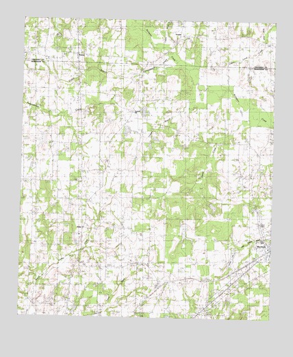
Murchinson West, TX USGS Topographic Map
Click on map above to begin viewing in our Map Viewer.

This topographic map contains these locations and features:
Feature Name Type Latitude Longitude GNIS ID View Map
Ash SchoolSchoolN32.2668°W95.7969°1329800View Map
BethelPopulated PlaceN32.2860°W95.8450°1889894View Map
Bethel ChurchChurchN32.2874°W95.8436°1330498View Map
Bethel SchoolSchoolN32.2840°W95.8452°1330514View Map
City of MurchisonCivilN32.2752°W95.7561°2411196View Map
Coppers BranchStreamN32.3626°W95.8069°1333341View Map
Cox ChapelChurchN32.3121°W95.8355°1333577View Map
Cox LakeReservoirN32.2551°W95.8602°1854672View Map
Cox Lake DamDamN32.2551°W95.8602°1854671View Map
Cream Level CreekStreamN32.3449°W95.7702°1373278View Map
Daniel CreekStreamN32.3346°W95.7533°1334029View Map
Diffy CreekStreamN32.3738°W95.7569°1373401View Map
Dillard LakeReservoirN32.2518°W95.7619°1854680View Map
Dillard Lake DamDamN32.2518°W95.7619°1854679View Map
Dragert LakeReservoirN32.2861°W95.7930°1854678View Map
Dragert Lake DamDamN32.2901°W95.7936°1854677View Map
Drakes BranchStreamN32.3518°W95.8177°1334599View Map
Jackson LakeLakeN32.2756°W95.7697°1889895View Map
Lee LakeReservoirN32.2518°W95.8486°1854676View Map
Lee Lake DamDamN32.2518°W95.8486°1854675View Map
Liberty CemeteryCemeteryN32.3679°W95.7872°1339870View Map
Martins Mills SchoolSchoolN32.3740°W95.7994°1341037View Map
Meredith SpringSpringN32.3446°W95.8719°1998586View Map
Meridith ChurchChurchN32.3449°W95.8716°1341383View Map
Murchison City HallBuildingN32.2790°W95.7503°2753267View Map
Murchison Volunteer Fire DepartmentBuildingN32.2789°W95.7502°2655289View Map
N M Jackson DamDamN32.2751°W95.7702°1854667View Map
Pottawatomie ChurchChurchN32.3385°W95.8186°1344436View Map
Pottawatomie CreekStreamN32.3593°W95.8014°1344437View Map
Ray CemeteryCemeteryN32.3443°W95.7936°1344845View Map
Stepp Airport (historical)AirportN32.2974°W95.8627°1386175View Map
Sumer HillPopulated PlaceN32.3368°W95.8208°1890012View Map
Tiner LakeReservoirN32.3285°W95.8619°1854674View Map
Tiner Lake DamDamN32.3285°W95.8619°1854673View Map
WaltonPopulated PlaceN32.3607°W95.8486°2034620View Map
Walton SchoolSchoolN32.3618°W95.8744°1349464View Map

Note: Coordinates in the location and feature list above are referenced to NAD83 datum.


Copyright (C) 2008-2024 Ryan Niemi / Sunset Dynamics ... All Rights Reserved