TopoQuest Logo
Do you find TopoQuest useful?
Help keep TopoQuest running and adding new maps/features by donating!
Bitcoin:  19c7KJd3qBynnjoSw5npx9KScwjBe4ifkT
Litecoin:  LXs6TkuXGGXo1vDsWCkWVdjQX94eUKd6ui
Home View Maps Find Maps Find Places Resources & Links


Murchinson East, Texas Topographic Map

USGS Map Title: Murchinson East, TX
USGS Map MRC: 32095C6
DRG (GeoTIFF) Download: o32095c6.tif


Neighboring USGS Topographic Map Quads:


  Martins Mill, TX  
32095D7
 

  Ben Wheeler, TX  
32095D6
 

  Carroll, TX  
32095D5
 

  Murchinson West, TX  
32095C7
 

  Murchinson East, TX  
32095C6
 

  Brownsboro, TX  
32095C5
 

  Athens, TX  
32095B7
 

  Leagueville, TX  
32095B6
 

  Moore Station, TX  
32095B5


Map MRC Location:

N33°
W96°
N33°
W95°
H8 H7 H6 H5 H4 H3 H2 H1
G8 G7 G6 G5 G4 G3 G2 G1
F8 F7 F6 F5 F4 F3 F2 F1
E8 E7 E6 E5 E4 E3 E2 E1
D8 D7 D6 D5 D4 D3 D2 D1
C8 C7 C6 C5 C4 C3 C2 C1
B8 B7 B6 B5 B4 B3 B2 B1
A8 A7 A6 A5 A4 A3 A2 A1
N32°
W96°
N32°
W95°

Murchinson East, TX USGS 1:24K Topographic Map Preview:
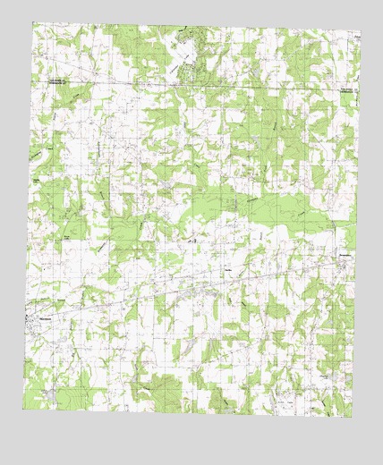
Murchinson East, TX USGS Topographic Map
Click on map above to begin viewing in our Map Viewer.

This topographic map contains these locations and features:
Feature Name Type Latitude Longitude GNIS ID View Map
Arms LakeLakeN32.3351°W95.7397°1351257View Map
Asberry CemeteryCemeteryN32.3554°W95.6805°1351292View Map
Bailey BranchStreamN32.3165°W95.6714°1351407View Map
Bailey Branch DamDamN32.2885°W95.6802°1854681View Map
Bailey Branch ReservoirReservoirN32.2810°W95.6800°1854682View Map
Big Duncan BranchStreamN32.2993°W95.7241°1356448View Map
Brownsboro Volunteer Fire DepartmentBuildingN32.3011°W95.6294°2655269View Map
Callender LakeReservoirN32.3652°W95.6947°1859772View Map
Callender Lake Census Designated PlaceCensusN32.3675°W95.6984°2586914View Map
Callender Lake DamDamN32.3551°W95.6919°1859771View Map
Chapman LakeReservoirN32.2633°W95.6325°1354309View Map
Echo Lake AirportAirportN32.2543°W95.6558°1386301View Map
Echols LakeLakeN32.2538°W95.7397°1356797View Map
Echols Lake DamDamN32.2551°W95.7386°1854685View Map
Gileon LakeLakeN32.3088°W95.7383°1358011View Map
Harten SloughLakeN32.3217°W95.7365°1358873View Map
Killingworth BranchStreamN32.3107°W95.7080°1358471View Map
Lewis CemeteryCemeteryN32.3418°W95.6830°1361121View Map
MarsPopulated PlaceN32.3593°W95.7258°2034766View Map
Mount Olive ChurchChurchN32.2729°W95.6419°1363292View Map
MurchisonPopulated PlaceN32.2785°W95.7497°1375068View Map
Murchison Post OfficePost OfficeN32.2794°W95.7464°2731417View Map
OpelikaPopulated PlaceN32.2971°W95.6744°1380308View Map
Opelika Gas FieldOilfieldN32.3313°W95.7058°1364567View Map
Pleasant Ridge ChurchChurchN32.3593°W95.7252°1365443View Map
Pounders LakeReservoirN32.3606°W95.6647°1365692View Map
Prairie CreekStreamN32.3354°W95.7416°1365717View Map
Price BranchStreamN32.3199°W95.6619°1365768View Map
Raines LakeLakeN32.3049°W95.7348°1365972View Map
Red Hill CemeteryCemeteryN32.2826°W95.6947°1366160View Map
Red Star AirportAirportN32.3557°W95.7144°2770652View Map
Reed BranchStreamN32.3165°W95.6714°1366292View Map
Roberson LakeReservoirN32.2726°W95.7370°1854684View Map
Roberson Lake DamDamN32.2735°W95.7336°1854683View Map
Scott MarshLakeN32.2776°W95.6794°1367888View Map
Shady Grove ChurchChurchN32.3357°W95.7169°1368026View Map
Slater CreekStreamN32.3171°W95.6858°1368403View Map
Waldrip LakeLakeN32.3271°W95.7475°1370745View Map

Note: Coordinates in the location and feature list above are referenced to NAD83 datum.


Copyright (C) 2008-2024 Ryan Niemi / Sunset Dynamics ... All Rights Reserved