TopoQuest Logo
Do you find TopoQuest useful?
Help keep TopoQuest running and adding new maps/features by donating!
Bitcoin:  19c7KJd3qBynnjoSw5npx9KScwjBe4ifkT
Litecoin:  LXs6TkuXGGXo1vDsWCkWVdjQX94eUKd6ui
Home View Maps Find Maps Find Places Resources & Links


Mount Mitchell, Oregon Topographic Map

USGS Map Title: Mount Mitchell, OR
USGS Map MRC: 45121A8
DRG (GeoTIFF) Download: o45121a8.tif


Neighboring USGS Topographic Map Quads:


  Three Lynx, OR  
45122B1
 

  High Rock, OR  
45121B8
 

  Wolf Peak, OR  
45121B7
 

  Fish Creek Mountain, OR  
45122A1
 

  Mount Mitchell, OR  
45121A8
 

  Timothy Lake, OR  
45121A7
 

  Bull of the Woods, OR  
44122H1
 

  Mount Lowe, OR  
44121H8
 

  Pinhead Buttes, OR  
44121H7


Map MRC Location:

N46°
W122°
N46°
W121°
H8 H7 H6 H5 H4 H3 H2 H1
G8 G7 G6 G5 G4 G3 G2 G1
F8 F7 F6 F5 F4 F3 F2 F1
E8 E7 E6 E5 E4 E3 E2 E1
D8 D7 D6 D5 D4 D3 D2 D1
C8 C7 C6 C5 C4 C3 C2 C1
B8 B7 B6 B5 B4 B3 B2 B1
A8 A7 A6 A5 A4 A3 A2 A1
N45°
W122°
N45°
W121°

Mount Mitchell, OR USGS 1:24K Topographic Map Preview:
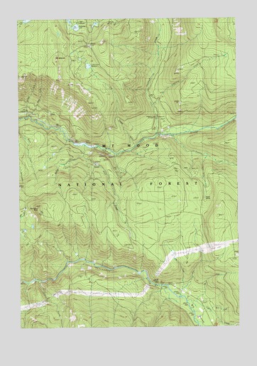
Mount Mitchell, OR USGS Topographic Map
Click on map above to begin viewing in our Map Viewer.

This topographic map contains these locations and features:
Feature Name Type Latitude Longitude GNIS ID View Map
Big BottomBendN45.0073°W121.9012°1137977View Map
Buck Lake TrailTrailN45.1173°W121.8887°1138797View Map
Cabin CreekStreamN45.0107°W121.9056°1139108View Map
Canyon CreekStreamN45.0873°W121.9967°1139322View Map
Cot CreekStreamN45.0735°W121.9356°1140165View Map
Cottonwood MeadowsFlatN45.1071°W121.9612°1140188View Map
Cottonwood Meadows TrailTrailN45.1148°W121.9667°1140189View Map
Devils Ridge QuarryMineN45.0288°W121.8763°2754422View Map
Devils SpringSpringN45.0516°W121.8952°1140975View Map
Devils Spring CreekStreamN45.0698°W121.8931°1637968View Map
Gee Zee QuarryMineN45.0701°W121.9542°2754420View Map
Granite CreekStreamN45.0196°W121.9923°1142924View Map
Harriet Lake Boat LaunchLocaleN45.0733°W121.9593°2699431View Map
Hideaway LakeLakeN45.1215°W121.9677°1143540View Map
Hideaway Lake Recreation SiteLocaleN45.1235°W121.9679°1156857View Map
Kelley CreekStreamN45.0732°W121.9634°1142543View Map
KII QuarryMineN45.0662°W121.9565°2754421View Map
Kink CreekStreamN45.0693°W121.9642°1144628View Map
Lake HarrietReservoirN45.0745°W121.9646°1158281View Map
Lake Harriet DamDamN45.0747°W121.9699°1155589View Map
Lake Harriet Recreation SiteLocaleN45.0735°W121.9581°1156861View Map
Lightning CreekStreamN45.0896°W121.9251°1144997View Map
Lost CreekStreamN45.0148°W121.9104°1145517View Map
Mount MitchellSummitN45.1082°W121.9776°1146526View Map
Oak Grove ButteSummitN45.0487°W121.9901°1147114View Map
Pan CreekStreamN45.0107°W121.9020°1147382View Map
Peavine CreekStreamN45.0779°W121.9151°1147540View Map
Pot CreekStreamN45.0137°W121.9142°1147927View Map
Pot Creek CabinLocaleN45.0140°W121.9067°1147930View Map
Pot Creek TrailTrailN45.0215°W121.9131°1147931View Map
Sam CreekStreamN45.0762°W121.9740°1149010View Map
Shellrock CreekStreamN45.0779°W121.9231°1149374View Map
Shellrock Creek Recreation SiteLocaleN45.0846°W121.9237°1149375View Map
Skunk CreekStreamN45.0871°W121.9940°1149644View Map
Spring CreekStreamN45.0721°W121.9512°1154934View Map
Steep SpringSpringN45.0772°W121.9592°1154933View Map
Thunder QuarryMineN45.1034°W121.9102°2754419View Map
Wolf CreekStreamN45.0096°W121.8984°1152576View Map

Note: Coordinates in the location and feature list above are referenced to NAD83 datum.


Copyright (C) 2008-2024 Ryan Niemi / Sunset Dynamics ... All Rights Reserved