TopoQuest Logo
Do you find TopoQuest useful?
Help keep TopoQuest running and adding new maps/features by donating!
Bitcoin:  19c7KJd3qBynnjoSw5npx9KScwjBe4ifkT
Litecoin:  LXs6TkuXGGXo1vDsWCkWVdjQX94eUKd6ui
Home View Maps Find Maps Find Places Resources & Links


Fish Creek Mountain, Oregon Topographic Map

USGS Map Title: Fish Creek Mountain, OR
USGS Map MRC: 45122A1
DRG (GeoTIFF) Download: o45122a1.tif


Neighboring USGS Topographic Map Quads:


  Bedford Point, OR  
45122B2
 

  Three Lynx, OR  
45122B1
 

  High Rock, OR  
45121B8
 

  Wanderers Peak, OR  
45122A2
 

  Fish Creek Mountain, OR  
45122A1
 

  Mount Mitchell, OR  
45121A8
 

  Bagby Hot Springs, OR  
44122H2
 

  Bull of the Woods, OR  
44122H1
 

  Mount Lowe, OR  
44121H8


Map MRC Location:

N46°
W123°
N46°
W122°
H8 H7 H6 H5 H4 H3 H2 H1
G8 G7 G6 G5 G4 G3 G2 G1
F8 F7 F6 F5 F4 F3 F2 F1
E8 E7 E6 E5 E4 E3 E2 E1
D8 D7 D6 D5 D4 D3 D2 D1
C8 C7 C6 C5 C4 C3 C2 C1
B8 B7 B6 B5 B4 B3 B2 B1
A8 A7 A6 A5 A4 A3 A2 A1
N45°
W123°
N45°
W122°

Fish Creek Mountain, OR USGS 1:24K Topographic Map Preview:
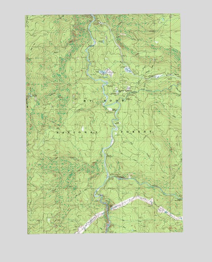
Fish Creek Mountain, OR USGS Topographic Map
Click on map above to begin viewing in our Map Viewer.

This topographic map contains these locations and features:
Feature Name Type Latitude Longitude GNIS ID View Map
Acme Timber Company Mill DamDamN45.0915°W122.0629°1153997View Map
Acme Timber Company Mill PondReservoirN45.0921°W122.0658°1153996View Map
Alder Flat Recreation SiteLocaleN45.0837°W122.0576°1137086View Map
Austin CreekStreamN45.0637°W122.0526°1154898View Map
Austin Hot SpringsSpringN45.0213°W122.0098°1137346View Map
Austin MeadowSwampN45.0627°W122.0509°1137348View Map
Austin PointSummitN45.0151°W122.0562°1137349View Map
Austin QuarryMineN45.0140°W122.0536°2754417View Map
Big CreekStreamN45.0782°W122.0626°1138002View Map
Boneyard QuarryMineN45.1106°W122.0613°2754408View Map
Bull CreekStreamN45.0921°W122.0620°1138898View Map
Butte CreekStreamN45.0832°W122.0048°1139058View Map
Cap CreekStreamN45.0096°W122.0606°1139341View Map
Cold Spring TrailTrailN45.0632°W122.1245°1158170View Map
Collawash RiverStreamN45.0312°W122.0615°1139987View Map
Cripple CreekStreamN45.1162°W122.0742°1140448View Map
Cripple Creek Forest CampLocaleN45.1151°W122.0734°1156854View Map
Cripple Creek QuarryMineN45.1198°W122.0180°2754409View Map
Cripple Creek TrailTrailN45.1229°W122.0312°1140449View Map
Curry Gravel PitMineN45.0361°W122.0104°2754414View Map
Drip CreekStreamN45.0198°W122.0026°1154896View Map
Dry CreekStreamN45.0776°W122.0595°1162451View Map
Estacada DivisionCivilN45.1056°W122.0479°1938012View Map
Fish Creek DivideRidgeN45.0707°W122.1237°1142151View Map
Fish Creek MountainSummitN45.0785°W122.1248°1142153View Map
Frog LakeReservoirN45.0928°W122.0436°1142500View Map
Frog Lake DamDamN45.0898°W122.0529°1154001View Map
Half-pint CreekStreamN45.0876°W122.0320°1143207View Map
High LakeLakeN45.0788°W122.1216°1143572View Map
High Lake PitMineN45.0724°W122.1057°2754412View Map
Indian Henry Recreation SiteLocaleN45.1082°W122.0756°1134279View Map
Jack Davis CreekStreamN45.0262°W122.0679°1154899View Map
John CreekStreamN45.0804°W122.0179°1144302View Map
Linerunner QuarryMineN45.0122°W122.0201°2754418View Map
Mag CreekStreamN45.0596°W122.0512°1154897View Map
Mistletoe Gravel PitMineN45.0781°W122.0880°2754411View Map
Nowhere MeadowFlatN45.0812°W122.0445°1147085View Map
Oak Grove Fork Clackamas RiverStreamN45.0746°W122.0523°1147116View Map
Oak Grove Ranger StationBuildingN45.0890°W122.0223°1147117View Map
Pickup PitMineN45.0997°W122.0841°2754407View Map
Pint CreekStreamN45.0804°W122.0379°1147749View Map
Quercus PitMineN45.0570°W122.0006°2754413View Map
RAAB Recreation SiteLocaleN45.0221°W122.0706°1162446View Map
Rainbow Recreation SiteLocaleN45.0762°W122.0442°1156851View Map
RipplebrookPopulated PlaceN45.0823°W122.0434°1134277View Map
Ripplebrook PondReservoirN45.0809°W122.0524°1134276View Map
Ripplebrook Ranger Station (historical)BuildingN45.0798°W122.0526°1134275View Map
Ripplebrook Recreation SiteLocaleN45.0790°W122.0429°1148480View Map
River Ford Recreation SiteLocaleN45.0332°W122.0512°1162452View Map
Riverside Recreation SiteLocaleN45.0510°W122.0562°1148494View Map
Rod CreekStreamN45.0387°W122.0776°1148680View Map
Sandstone CreekStreamN45.0885°W122.0734°1149052View Map
Sandstone PitsMineN45.0043°W122.1040°2754415View Map
Silver Tip CampLocaleN45.0901°W122.0076°1149510View Map
Sluice CreekStreamN45.0060°W122.0598°1149734View Map
South Fork Cripple CreekStreamN45.1146°W122.0626°1149960View Map
Station CreekStreamN45.0818°W122.0312°1154900View Map
Surprise LakeLakeN45.1092°W122.0634°1150698View Map
Switch CreekStreamN45.0221°W122.0170°1150792View Map
Tag CreekStreamN45.0640°W122.0520°1150834View Map
Tar CreekStreamN45.0501°W122.0576°1150899View Map
Timber LakeLakeN45.0923°W122.0644°1156855View Map
Timber Lake Job Corps CenterLocaleN45.0918°W122.0604°1134278View Map
Trout CreekStreamN45.0410°W122.0631°1151437View Map
Two Rivers Recreation SiteLocaleN45.0318°W122.0623°1162447View Map
Umpqua QuarryMineN45.0192°W122.0688°2754416View Map
Upper Mitchell QuarryMineN45.0983°W122.0231°2754410View Map
Wards MeadowSwampN45.0710°W122.0590°1151889View Map
Whale CreekStreamN45.1110°W122.0726°1152167View Map
Whale HeadSummitN45.1062°W122.1190°1152168View Map

Note: Coordinates in the location and feature list above are referenced to NAD83 datum.


Copyright (C) 2008-2024 Ryan Niemi / Sunset Dynamics ... All Rights Reserved