TopoQuest Logo
Do you find TopoQuest useful?
Help keep TopoQuest running and adding new maps/features by donating!
Bitcoin:  19c7KJd3qBynnjoSw5npx9KScwjBe4ifkT
Litecoin:  LXs6TkuXGGXo1vDsWCkWVdjQX94eUKd6ui
Home View Maps Find Maps Find Places Resources & Links


Morley, New York Topographic Map

USGS Map Title: Morley, NY
USGS Map MRC: 44075F2
DRG (GeoTIFF) Download: o44075f2.tif


Neighboring USGS Topographic Map Quads:


  Sparrowhawk Point, NY  
44075G3
 

  Waddington, NY  
44075G2
 

  Chase Mills, NY  
44075G1
 

  Lisbon, NY  
44075F3
 

  Morley, NY  
44075F2
 

  West Potsdam, NY  
44075F1
 

  Rensselaer Falls, NY  
44075E3
 

  Canton, NY  
44075E2
 

  Pierrepont, NY  
44075E1


Map MRC Location:

N45°
W76°
N45°
W75°
H8 H7 H6 H5 H4 H3 H2 H1
G8 G7 G6 G5 G4 G3 G2 G1
F8 F7 F6 F5 F4 F3 F2 F1
E8 E7 E6 E5 E4 E3 E2 E1
D8 D7 D6 D5 D4 D3 D2 D1
C8 C7 C6 C5 C4 C3 C2 C1
B8 B7 B6 B5 B4 B3 B2 B1
A8 A7 A6 A5 A4 A3 A2 A1
N44°
W76°
N44°
W75°

Morley, NY USGS 1:24K Topographic Map Preview:
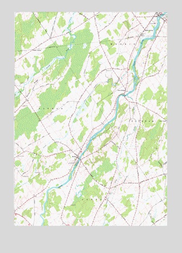
Morley, NY USGS Topographic Map
Click on map above to begin viewing in our Map Viewer.

This topographic map contains these locations and features:
Feature Name Type Latitude Longitude GNIS ID View Map
Bucks BridgePopulated PlaceN44.7051°W75.1591°976055View Map
Canton Free Library Morley BranchBuildingN44.6645°W75.1979°2599065View Map
Casey CornersLocaleN44.6864°W75.1252°976085View Map
Cedar Meadows FarmLocaleN44.7336°W75.2192°2702692View Map
Christian Fellowship CenterChurchN44.7435°W75.1353°2599059View Map
Doran CemeteryCemeteryN44.7161°W75.1708°976256View Map
Hague CrossingPopulated PlaceN44.7278°W75.2352°976388View Map
Hepburn Public LibraryBuildingN44.7486°W75.1339°2417693View Map
Jordan FarmsLocaleN44.6633°W75.2022°2702694View Map
Lawrence CemeteryCemeteryN44.6656°W75.2471°976536View Map
Line CreekStreamN44.7153°W75.1524°976549View Map
Madrid Census Designated PlaceCensusN44.7484°W75.1299°2627948View Map
Madrid Central SchoolSchoolN44.7437°W75.1352°976108View Map
Madrid Golf ClubLocaleN44.7446°W75.1357°2599050View Map
Madrid Rescue SquadBuildingN44.7363°W75.1442°2720107View Map
Madrid SpringsPopulated PlaceN44.7401°W75.1435°976617View Map
Madrid Town HallBuildingN44.7382°W75.1459°2599074View Map
Madrid Volunteer Fire DepartmentBuildingN44.7488°W75.1332°2735280View Map
Madrid Water District Filter House And Pumping StationBuildingN44.7467°W75.1303°2417694View Map
Mapleview DairyLocaleN44.7397°W75.1597°2559382View Map
Morey RidgeRidgeN44.7053°W75.2360°976676View Map
MorleyPopulated PlaceN44.6651°W75.1988°976678View Map
Morley CemeteryCemeteryN44.6615°W75.2009°976679View Map
Morley Volunteer Fire CompanyBuildingN44.6647°W75.1971°2735281View Map
Nettle CreekStreamN44.7014°W75.1574°976714View Map
Olin CemeteryCemeteryN44.6444°W75.1729°976768View Map
Paradise Valley FarmLocaleN44.7242°W75.1544°2702623View Map
Pilgrim Holiness Church (historical)ChurchN44.7494°W75.1317°2417692View Map
Saint John's Roman Catholic ChurchChurchN44.7494°W75.1347°2417691View Map
Trinity Episcopal CemeteryCemeteryN44.6619°W75.2004°977135View Map
Wesleyan ChurchChurchN44.6648°W75.1978°2598307View Map

Note: Coordinates in the location and feature list above are referenced to NAD83 datum.


Copyright (C) 2008-2024 Ryan Niemi / Sunset Dynamics ... All Rights Reserved