TopoQuest Logo
Do you find TopoQuest useful?
Help keep TopoQuest running and adding new maps/features by donating!
Bitcoin:  19c7KJd3qBynnjoSw5npx9KScwjBe4ifkT
Litecoin:  LXs6TkuXGGXo1vDsWCkWVdjQX94eUKd6ui
Home View Maps Find Maps Find Places Resources & Links


Bee Mountain, Arkansas Topographic Map

USGS Map Title: Bee Mountain, AR
USGS Map MRC: 34093H8
DRG (GeoTIFF) Download: o34093h8.tif


Neighboring USGS Topographic Map Quads:


  Ione, AR  
35094A1
 

  Golden City, AR  
35093A8
 

  Sugar Grove, AR  
35093A7
 

  Waldron, AR  
34094H1
 

  Bee Mountain, AR  
34093H8
 

  Freedom Mountain, AR  
34093H7
 

  Boles, AR  
34094G1
 

  Parks, AR  
34093G8
 

  Harvey, AR  
34093G7


Map MRC Location:

N35°
W94°
N35°
W93°
H8 H7 H6 H5 H4 H3 H2 H1
G8 G7 G6 G5 G4 G3 G2 G1
F8 F7 F6 F5 F4 F3 F2 F1
E8 E7 E6 E5 E4 E3 E2 E1
D8 D7 D6 D5 D4 D3 D2 D1
C8 C7 C6 C5 C4 C3 C2 C1
B8 B7 B6 B5 B4 B3 B2 B1
A8 A7 A6 A5 A4 A3 A2 A1
N34°
W94°
N34°
W93°

Bee Mountain, AR USGS 1:24K Topographic Map Preview:
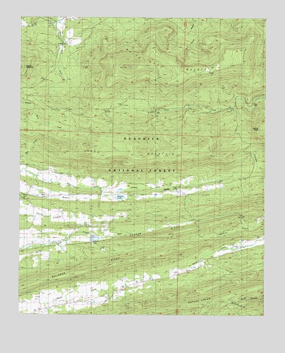
Bee Mountain, AR USGS Topographic Map
Click on map above to begin viewing in our Map Viewer.

This topographic map contains these locations and features:
Feature Name Type Latitude Longitude GNIS ID View Map
Bed CreekStreamN34.9362°W93.9996°70597View Map
Bee MountainSummitN34.9451°W93.9058°70605View Map
CardiffPopulated PlaceN34.9273°W93.9252°66276View Map
Friendship CemeteryCemeteryN34.8826°W93.9541°71693View Map
Friendship ChurchChurchN34.8873°W93.9455°71694View Map
Harding RidgeRidgeN34.9540°W93.8760°71903View Map
Highway 250 Rural Volunteer Fire DepartmentBuildingN34.8797°W93.9732°2116569View Map
Moore LakeReservoirN34.9252°W93.9491°80557View Map
Mount Pleasant CemeteryCemeteryN34.9237°W93.9971°66314View Map
Mount Pleasant ChurchChurchN34.9234°W93.9985°72764View Map
Narrow RidgeRidgeN34.9087°W93.9258°72833View Map
Poteau River Watershed Site One DamDamN34.9084°W93.9635°80560View Map
Poteau River Watershed Site Two DamDamN34.9251°W93.9502°80556View Map
Selkirk LakeReservoirN34.9072°W93.9616°66332View Map
Township of Mount PleasantCivilN34.9251°W93.9615°69075View Map
Township of TateCivilN34.9869°W93.9164°69078View Map
Waldron RidgeRidgeN34.8945°W93.9602°73984View Map
White Oak Lookout TowerTowerN34.9793°W93.9449°82586View Map
White Oak MountainSummitN34.9793°W93.9452°74124View Map

Note: Coordinates in the location and feature list above are referenced to NAD83 datum.


Copyright (C) 2008-2024 Ryan Niemi / Sunset Dynamics ... All Rights Reserved