TopoQuest Logo
Do you find TopoQuest useful?
Help keep TopoQuest running and adding new maps/features by donating!
Bitcoin:  19c7KJd3qBynnjoSw5npx9KScwjBe4ifkT
Litecoin:  LXs6TkuXGGXo1vDsWCkWVdjQX94eUKd6ui
Home View Maps Find Maps Find Places Resources & Links


Moorland, Iowa Topographic Map

USGS Map Title: Moorland, IA
USGS Map MRC: 42094D3
DRG (GeoTIFF) Download: o42094d3.tif


Neighboring USGS Topographic Map Quads:


  Gilmore City SW, IA  
42094E4
 

  Clare, IA  
42094E3
 

  Fort Dodge North, IA  
42094E2
 

  Knierim, IA  
42094D4
 

  Moorland, IA  
42094D3
 

  Fort Dodge South, IA  
42094D2
 

  Farnhamville, IA  
42094C4
 

  Gowrie, IA  
42094C3
 

  Harcourt, IA  
42094C2


Map MRC Location:

N43°
W95°
N43°
W94°
H8 H7 H6 H5 H4 H3 H2 H1
G8 G7 G6 G5 G4 G3 G2 G1
F8 F7 F6 F5 F4 F3 F2 F1
E8 E7 E6 E5 E4 E3 E2 E1
D8 D7 D6 D5 D4 D3 D2 D1
C8 C7 C6 C5 C4 C3 C2 C1
B8 B7 B6 B5 B4 B3 B2 B1
A8 A7 A6 A5 A4 A3 A2 A1
N42°
W95°
N42°
W94°

Moorland, IA USGS 1:24K Topographic Map Preview:
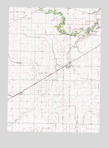
Moorland, IA USGS Topographic Map
Click on map above to begin viewing in our Map Viewer.

This topographic map contains these locations and features:
Feature Name Type Latitude Longitude GNIS ID View Map
City of MoorlandCivilN42.4414°W94.2954°2395394View Map
Congregational ChurchChurchN42.4414°W94.2952°1996766View Map
Fulton CemeteryCemeteryN42.4268°W94.3691°456804View Map
Fulton Lutheran ChurchChurchN42.4122°W94.3586°1996764View Map
Fulton Township CemeteryCemeteryN42.4272°W94.3158°1996854View Map
Lizard Creek State Recreation AreaParkN42.4769°W94.2636°458544View Map
McLaughlin's Grove Post Office (historical)Post OfficeN42.4944°W94.2961°1996641View Map
Mizpah CemeteryCemeteryN42.3839°W94.3713°459157View Map
Mooreland Fire DepartmentBuildingN42.4399°W94.2968°1996768View Map
MoorlandLocaleN42.4419°W94.2961°1996771View Map
MoorlandPopulated PlaceN42.4416°W94.2950°459218View Map
Moorland City Community CenterBuildingN42.4416°W94.2950°1996767View Map
Moorland Pond ParkParkN42.4455°W94.2919°1996594View Map
Moorland Post OfficePost OfficeN42.4414°W94.2921°1996770View Map
Nesler Field (historical)AirportN42.4333°W94.2836°466886View Map
New Cooperative Incorporated ElevatorLocaleN42.4416°W94.2950°1996769View Map
Our Lady of Good Council CemeteryCemeteryN42.4427°W94.3047°459955View Map
Our Lady of Good Counsel ChurchChurchN42.4416°W94.2936°1996765View Map
Prairie CreekStreamN42.4372°W94.3083°460395View Map
RoelynLocaleN42.4136°W94.3575°1996606View Map
RoelynPopulated PlaceN42.4136°W94.3575°460761View Map
Roelyn Post Office (historical)Post OfficeN42.4136°W94.3575°1996605View Map
Spring CreekStreamN42.4766°W94.2664°461887View Map
Tara Post Office (historical)Post OfficeN42.4828°W94.3330°466669View Map
Township of FultonCivilN42.4284°W94.3390°467886View Map

Note: Coordinates in the location and feature list above are referenced to NAD83 datum.


Copyright (C) 2008-2024 Ryan Niemi / Sunset Dynamics ... All Rights Reserved