TopoQuest Logo
Do you find TopoQuest useful?
Help keep TopoQuest running and adding new maps/features by donating!
Bitcoin:  19c7KJd3qBynnjoSw5npx9KScwjBe4ifkT
Litecoin:  LXs6TkuXGGXo1vDsWCkWVdjQX94eUKd6ui
Home View Maps Find Maps Find Places Resources & Links


Gowrie, Iowa Topographic Map

USGS Map Title: Gowrie, IA
USGS Map MRC: 42094C3
DRG (GeoTIFF) Download: o42094c3.tif


Neighboring USGS Topographic Map Quads:


  Knierim, IA  
42094D4
 

  Moorland, IA  
42094D3
 

  Fort Dodge South, IA  
42094D2
 

  Farnhamville, IA  
42094C4
 

  Gowrie, IA  
42094C3
 

  Harcourt, IA  
42094C2
 

  Churdan, IA  
42094B4
 

  Paton, IA  
42094B3
 

  Lanyon, IA  
42094B2


Map MRC Location:

N43°
W95°
N43°
W94°
H8 H7 H6 H5 H4 H3 H2 H1
G8 G7 G6 G5 G4 G3 G2 G1
F8 F7 F6 F5 F4 F3 F2 F1
E8 E7 E6 E5 E4 E3 E2 E1
D8 D7 D6 D5 D4 D3 D2 D1
C8 C7 C6 C5 C4 C3 C2 C1
B8 B7 B6 B5 B4 B3 B2 B1
A8 A7 A6 A5 A4 A3 A2 A1
N42°
W95°
N42°
W94°

Gowrie, IA USGS 1:24K Topographic Map Preview:
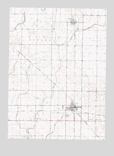
Gowrie, IA USGS Topographic Map
Click on map above to begin viewing in our Map Viewer.

This topographic map contains these locations and features:
Feature Name Type Latitude Longitude GNIS ID View Map
Bruntlett ElevatorLocaleN42.2875°W94.2933°1996791View Map
CallenderLocaleN42.3616°W94.2908°1996834View Map
CallenderPopulated PlaceN42.3619°W94.2958°455056View Map
Callender CemeteryCemeteryN42.3693°W94.2791°1996857View Map
Callender Community CenterBuildingN42.3619°W94.2933°1996830View Map
Callender Community Fire DepartmentBuildingN42.3620°W94.2918°2577447View Map
Callender Post OfficePost OfficeN42.3620°W94.2930°1996832View Map
Callender Public LibraryBuildingN42.3619°W94.2933°1996833View Map
City of CallenderCivilN42.3616°W94.2955°2393498View Map
City of GowrieCivilN42.2778°W94.2897°2394939View Map
Community ClinicHospitalN42.2805°W94.2908°1996797View Map
Danish CemeteryCemeteryN42.3686°W94.3689°455789View Map
Ditch Number 5CanalN42.3600°W94.2611°465725View Map
Ditch Number 52CanalN42.2933°W94.3527°465726View Map
GowriePopulated PlaceN42.2805°W94.2908°456991View Map
GowrieLocaleN42.2778°W94.2919°1996801View Map
Gowrie Care CenterHospitalN42.2805°W94.2908°1996795View Map
Gowrie City Community CenterBuildingN42.2805°W94.2886°1996790View Map
Gowrie City Police DepartmentBuildingN42.2808°W94.2915°1996788View Map
Gowrie Depot Historical MuseumBuildingN42.2847°W94.2891°1996794View Map
Gowrie Fire DepartmentBuildingN42.2826°W94.2900°2577294View Map
Gowrie Golf and Country ClubLocaleN42.2715°W94.2846°1996786View Map
Gowrie Post OfficePost OfficeN42.2815°W94.2883°1996787View Map
Gowrie Public LibraryBuildingN42.2805°W94.2886°1996789View Map
Gowrie Township CemeteryCemeteryN42.2806°W94.3048°463764View Map
Laurel ParkParkN42.2847°W94.2891°1996793View Map
Lindquist Wildlife SanctuaryParkN42.2861°W94.2864°1996591View Map
Our Saviour CemeteryCemeteryN42.3397°W94.3153°459966View Map
Our Saviours Lutheran ChurchChurchN42.3639°W94.2930°1996836View Map
Peterson Airport (historical)AirportN42.3547°W94.3194°466724View Map
Rock Vision ClinicHospitalN42.2805°W94.2908°1996796View Map
Southeast Valley High SchoolSchoolN42.2795°W94.2957°1996800View Map
Southwest Webster Ambulance ServiceBuildingN42.2825°W94.2880°2599956View Map
Township of GowrieCivilN42.2528°W94.3395°467919View Map
Township of RolandCivilN42.3400°W94.3391°468636View Map
United Methodist ChurchChurchN42.2805°W94.2908°1996798View Map
West Central Co-op Company ElevatorLocaleN42.3619°W94.2933°1996831View Map
West Central Co-op ElevatorLocaleN42.2750°W94.2891°1996792View Map
Zion Lutheran ChurchChurchN42.2794°W94.2864°1996799View Map

Note: Coordinates in the location and feature list above are referenced to NAD83 datum.


Copyright (C) 2008-2024 Ryan Niemi / Sunset Dynamics ... All Rights Reserved