TopoQuest Logo
Do you find TopoQuest useful?
Help keep TopoQuest running and adding new maps/features by donating!
Bitcoin:  19c7KJd3qBynnjoSw5npx9KScwjBe4ifkT
Litecoin:  LXs6TkuXGGXo1vDsWCkWVdjQX94eUKd6ui
Home View Maps Find Maps Find Places Resources & Links


Beckwith Mountain, Colorado Topographic Map

USGS Map Title: Beckwith Mountain, CO
USGS Map MRC: 38105B5
DRG (GeoTIFF) Download: o38105b5.tif


Neighboring USGS Topographic Map Quads:


  Cotopaxi, CO  
38105C6
 

  Hillside, CO  
38105C5
 

  Iron Mountain, CO  
38105C4
 

  Electric Peak, CO  
38105B6
 

  Beckwith Mountain, CO  
38105B5
 

  Westcliffe, CO  
38105B4
 

  Rito Alto Peak, CO  
38105A6
 

  Horn Peak, CO  
38105A5
 

  Aldrich Gulch, CO  
38105A4


Map MRC Location:

N39°
W106°
N39°
W105°
H8 H7 H6 H5 H4 H3 H2 H1
G8 G7 G6 G5 G4 G3 G2 G1
F8 F7 F6 F5 F4 F3 F2 F1
E8 E7 E6 E5 E4 E3 E2 E1
D8 D7 D6 D5 D4 D3 D2 D1
C8 C7 C6 C5 C4 C3 C2 C1
B8 B7 B6 B5 B4 B3 B2 B1
A8 A7 A6 A5 A4 A3 A2 A1
N38°
W106°
N38°
W105°

Beckwith Mountain, CO USGS 1:24K Topographic Map Preview:
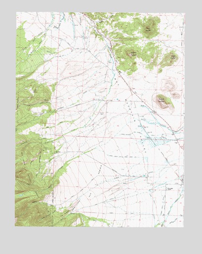
Beckwith Mountain, CO USGS Topographic Map
Click on map above to begin viewing in our Map Viewer.

This topographic map contains these locations and features:
Feature Name Type Latitude Longitude GNIS ID View Map
Beckwith MountainSummitN38.1992°W105.5181°192132View Map
Beddows MountainSummitN38.2261°W105.5386°192133View Map
Buck MountainSummitN38.2402°W105.5271°192135View Map
Buttermilk CreekStreamN38.1750°W105.5978°191958View Map
Cress Field (historical)AirportN38.1903°W105.5639°192131View Map
Freer-Beckwith and Kennicott DitchCanalN38.1778°W105.5283°192128View Map
Gibson CreekStreamN38.1356°W105.5914°192111View Map
Gibson Creek TrailheadLocaleN38.1361°W105.5892°197619View Map
Goat CreekStreamN38.2242°W105.5547°191965View Map
Goodwin CreekStreamN38.1281°W105.5147°192114View Map
Greenleaf CreekStreamN38.2103°W105.5539°192130View Map
Grouse MountainSummitN38.2240°W105.5092°192134View Map
Hogback DitchCanalN38.1375°W105.5797°192108View Map
Howard Number 1 DitchCanalN38.2278°W105.5942°192138View Map
James Jarvis Swift Creek Ditch Number 3CanalN38.1658°W105.5450°192125View Map
Kick and Kint DitchCanalN38.2250°W105.5875°192137View Map
Koch SpringsSpringN38.2400°W105.5961°192140View Map
Lohstroh Highline DitchCanalN38.1833°W105.5014°203572View Map
Lower Smith DitchCanalN38.1389°W105.5128°192122View Map
North Brush CreekStreamN38.2403°W105.6025°191972View Map
North Greenleaf CreekStreamN38.1817°W105.6236°191988View Map
O'Leary CreekStreamN38.2489°W105.5786°192136View Map
Oak DrawValleyN38.1872°W105.5808°192129View Map
Phares and Allen MineMineN38.2006°W105.5144°1725053View Map
Reed DitchCanalN38.2250°W105.5728°192139View Map
Reed GulchValleyN38.2440°W105.5700°191809View Map
San Isabel RanchLocaleN38.1472°W105.5131°192141View Map
Short CreekStreamN38.1856°W105.5422°192109View Map
South Brush CreekStreamN38.2403°W105.6025°191973View Map
South Greenleaf CreekStreamN38.1817°W105.6236°191989View Map
The HogbackRidgeN38.1367°W105.5825°192119View Map
The PinesLocaleN38.1678°W105.5950°192126View Map
The Pines CemeteryCemeteryN38.1708°W105.6014°192127View Map
Ula (historical)Populated PlaceN38.1501°W105.5019°1782041View Map
Ula CemeteryCemeteryN38.1508°W105.5055°192142View Map
Ula DitchCanalN38.1389°W105.5617°192121View Map
Ula PrairieAreaN38.1500°W105.5644°192123View Map
Upper Smith DitchCanalN38.1417°W105.5200°192120View Map
Verde CreekStreamN38.1356°W105.5914°192118View Map

Note: Coordinates in the location and feature list above are referenced to NAD83 datum.


Copyright (C) 2008-2024 Ryan Niemi / Sunset Dynamics ... All Rights Reserved