TopoQuest Logo
Do you find TopoQuest useful?
Help keep TopoQuest running and adding new maps/features by donating!
Bitcoin:  19c7KJd3qBynnjoSw5npx9KScwjBe4ifkT
Litecoin:  LXs6TkuXGGXo1vDsWCkWVdjQX94eUKd6ui
Home View Maps Find Maps Find Places Resources & Links


Mineral, Washington Topographic Map

USGS Map Title: Mineral, WA
USGS Map MRC: 46122F2
DRG (GeoTIFF) Download: o46122f2.tif


Neighboring USGS Topographic Map Quads:


  Eatonville, WA  
46122G3
 

  Elbe, WA  
46122G2
 

  Ashford, WA  
46122G1
 

  The Rockies, WA  
46122F3
 

  Mineral, WA  
46122F2
 

  Anderson Lake, WA  
46122F1
 

  Morton, WA  
46122E3
 

  Glenoma, WA  
46122E2
 

  Kiona Peak, WA  
46122E1


Map MRC Location:

N47°
W123°
N47°
W122°
H8 H7 H6 H5 H4 H3 H2 H1
G8 G7 G6 G5 G4 G3 G2 G1
F8 F7 F6 F5 F4 F3 F2 F1
E8 E7 E6 E5 E4 E3 E2 E1
D8 D7 D6 D5 D4 D3 D2 D1
C8 C7 C6 C5 C4 C3 C2 C1
B8 B7 B6 B5 B4 B3 B2 B1
A8 A7 A6 A5 A4 A3 A2 A1
N46°
W123°
N46°
W122°

Mineral, WA USGS 1:24K Topographic Map Preview:
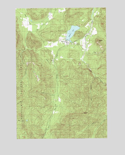
Mineral, WA USGS Topographic Map
Click on map above to begin viewing in our Map Viewer.

This topographic map contains these locations and features:
Feature Name Type Latitude Longitude GNIS ID View Map
CarlsonPopulated PlaceN46.7001°W122.1996°1517401View Map
Coal CreekStreamN46.6987°W122.1996°1517882View Map
DivideLocaleN46.6651°W122.1929°1518807View Map
Lewis County Fire District 9 Mineral Fire DepartmentBuildingN46.7178°W122.1816°2643277View Map
MineralPopulated PlaceN46.7171°W122.1809°1523205View Map
Mineral Census Designated PlaceCensusN46.7193°W122.1860°2586741View Map
Mineral LakeReservoirN46.7182°W122.1779°1523216View Map
Mineral Lake DamDamN46.7182°W122.1779°1532239View Map
Mineral Landing Strip (historical)AirportN46.7240°W122.1465°1530178View Map
Mineral Post OfficePost OfficeN46.7161°W122.1793°2781635View Map
North Fork Mineral CreekStreamN46.7090°W122.1551°1523806View Map
Roundtop CreekStreamN46.7209°W122.1571°1525247View Map
Roundtop MountainSummitN46.7157°W122.1354°1525246View Map
Storm King LookoutLocaleN46.6484°W122.1584°1530247View Map
Storm King MountainSummitN46.6484°W122.1584°1526597View Map
Summit CreekStreamN46.6682°W122.1946°1526710View Map
Washington CreekStreamN46.6837°W122.1434°1527823View Map

Note: Coordinates in the location and feature list above are referenced to NAD83 datum.


Copyright (C) 2008-2024 Ryan Niemi / Sunset Dynamics ... All Rights Reserved