TopoQuest Logo
Do you find TopoQuest useful?
Help keep TopoQuest running and adding new maps/features by donating!
Bitcoin:  19c7KJd3qBynnjoSw5npx9KScwjBe4ifkT
Litecoin:  LXs6TkuXGGXo1vDsWCkWVdjQX94eUKd6ui
Home View Maps Find Maps Find Places Resources & Links


Morton, Washington Topographic Map

USGS Map Title: Morton, WA
USGS Map MRC: 46122E3
DRG (GeoTIFF) Download: o46122e3.tif


Neighboring USGS Topographic Map Quads:


  Newaukum Lake, WA  
46122F4
 

  The Rockies, WA  
46122F3
 

  Mineral, WA  
46122F2
 

  Mossyrock, WA  
46122E4
 

  Morton, WA  
46122E3
 

  Glenoma, WA  
46122E2
 

  Coyote Mountain, WA  
46122D4
 

  Winters Mountain, WA  
46122D3
 

  Vanson Peak, WA  
46122D2


Map MRC Location:

N47°
W123°
N47°
W122°
H8 H7 H6 H5 H4 H3 H2 H1
G8 G7 G6 G5 G4 G3 G2 G1
F8 F7 F6 F5 F4 F3 F2 F1
E8 E7 E6 E5 E4 E3 E2 E1
D8 D7 D6 D5 D4 D3 D2 D1
C8 C7 C6 C5 C4 C3 C2 C1
B8 B7 B6 B5 B4 B3 B2 B1
A8 A7 A6 A5 A4 A3 A2 A1
N46°
W123°
N46°
W122°

Morton, WA USGS 1:24K Topographic Map Preview:
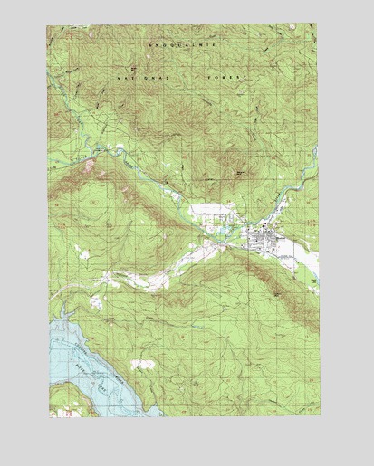
Morton, WA USGS Topographic Map
Click on map above to begin viewing in our Map Viewer.

This topographic map contains these locations and features:
Feature Name Type Latitude Longitude GNIS ID View Map
Beaver CreekStreamN46.6076°W122.3718°1516313View Map
Bergen MountainSummitN46.6101°W122.3365°1516429View Map
Bromo CreekStreamN46.5948°W122.3607°1516970View Map
City of MortonCivilN46.5575°W122.2815°2411171View Map
Connelly CreekStreamN46.5684°W122.2707°1518020View Map
Coon CreekStreamN46.6212°W122.2537°1518046View Map
Cottlers RockSummitN46.5376°W122.2734°1518136View Map
Coyote CreekStreamN46.6007°W122.3665°1518242View Map
Fisher CreekStreamN46.6062°W122.3732°1519601View Map
Heller CreekStreamN46.5901°W122.2804°1520693View Map
Highland CreekStreamN46.5590°W122.3032°1520795View Map
Hopgood RockPillarN46.5776°W122.2904°1520909View Map
Hopkins Hill ViewpointLocaleN46.5590°W122.3396°1529652View Map
Indian Hole CampgroundLocaleN46.5848°W122.3496°1528736View Map
Lake CreekStreamN46.5557°W122.2951°1521835View Map
Lewis County Fire District 4 Morton Fire DepartmentBuildingN46.5586°W122.2769°2643283View Map
MortonPopulated PlaceN46.5584°W122.2751°1523383View Map
Morton Elementary SchoolSchoolN46.5585°W122.2790°1530690View Map
Morton General HospitalHospitalN46.5557°W122.2804°2625488View Map
Morton Junior - Senior High SchoolSchoolN46.5528°W122.2722°1530689View Map
Morton Police DepartmentBuildingN46.5585°W122.2765°2722096View Map
Morton Post OfficePost OfficeN46.5566°W122.2757°2781600View Map
North Fork Tilton RiverStreamN46.5832°W122.3554°1523863View Map
Riffe (historical)Populated PlaceN46.5140°W122.3704°1525047View Map
Simmons CreekStreamN46.5240°W122.3698°1525807View Map
Snow CreekStreamN46.6190°W122.2665°1526029View Map
Strom FieldAirportN46.5504°W122.2665°1533845View Map
Tumble CreekStreamN46.6229°W122.3659°1527443View Map
Weasel SpringSpringN46.6098°W122.3676°1527865View Map

Note: Coordinates in the location and feature list above are referenced to NAD83 datum.


Copyright (C) 2008-2024 Ryan Niemi / Sunset Dynamics ... All Rights Reserved