TopoQuest Logo
Do you find TopoQuest useful?
Help keep TopoQuest running and adding new maps/features by donating!
Bitcoin:  19c7KJd3qBynnjoSw5npx9KScwjBe4ifkT
Litecoin:  LXs6TkuXGGXo1vDsWCkWVdjQX94eUKd6ui
Home View Maps Find Maps Find Places Resources & Links


Beaver, Oregon Topographic Map

USGS Map Title: Beaver, OR
USGS Map MRC: 45123C7
DRG (GeoTIFF) Download: o45123c7.tif


Neighboring USGS Topographic Map Quads:


  Netarts, OR  
45123D8
 

  Tillamook, OR  
45123D7
 

  The Peninsula, OR  
45123D6
 

  Sand Lake, OR  
45123C8
 

  Beaver, OR  
45123C7
 

  Blaine, OR  
45123C6
 

  Nestucca Bay, OR  
45123B8
 

  Hebo, OR  
45123B7
 

  Niagara Creek, OR  
45123B6


Map MRC Location:

N46°
W124°
N46°
W123°
H8 H7 H6 H5 H4 H3 H2 H1
G8 G7 G6 G5 G4 G3 G2 G1
F8 F7 F6 F5 F4 F3 F2 F1
E8 E7 E6 E5 E4 E3 E2 E1
D8 D7 D6 D5 D4 D3 D2 D1
C8 C7 C6 C5 C4 C3 C2 C1
B8 B7 B6 B5 B4 B3 B2 B1
A8 A7 A6 A5 A4 A3 A2 A1
N45°
W124°
N45°
W123°

Beaver, OR USGS 1:24K Topographic Map Preview:
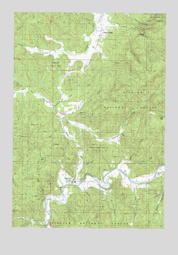
Beaver, OR USGS Topographic Map
Click on map above to begin viewing in our Map Viewer.

This topographic map contains these locations and features:
Feature Name Type Latitude Longitude GNIS ID View Map
Battle LakeLakeN45.3147°W123.7523°1137593View Map
Bear CreekStreamN45.3137°W123.8340°1137665View Map
BeaverPopulated PlaceN45.2768°W123.8265°1137797View Map
Beaver Census Designated PlaceCensusN45.2741°W123.8196°2407817View Map
Beaver CreekStreamN45.2748°W123.8271°1137808View Map
Beaver Creek Forest CampLocaleN45.3196°W123.7751°1137827View Map
Beaver DivisionCivilN45.2921°W123.7677°1937963View Map
Beaver Post OfficePost OfficeN45.2768°W123.8265°1164898View Map
Bixby County Drift Boat LaunchLocaleN45.2731°W123.8344°2668336View Map
Boulder CreekStreamN45.2823°W123.7582°1138480View Map
Bummer CreekStreamN45.3054°W123.8110°1154434View Map
Davidson SpringSpringN45.2712°W123.8076°1134656View Map
East Beaver CreekStreamN45.3115°W123.8362°1141504View Map
Farmer CreekStreamN45.2521°W123.8465°1142023View Map
Farmer Creek Boat RampLocaleN45.2514°W123.8473°2668472View Map
Farmer Creek Rest AreaParkN45.2540°W123.8596°1132136View Map
First Bridge RampLocaleN45.2762°W123.8188°2668626View Map
Foland CreekStreamN45.2759°W123.8198°1142284View Map
Fourth Bridge RampLocaleN45.2787°W123.7802°2668519View Map
Frank CreekStreamN45.2582°W123.8484°1132135View Map
Fuqua CreekStreamN45.2540°W123.8596°1154439View Map
Gilbert CreekStreamN45.3037°W123.7910°1154433View Map
HemlockPopulated PlaceN45.3157°W123.8368°1143472View Map
Hemlock Post Office (historical)Post OfficeN45.3157°W123.8368°1165385View Map
Henkin PondReservoirN45.2530°W123.8536°1134657View Map
Hester CreekStreamN45.2873°W123.8221°1154436View Map
Jackson CreekStreamN45.2832°W123.8248°1154437View Map
Lehman CreekStreamN45.2748°W123.8346°1158959View Map
Little Foland CreekStreamN45.2762°W123.8179°1154438View Map
Mills CreekStreamN45.3571°W123.8132°1146293View Map
Munson CreekStreamN45.3709°W123.8082°1146666View Map
Munson Creek FallsFallsN45.3618°W123.7610°1155952View Map
Munson Creek Falls State Natural AreaParkN45.3646°W123.7723°1154440View Map
Nestucca Rural Fire Protection District Station 83 BeaverBuildingN45.2767°W123.8240°2576743View Map
Nestucca Valley Middle SchoolSchoolN45.2764°W123.8243°2487505View Map
North Beaver CreekStreamN45.3312°W123.8640°1146882View Map
Pleasant ValleyPopulated PlaceN45.3654°W123.8040°1147801View Map
River Front DairyLocaleN45.2775°W123.7972°2707101View Map
Saling CreekStreamN45.2665°W123.8479°1148959View Map
Spruce Post Office (historical)Post OfficeN45.3373°W123.8360°1165980View Map
Swab CreekStreamN45.2884°W123.7790°1150719View Map
Ti - Sue DairyLocaleN45.3492°W123.8119°2707165View Map
Tiger CreekStreamN45.3209°W123.8421°1151215View Map
Tony CreekStreamN45.2768°W123.7773°1151335View Map
Trobough SpringSpringN45.2804°W123.8382°1135228View Map
Turpy CreekStreamN45.2607°W123.7584°1155086View Map
Walter CreekStreamN45.3234°W123.8498°1154431View Map
West Beaver CreekStreamN45.3118°W123.8365°1152024View Map
West CreekStreamN45.2748°W123.8296°1152040View Map
Wildcat CreekStreamN45.3123°W123.8326°1154435View Map
Wolfe CreekStreamN45.2840°W123.7887°1152608View Map
Woods CreekStreamN45.3057°W123.8335°1154432View Map

Note: Coordinates in the location and feature list above are referenced to NAD83 datum.


Copyright (C) 2008-2024 Ryan Niemi / Sunset Dynamics ... All Rights Reserved