TopoQuest Logo
Do you find TopoQuest useful?
Help keep TopoQuest running and adding new maps/features by donating!
Bitcoin:  19c7KJd3qBynnjoSw5npx9KScwjBe4ifkT
Litecoin:  LXs6TkuXGGXo1vDsWCkWVdjQX94eUKd6ui
Home View Maps Find Maps Find Places Resources & Links


McDonald, Michigan Topographic Map

USGS Map Title: McDonald, MI
USGS Map MRC: 42086C2
DRG (GeoTIFF) Download: o42086c2.tif


Neighboring USGS Topographic Map Quads:


  South Haven, MI  
42086D3
 

  Lacota, MI  
42086D2
 

  Pullman, MI  
42086D1
 

  Covert, MI  
42086C3
 

  McDonald, MI  
42086C2
 

  Bangor, MI  
42086C1
 

  Coloma, MI  
42086B3
 

  Hartford, MI  
42086B2
 

  Lawrence, MI  
42086B1


Map MRC Location:

N43°
W87°
N43°
W86°
H8 H7 H6 H5 H4 H3 H2 H1
G8 G7 G6 G5 G4 G3 G2 G1
F8 F7 F6 F5 F4 F3 F2 F1
E8 E7 E6 E5 E4 E3 E2 E1
D8 D7 D6 D5 D4 D3 D2 D1
C8 C7 C6 C5 C4 C3 C2 C1
B8 B7 B6 B5 B4 B3 B2 B1
A8 A7 A6 A5 A4 A3 A2 A1
N42°
W87°
N42°
W86°

McDonald, MI USGS 1:24K Topographic Map Preview:
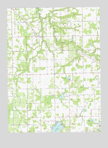
McDonald, MI USGS Topographic Map
Click on map above to begin viewing in our Map Viewer.

This topographic map contains these locations and features:
Feature Name Type Latitude Longitude GNIS ID View Map
Bangor Center SchoolSchoolN42.2873°W86.1661°620547View Map
Cedar CreekStreamN42.3656°W86.2050°622892View Map
Circle Y Ranch Bible CampLocaleN42.2889°W86.1769°2112810View Map
Coloma Emergency Medical Services Medical Transport Station 2BuildingN42.2998°W86.1680°2662118View Map
Donovan LakeLakeN42.2584°W86.1263°624790View Map
Duck LakeLakeN42.2615°W86.1365°624925View Map
FriendsvillePopulated PlaceN42.3078°W86.2236°626501View Map
German ChurchChurchN42.3220°W86.2422°626754View Map
Hawley SchoolSchoolN42.2645°W86.2125°627964View Map
His Place Cathedral of FaithChurchN42.3083°W86.2206°2574977View Map
Hooker Post Office (historical)Post OfficeN42.3375°W86.1967°2574487View Map
Jericho CornersPopulated PlaceN42.3458°W86.2056°2112808View Map
Jericho SchoolSchoolN42.3459°W86.2059°629262View Map
Johnstown SchoolSchoolN42.3284°W86.1486°629359View Map
Lafler SchoolSchoolN42.3467°W86.1536°629948View Map
Maple Grove Bible ChurchChurchN42.3742°W86.2439°2574525View Map
Maple Grove Elementary SchoolSchoolN42.3744°W86.2481°2574669View Map
Maple Grove SchoolSchoolN42.3734°W86.2425°631454View Map
McDonaldPopulated PlaceN42.2653°W86.1570°631870View Map
McDonald Post Office (historical)Post OfficeN42.2653°W86.1569°2574430View Map
McDonald Station (historical)LocaleN42.2653°W86.1564°2574415View Map
Merriman LakeLakeN42.3041°W86.1680°632135View Map
Monk CemeteryCemeteryN42.3450°W86.1325°2574950View Map
Mud LakeLakeN42.2715°W86.1477°632908View Map
Mud Lake DrainCanalN42.2561°W86.1514°633079View Map
North Mill SchoolSchoolN42.3159°W86.2420°633614View Map
School Section LakeLakeN42.2857°W86.1772°637413View Map
Seventh Day Adventist ChurchChurchN42.3203°W86.1319°2112856View Map
Taylor CemeteryCemeteryN42.3033°W86.1289°2112855View Map
Thomas CemeteryCemeteryN42.2869°W86.1872°2574963View Map
ToquinPopulated PlaceN42.2575°W86.2231°1614967View Map
Toquin Post Office (historical)Post OfficeN42.2575°W86.2231°2574421View Map
Toquin Station (historical)LocaleN42.2572°W86.2233°2574417View Map
Township of BangorCivilN42.2869°W86.1681°1625880View Map
Van Auken CemeteryCemeteryN42.2586°W86.1644°2112809View Map
Van Auken LakeLakeN42.2541°W86.1841°1615462View Map
Van Auken SchoolSchoolN42.2578°W86.1670°1615463View Map
Webster SchoolSchoolN42.2506°W86.1272°1615955View Map
West BangorPopulated PlaceN42.3078°W86.1867°1617928View Map
West Brick SchoolSchoolN42.3073°W86.2164°1616085View Map
West Gate SchoolSchoolN42.3456°W86.2425°1616112View Map
Wood SchoolSchoolN42.3086°W86.1869°2112857View Map

Note: Coordinates in the location and feature list above are referenced to NAD83 datum.


Copyright (C) 2008-2024 Ryan Niemi / Sunset Dynamics ... All Rights Reserved