TopoQuest Logo
Do you find TopoQuest useful?
Help keep TopoQuest running and adding new maps/features by donating!
Bitcoin:  19c7KJd3qBynnjoSw5npx9KScwjBe4ifkT
Litecoin:  LXs6TkuXGGXo1vDsWCkWVdjQX94eUKd6ui
Home View Maps Find Maps Find Places Resources & Links


Hartford, Michigan Topographic Map

USGS Map Title: Hartford, MI
USGS Map MRC: 42086B2
DRG (GeoTIFF) Download: o42086b2.tif


Neighboring USGS Topographic Map Quads:


  Covert, MI  
42086C3
 

  McDonald, MI  
42086C2
 

  Bangor, MI  
42086C1
 

  Coloma, MI  
42086B3
 

  Hartford, MI  
42086B2
 

  Lawrence, MI  
42086B1
 

  Sodus, MI  
42086A3
 

  Sister Lakes, MI  
42086A2
 

  Twin Lakes, MI  
42086A1


Map MRC Location:

N43°
W87°
N43°
W86°
H8 H7 H6 H5 H4 H3 H2 H1
G8 G7 G6 G5 G4 G3 G2 G1
F8 F7 F6 F5 F4 F3 F2 F1
E8 E7 E6 E5 E4 E3 E2 E1
D8 D7 D6 D5 D4 D3 D2 D1
C8 C7 C6 C5 C4 C3 C2 C1
B8 B7 B6 B5 B4 B3 B2 B1
A8 A7 A6 A5 A4 A3 A2 A1
N42°
W87°
N42°
W86°

Hartford, MI USGS 1:24K Topographic Map Preview:
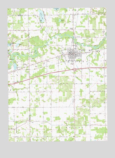
Hartford, MI USGS Topographic Map
Click on map above to begin viewing in our Map Viewer.

This topographic map contains these locations and features:
Feature Name Type Latitude Longitude GNIS ID View Map
Abbott SchoolSchoolN42.1400°W86.1289°619788View Map
Brague SchoolSchoolN42.1564°W86.1953°621868View Map
Brown SchoolSchoolN42.1923°W86.1289°622092View Map
Burg SchoolSchoolN42.1300°W86.2281°622270View Map
Calvary Pentecostal ChurchChurchN42.2061°W86.1653°2574813View Map
City of HartfordCivilN42.2049°W86.1660°1626444View Map
Community Hospital - WatervlietHospitalN42.1849°W86.2500°2377458View Map
Ely ParkParkN42.2075°W86.1697°2112892View Map
Fairview Memorial CemeteryCemeteryN42.1969°W86.2236°2109246View Map
Faith of the Apostle's ChurchChurchN42.2075°W86.1617°2574815View Map
Federated ChurchChurchN42.2067°W86.1806°2112893View Map
First Hispanic Midway Baptist ChurchChurchN42.2047°W86.1633°2574814View Map
HartfordPopulated PlaceN42.2067°W86.1667°627881View Map
Hartford Church of GodChurchN42.2022°W86.1722°2574816View Map
Hartford City HallBuildingN42.2069°W86.1683°2574821View Map
Hartford Fire DepartmentBuildingN42.2070°W86.1597°2574820View Map
Hartford High SchoolSchoolN42.2117°W86.1653°2574822View Map
Hartford Medical CenterHospitalN42.2017°W86.1667°2574818View Map
Hartford Middle SchoolSchoolN42.2117°W86.1639°2574823View Map
Hartford Police DepartmentBuildingN42.2071°W86.1676°2574817View Map
Hartford Post OfficePost OfficeN42.2078°W86.1667°2574827View Map
Hartford Public LibraryBuildingN42.2075°W86.1708°2574819View Map
Hartford Speedway ParkLocaleN42.2133°W86.1728°2574824View Map
Hartford StationLocaleN42.2089°W86.1708°2574826View Map
Hartford United Methodist ChurchChurchN42.2078°W86.1606°2574812View Map
Hog CreekStreamN42.2120°W86.1414°628386View Map
Hope ChurchChurchN42.2097°W86.1586°2112888View Map
Immaculate Conception ChurchChurchN42.2000°W86.1622°2112886View Map
Interchange 46CrossingN42.1925°W86.1667°2575017View Map
Irish SchoolSchoolN42.1595°W86.2231°629070View Map
Johnson SchoolSchoolN42.1720°W86.1381°629350View Map
Living Word Church of GodChurchN42.2175°W86.2486°2377505View Map
Maple Hill CemeteryCemeteryN42.1980°W86.1683°2112889View Map
Maple Hill Village Mobile Home ParkPopulated PlaceN42.2000°W86.1694°2574825View Map
Miles SchoolSchoolN42.2300°W86.1253°632305View Map
Mud LakeLakeN42.2100°W86.2461°2377474View Map
New Life Harvest MinistriesChurchN42.2011°W86.2006°2112890View Map
North Bell SchoolSchoolN42.1798°W86.1850°633480View Map
Paw Paw River CampgroundsLocaleN42.2103°W86.2444°2377456View Map
Pine CreekStreamN42.2150°W86.2009°634906View Map
Pioneer CemeteryCemeteryN42.2050°W86.1769°2112891View Map
Red Arrow Elementary SchoolSchoolN42.2061°W86.1639°2574828View Map
River of Life ChurchChurchN42.1894°W86.2489°2377455View Map
Rush LakeLakeN42.2427°W86.2070°636389View Map
Rush Lake Catholic CemeteryCemeteryN42.2344°W86.2053°2574953View Map
Rush Lake Mobile Home ParkPopulated PlaceN42.2417°W86.2114°2574829View Map
Rush Lake SchoolSchoolN42.2328°W86.2047°636396View Map
Sassafras LakeLakeN42.2383°W86.1839°637264View Map
Seventh-Day Adventist SchoolSchoolN42.2097°W86.1811°2112894View Map
Sherwood LakeLakeN42.2160°W86.2381°637780View Map
South Bell SchoolSchoolN42.1289°W86.1947°638265View Map
Stickney SchoolSchoolN42.2289°W86.2425°638843View Map
Stoughton CornersPopulated PlaceN42.2295°W86.1664°638928View Map
Sunset Drive-In TheatreLocaleN42.1967°W86.2147°2574830View Map
Sunset ParkParkN42.2092°W86.2494°2377473View Map
Thomas SchoolSchoolN42.2003°W86.2009°1614757View Map
Township of HartfordCivilN42.1752°W86.1659°1626445View Map
Township of WatervlietCivilN42.1965°W86.2495°1627225View Map
Watervliet Rest AreaLocaleN42.1803°W86.2403°2571029View Map
Watervliet Seventh Day Adventist ChurchChurchN42.1789°W86.2083°2367649View Map
Webster HillsLocaleN42.2439°W86.1445°1615952View Map
Wilder SchoolSchoolN42.1392°W86.1650°1616451View Map
Woodside SchoolSchoolN42.2028°W86.1611°2112887View Map

Note: Coordinates in the location and feature list above are referenced to NAD83 datum.


Copyright (C) 2008-2024 Ryan Niemi / Sunset Dynamics ... All Rights Reserved