TopoQuest Logo
Do you find TopoQuest useful?
Help keep TopoQuest running and adding new maps/features by donating!
Bitcoin:  19c7KJd3qBynnjoSw5npx9KScwjBe4ifkT
Litecoin:  LXs6TkuXGGXo1vDsWCkWVdjQX94eUKd6ui
Home View Maps Find Maps Find Places Resources & Links


McDonald, Mississippi Topographic Map

USGS Map Title: McDonald, MS
USGS Map MRC: 32089F2
DRG (GeoTIFF) Download: o32089f2.tif


Neighboring USGS Topographic Map Quads:


  Edinburg, MS  
32089G3
 

  Pearl River, MS  
32089G2
 

  Philadelphia, MS  
32089G1
 

  Madden, MS  
32089F3
 

  McDonald, MS  
32089F2
 

  Deemer, MS  
32089F1
 

  Sebastopol, MS  
32089E3
 

  Union West, MS  
32089E2
 

  Union East, MS  
32089E1


Map MRC Location:

N33°
W90°
N33°
W89°
H8 H7 H6 H5 H4 H3 H2 H1
G8 G7 G6 G5 G4 G3 G2 G1
F8 F7 F6 F5 F4 F3 F2 F1
E8 E7 E6 E5 E4 E3 E2 E1
D8 D7 D6 D5 D4 D3 D2 D1
C8 C7 C6 C5 C4 C3 C2 C1
B8 B7 B6 B5 B4 B3 B2 B1
A8 A7 A6 A5 A4 A3 A2 A1
N32°
W90°
N32°
W89°

McDonald, MS USGS 1:24K Topographic Map Preview:
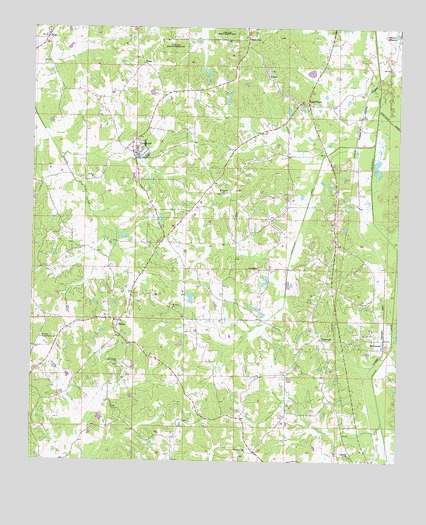
McDonald, MS USGS Topographic Map
Click on map above to begin viewing in our Map Viewer.

This topographic map contains these locations and features:
Feature Name Type Latitude Longitude GNIS ID View Map
Bill Turner Lake DamDamN32.7118°W89.2217°681594View Map
Bluff Springs ChurchChurchN32.6276°W89.1765°667341View Map
Buddy Dees Lake DamDamN32.7251°W89.1617°681605View Map
ColdwaterPopulated PlaceN32.7149°W89.2142°668664View Map
Coldwater Baptist ChurchChurchN32.7179°W89.2145°685015View Map
Coonshuck CreekStreamN32.6868°W89.1253°685017View Map
DeemerLocaleN32.7465°W89.1259°669188View Map
DixonPopulated PlaceN32.6654°W89.2206°669298View Map
Dixon CemeteryCemeteryN32.6612°W89.2206°707195View Map
Dixon Volunteer Fire Department Station 1 HeadquartersBuildingN32.6654°W89.2197°2665795View Map
E Johnson Lake DamDamN32.7268°W89.1834°681606View Map
Eldridge Lake DamDamN32.6335°W89.1267°681545View Map
Fulton CanalCanalN32.6582°W89.1270°670270View Map
Good HopePopulated PlaceN32.7279°W89.1570°670462View Map
Good Hope Baptist ChurchChurchN32.7115°W89.1601°685029View Map
Good Hope CemeteryCemeteryN32.7110°W89.1595°707197View Map
HopePopulated PlaceN32.7474°W89.2453°671398View Map
Hope Baptist ChurchChurchN32.7496°W89.2451°685033View Map
Hope CemeteryCemeteryN32.7490°W89.2451°707203View Map
Hope Volunteer Fire Department Station 1 HeadquartersBuildingN32.7465°W89.2456°2665831View Map
Laird Lake DamDamN32.6701°W89.1951°681572View Map
Lenord Duncan Lake DamDamN32.6785°W89.1701°681579View Map
LinwoodPopulated PlaceN32.6604°W89.1509°672517View Map
Linwood Baptist ChurchChurchN32.6624°W89.1509°685036View Map
Linwood Volunteer Fire Department Station 1 HeadquartersBuildingN32.6599°W89.1492°2665805View Map
Linwood Volunteer Fire Department Station 2BuildingN32.6969°W89.1472°2665830View Map
Lonsilocher CanalCanalN32.6962°W89.1578°672863View Map
McDonaldPopulated PlaceN32.6604°W89.1328°673330View Map
Morrow Memorial CemeteryCemeteryN32.6604°W89.2467°673858View Map
Mount Carmel CemeteryCemeteryN32.7021°W89.1853°707212View Map
Mount Carmel ChurchChurchN32.7021°W89.1862°673959View Map
Mount Evon ChurchChurchN32.6693°W89.2026°673995View Map
Neshoba County FairgroundsLocaleN32.7140°W89.2123°685040View Map
O Burrage Lake DamDamN32.7401°W89.1951°681614View Map
Oak Ridge ChurchChurchN32.6807°W89.1728°675097View Map
Pine Grove ChurchChurchN32.6532°W89.2203°675842View Map
Saint Paul ChurchChurchN32.7065°W89.2295°677194View Map
Sand Hill ChurchChurchN32.6271°W89.1412°677347View Map
Sapa Chitto (historical)LocaleN32.6626°W89.2209°707229View Map
Scitz (historical)LocaleN32.7146°W89.1506°707231View Map
Supervisor District 4CivilN32.6637°W89.2069°712000View Map
TrappPopulated PlaceN32.7396°W89.2137°692275View Map

Note: Coordinates in the location and feature list above are referenced to NAD83 datum.


Copyright (C) 2008-2024 Ryan Niemi / Sunset Dynamics ... All Rights Reserved