TopoQuest Logo
Do you find TopoQuest useful?
Help keep TopoQuest running and adding new maps/features by donating!
Bitcoin:  19c7KJd3qBynnjoSw5npx9KScwjBe4ifkT
Litecoin:  LXs6TkuXGGXo1vDsWCkWVdjQX94eUKd6ui
Home View Maps Find Maps Find Places Resources & Links


Matlock Prairie, Oregon Topographic Map

USGS Map Title: Matlock Prairie, OR
USGS Map MRC: 45119B2
DRG (GeoTIFF) Download: o45119b2.tif


Neighboring USGS Topographic Map Quads:


  Freezeout Ridge, OR  
45119C3
 

  Hoodlum Canyon, OR  
45119C2
 

  Gurdane, OR  
45119C1
 

  Arbuckle Mountain, OR  
45119B3
 

  Matlock Prairie, OR  
45119B2
 

  Sugarbowl Creek, OR  
45119B1
 

  Lake Penland, OR  
45119A3
 

  Thompson Flat, OR  
45119A2
 

  Deerhorn Creek, OR  
45119A1


Map MRC Location:

N46°
W120°
N46°
W119°
H8 H7 H6 H5 H4 H3 H2 H1
G8 G7 G6 G5 G4 G3 G2 G1
F8 F7 F6 F5 F4 F3 F2 F1
E8 E7 E6 E5 E4 E3 E2 E1
D8 D7 D6 D5 D4 D3 D2 D1
C8 C7 C6 C5 C4 C3 C2 C1
B8 B7 B6 B5 B4 B3 B2 B1
A8 A7 A6 A5 A4 A3 A2 A1
N45°
W120°
N45°
W119°

Matlock Prairie, OR USGS 1:24K Topographic Map Preview:
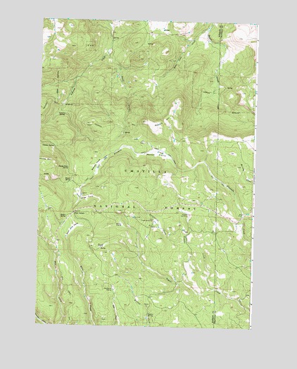
Matlock Prairie, OR USGS Topographic Map
Click on map above to begin viewing in our Map Viewer.

This topographic map contains these locations and features:
Feature Name Type Latitude Longitude GNIS ID View Map
Arbuckle Ski AreaLocaleN45.1960°W119.2428°1137285View Map
Balsinger PrairieFlatN45.1910°W119.2178°1137491View Map
Bear Claw CreekStreamN45.2471°W119.1547°1137646View Map
Biscuit SpringSpringN45.1838°W119.2316°1138159View Map
Chicken SpringSpringN45.1979°W119.2416°1139632View Map
Deadhorse SpringSpringN45.1397°W119.2060°1140727View Map
Ellis Forest Service StationBuildingN45.1685°W119.1833°1141838View Map
Fivemile Cow CampLocaleN45.1704°W119.1639°1142202View Map
Four CornersLocaleN45.1710°W119.2300°1142355View Map
Freezeout TrailTrailN45.2146°W119.2400°1142451View Map
Gopher SpringSpringN45.1299°W119.1851°1142862View Map
Happy Home SpringSpringN45.1893°W119.2332°1143282View Map
Kenny PrairieFlatN45.1665°W119.2017°1144553View Map
Matlock HillSummitN45.2087°W119.1900°1145871View Map
Matlock PrairieFlatN45.1960°W119.1833°1145872View Map
North Jones PrairieFlatN45.1771°W119.2225°1147032View Map
North Jones TrailTrailN45.1779°W119.1842°1158396View Map
Pole Creek TrailTrailN45.1357°W119.2294°1147852View Map
Round PrairieFlatN45.1576°W119.2117°1148797View Map
South Jones PrairieFlatN45.1645°W119.2307°1150051View Map
Spruce SpringSpringN45.1695°W119.2339°1150213View Map
Sulphur SpringSpringN45.2120°W119.2377°1150589View Map
Swale CreekStreamN45.2371°W119.2133°1150722View Map
Tribble CreekStreamN45.1410°W119.1472°1151416View Map
Turpentine CreekStreamN45.1601°W119.1644°1151537View Map

Note: Coordinates in the location and feature list above are referenced to NAD83 datum.


Copyright (C) 2008-2024 Ryan Niemi / Sunset Dynamics ... All Rights Reserved