TopoQuest Logo
Do you find TopoQuest useful?
Help keep TopoQuest running and adding new maps/features by donating!
Bitcoin:  19c7KJd3qBynnjoSw5npx9KScwjBe4ifkT
Litecoin:  LXs6TkuXGGXo1vDsWCkWVdjQX94eUKd6ui
Home View Maps Find Maps Find Places Resources & Links


Lake Penland, Oregon Topographic Map

USGS Map Title: Lake Penland, OR
USGS Map MRC: 45119A3
DRG (GeoTIFF) Download: o45119a3.tif


Neighboring USGS Topographic Map Quads:


  Summerfield Ridge, OR  
45119B4
 

  Arbuckle Mountain, OR  
45119B3
 

  Matlock Prairie, OR  
45119B2
 

  Madison Butte, OR  
45119A4
 

  Lake Penland, OR  
45119A3
 

  Thompson Flat, OR  
45119A2
 

  Johnny Cake Mountain, OR  
44119H4
 

  Slickear Mountain, OR  
44119H3
 

  Ritter, OR  
44119H2


Map MRC Location:

N46°
W120°
N46°
W119°
H8 H7 H6 H5 H4 H3 H2 H1
G8 G7 G6 G5 G4 G3 G2 G1
F8 F7 F6 F5 F4 F3 F2 F1
E8 E7 E6 E5 E4 E3 E2 E1
D8 D7 D6 D5 D4 D3 D2 D1
C8 C7 C6 C5 C4 C3 C2 C1
B8 B7 B6 B5 B4 B3 B2 B1
A8 A7 A6 A5 A4 A3 A2 A1
N45°
W120°
N45°
W119°

Lake Penland, OR USGS 1:24K Topographic Map Preview:
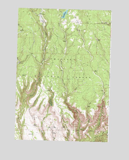
Lake Penland, OR USGS Topographic Map
Click on map above to begin viewing in our Map Viewer.

This topographic map contains these locations and features:
Feature Name Type Latitude Longitude GNIS ID View Map
Brown PrairieFlatN45.1151°W119.2969°1138676View Map
Brush SpringSpringN45.1127°W119.2592°1138724View Map
Butcher Bill CreekStreamN45.1246°W119.3442°1139032View Map
Cold SpringSpringN45.1041°W119.3700°1139945View Map
Cutsforth DamDamN45.1167°W119.3174°1158685View Map
Deep Canyon SpringSpringN45.0613°W119.3670°1140790View Map
Ditch Creek Forest Sevice StationLocaleN45.1196°W119.3478°1141059View Map
Doghouse SpringSpringN45.0141°W119.3505°1141150View Map
Dry Swale CreekStreamN45.0729°W119.3719°1141361View Map
Elkhorn SpringSpringN45.0964°W119.2682°1141823View Map
Groshen CabinLocaleN45.0665°W119.3136°1143112View Map
Heck and GoneLocaleN45.1012°W119.3747°1162291View Map
Lake PenlandReservoirN45.1200°W119.3131°1144783View Map
Lake Penland DamDamN45.1165°W119.3169°1155590View Map
Little Potamus CreekStreamN45.0013°W119.2689°1145229View Map
Little Potamus WellLocaleN45.1046°W119.2939°1145230View Map
Long CanyonValleyN45.0043°W119.3361°1145389View Map
Main SpringSpringN45.0673°W119.2685°1145760View Map
Mallory SpringSpringN45.0943°W119.3100°1145777View Map
Martin CreekStreamN45.1176°W119.3453°1145845View Map
McAttee SpringSpringN45.0479°W119.3295°1145906View Map
McMurdo CabinLocaleN45.0485°W119.2583°1146027View Map
Penland Lake Boat LaunchLocaleN45.1184°W119.3159°2700195View Map
Penland Lake Recreation SiteLocaleN45.1190°W119.3156°1156085View Map
Potato HillSummitN45.0124°W119.3114°1147936View Map
Road CanyonValleyN45.0215°W119.3508°1148500View Map
Rock SpringSpringN45.0059°W119.3511°1148633View Map
Slop SpringSpringN45.0134°W119.3229°1149730View Map
Stalder CreekStreamN45.0426°W119.3069°1150323View Map
Swale SpringSpringN45.0729°W119.3725°1150725View Map
Tepee SpringSpringN45.0121°W119.3277°1150985View Map
Thompson CorralLocaleN45.1129°W119.3431°1151088View Map
Wickiup CreekStreamN45.0113°W119.2889°1152298View Map
Wickiup SpringSpringN45.0329°W119.2793°1152312View Map
Yoyo SpringSpringN45.0073°W119.3235°1152762View Map

Note: Coordinates in the location and feature list above are referenced to NAD83 datum.


Copyright (C) 2008-2024 Ryan Niemi / Sunset Dynamics ... All Rights Reserved