TopoQuest Logo
Do you find TopoQuest useful?
Help keep TopoQuest running and adding new maps/features by donating!
Bitcoin:  19c7KJd3qBynnjoSw5npx9KScwjBe4ifkT
Litecoin:  LXs6TkuXGGXo1vDsWCkWVdjQX94eUKd6ui
Home View Maps Find Maps Find Places Resources & Links


Martin, Georgia Topographic Map

USGS Map Title: Martin, GA
USGS Map MRC: 34083D2
DRG (GeoTIFF) Download: o34083d2.tif


Neighboring USGS Topographic Map Quads:


  Toccoa, GA  
34083E3
 

  Avalon, GA  
34083E2
 

  Oakway, SC  
34083E1
 

  Red Hill, GA  
34083D3
 

  Martin, GA  
34083D2
 

  Lavonia, GA  
34083D1
 

  Ashland, GA  
34083C3
 

  Carnesville, GA  
34083C2
 

  Royston, GA  
34083C1


Map MRC Location:

N35°
W84°
N35°
W83°
H8 H7 H6 H5 H4 H3 H2 H1
G8 G7 G6 G5 G4 G3 G2 G1
F8 F7 F6 F5 F4 F3 F2 F1
E8 E7 E6 E5 E4 E3 E2 E1
D8 D7 D6 D5 D4 D3 D2 D1
C8 C7 C6 C5 C4 C3 C2 C1
B8 B7 B6 B5 B4 B3 B2 B1
A8 A7 A6 A5 A4 A3 A2 A1
N34°
W84°
N34°
W83°

Martin, GA USGS 1:24K Topographic Map Preview:
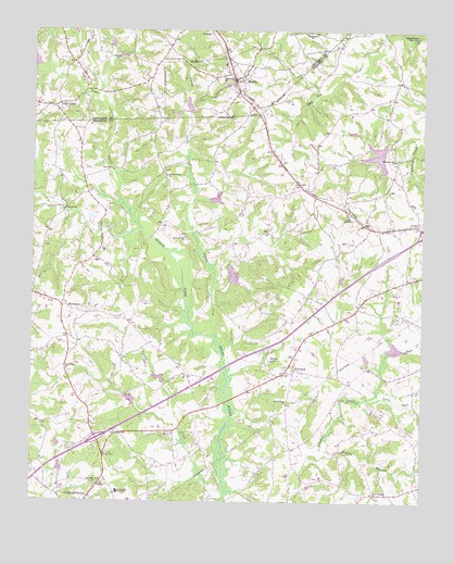
Martin, GA USGS Topographic Map
Click on map above to begin viewing in our Map Viewer.

This topographic map contains these locations and features:
Feature Name Type Latitude Longitude GNIS ID View Map
Bear CreekStreamN34.4154°W83.1293°310941View Map
Broad River Air ParkAirportN34.4145°W83.1773°2625390View Map
Broad River ChurchChurchN34.4020°W83.1665°311814View Map
C C Hall MonumentParkN34.3879°W83.2260°312137View Map
Carnesville Trade SchoolSchoolN34.3770°W83.2215°354998View Map
Central Franklin Elementary SchoolSchoolN34.3988°W83.1923°2545653View Map
Clarks CreekStreamN34.4187°W83.1902°327462View Map
Clarks Creek ChurchChurchN34.4451°W83.2007°355177View Map
Exit 57CrossingN34.3918°W83.2288°1705000View Map
FairviewPopulated PlaceN34.4104°W83.1649°331688View Map
Fairview ChurchChurchN34.4112°W83.1685°349320View Map
Fairview ChurchChurchN34.4104°W83.1660°349321View Map
Franklin CountyCivilN34.3754°W83.2292°349324View Map
Franklin County Middle SchoolSchoolN34.3952°W83.1945°2545669View Map
Franklin Memorial CemeteryCemeteryN34.4154°W83.1638°349327View Map
Greater Hope ChurchChurchN34.4615°W83.2074°314808View Map
Hopewell ChurchChurchN34.4098°W83.2385°315665View Map
Hurricane Grove CemeteryCemeteryN34.4995°W83.1624°350007View Map
Lavonia DivisionCivilN34.4499°W83.1349°1936353View Map
Lavonia Water Works DamDamN34.4701°W83.1365°339208View Map
Lavonia Water Works LakeReservoirN34.4672°W83.1396°339209View Map
Line AcademySchoolN34.4512°W83.1485°316904View Map
Line Volunteer Fire DepartmentBuildingN34.4642°W83.1593°2604402View Map
Little Bear CreekStreamN34.4032°W83.1379°316940View Map
MartinPopulated PlaceN34.4870°W83.1849°317732View Map
Martin Baptist ChurchChurchN34.4912°W83.1849°350011View Map
Martin Community CemeteryCemeteryN34.4943°W83.1854°350012View Map
Muddy BranchStreamN34.3751°W83.1654°319130View Map
New Franklin ChurchChurchN34.3768°W83.1385°319317View Map
North Broad River Structure 33 DamDamN34.4334°W83.1865°336616View Map
North Broad River Structure Four DamDamN34.4068°W83.2082°336610View Map
North Broad River Structure Number 32 DamDamN34.4551°W83.1932°336614View Map
North Broad River Structure Number 38 DamDamN34.4151°W83.1349°336620View Map
North Broad River Structure Number Five DamDamN34.4018°W83.2165°336612View Map
North Broad River Structure Number One DamDamN34.4801°W83.1999°336558View Map
North Fork Broad RiverReservoirN34.4934°W83.2349°336581View Map
North Fork Broad River Dam Number 13DamN34.4934°W83.2349°336580View Map
North Fork Broad River Structure 11 DamDamN34.4901°W83.2499°336556View Map
North Fork Broad River Structure 14 DamDamN34.4951°W83.2249°336560View Map
North Fork Broad River Structure 15 DamDamN34.4918°W83.2232°336564View Map
ParhamsPopulated PlaceN34.4268°W83.2404°332604View Map
Pleasant Hill CemeteryCemeteryN34.4654°W83.1332°349342View Map
Pleasant Hill ChurchChurchN34.4662°W83.1335°320913View Map
Red Hill Volunteer Fire DepartmentBuildingN34.4243°W83.2400°2604675View Map
Reservoir 11ReservoirN34.4901°W83.2499°336557View Map
Reservoir 14ReservoirN34.4967°W83.2250°336561View Map
Reservoir 15ReservoirN34.4931°W83.2220°336565View Map
Reservoir 32ReservoirN34.4557°W83.1911°336615View Map
Reservoir 33ReservoirN34.4350°W83.1856°336617View Map
Reservoir 38ReservoirN34.4159°W83.1337°336621View Map
Reservoir FiveReservoirN34.4022°W83.2180°336613View Map
Reservoir FourReservoirN34.4080°W83.2086°336611View Map
Reservoir Number OneReservoirN34.4803°W83.2003°336559View Map
Revelation ChapelChurchN34.4651°W83.2035°349345View Map
Salubrity (historical)Populated PlaceN34.4223°W83.2185°349350View Map
Shady LakeReservoirN34.4122°W83.1733°322772View Map
Stephens County Fire Department Station 5BuildingN34.4887°W83.1818°2604640View Map
Thompsons Store (historical)LocaleN34.3865°W83.1721°349355View Map
Toms CreekStreamN34.4476°W83.2146°330020View Map
Toms CreekPopulated PlaceN34.4798°W83.2438°333245View Map
Toms Creek Baptist ChurchChurchN34.4787°W83.2424°350042View Map
Toms Creek CemeteryCemeteryN34.4787°W83.2415°350043View Map
Town of MartinCivilN34.4856°W83.1983°2406105View Map
Turkey CreekStreamN34.3762°W83.1865°324374View Map
Zion Hill ChurchChurchN34.3798°W83.2277°325704View Map

Note: Coordinates in the location and feature list above are referenced to NAD83 datum.


Copyright (C) 2008-2024 Ryan Niemi / Sunset Dynamics ... All Rights Reserved