TopoQuest Logo
Do you find TopoQuest useful?
Help keep TopoQuest running and adding new maps/features by donating!
Bitcoin:  19c7KJd3qBynnjoSw5npx9KScwjBe4ifkT
Litecoin:  LXs6TkuXGGXo1vDsWCkWVdjQX94eUKd6ui
Home View Maps Find Maps Find Places Resources & Links


Mark Center, Ohio Topographic Map

USGS Map Title: Mark Center, OH
USGS Map MRC: 41084C6
DRG (GeoTIFF) Download: o41084c6.tif


Neighboring USGS Topographic Map Quads:


  Butler East, IN  
41084D7
 

  Edgerton, OH  
41084D6
 

  Bryan, OH  
41084D5
 

  Hicksville, OH  
41084C7
 

  Mark Center, OH  
41084C6
 

  Sherwood, OH  
41084C5
 

  Woodburn North, IN  
41084B7
 

  Antwerp, OH  
41084B6
 

  Paulding, OH  
41084B5


Map MRC Location:

N42°
W85°
N42°
W84°
H8 H7 H6 H5 H4 H3 H2 H1
G8 G7 G6 G5 G4 G3 G2 G1
F8 F7 F6 F5 F4 F3 F2 F1
E8 E7 E6 E5 E4 E3 E2 E1
D8 D7 D6 D5 D4 D3 D2 D1
C8 C7 C6 C5 C4 C3 C2 C1
B8 B7 B6 B5 B4 B3 B2 B1
A8 A7 A6 A5 A4 A3 A2 A1
N41°
W85°
N41°
W84°

Mark Center, OH USGS 1:24K Topographic Map Preview:
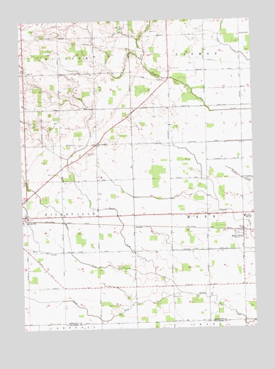
Mark Center, OH USGS Topographic Map
Click on map above to begin viewing in our Map Viewer.

This topographic map contains these locations and features:
Feature Name Type Latitude Longitude GNIS ID View Map
Arend AirportAirportN41.2532°W84.6424°1082838View Map
Cicero (historical)Populated PlaceN41.3395°W84.7094°1080736View Map
Cicero Post Office (historical)Post OfficeN41.3389°W84.7097°1983558View Map
Crary School (historical)SchoolN41.3542°W84.7091°1080735View Map
Greens School (historical)SchoolN41.2964°W84.6694°1080731View Map
Kent CemeteryCemeteryN41.3703°W84.6803°1042231View Map
LoganPopulated PlaceN41.3537°W84.7480°1063300View Map
Logan ChurchChurchN41.3539°W84.7463°1042719View Map
Lost Creek CemeteryCemeteryN41.3553°W84.6700°1042790View Map
Lost Creek School (historical)SchoolN41.3545°W84.6697°1080729View Map
Mark CenterPopulated PlaceN41.2889°W84.6311°1057832View Map
Mark Center High School (historical)SchoolN41.2951°W84.6302°1079640View Map
Mark Center Post OfficePost OfficeN41.2889°W84.6305°1983552View Map
Mark Center United Methodist ChurchChurchN41.2903°W84.6311°1063678View Map
Mark Elementary SchoolSchoolN41.2951°W84.6302°1079978View Map
McCartney School (historical)SchoolN41.2673°W84.7469°1080741View Map
Middle Fork Gordon CreekStreamN41.2723°W84.6786°1043265View Map
Mill CreekStreamN41.2814°W84.7241°1043325View Map
North Fork Gordon CreekStreamN41.2723°W84.6786°1066118View Map
Oliver School (historical)SchoolN41.3548°W84.6313°1080728View Map
Pleasant Ridge School (historical)SchoolN41.3245°W84.7480°1080737View Map
Ridenour School (historical)SchoolN41.3256°W84.6311°1080727View Map
RosedalePopulated PlaceN41.2912°W84.6902°1062991View Map
Rotary ParkParkN41.3131°W84.7313°1045216View Map
School Number 1 (historical)SchoolN41.3245°W84.7427°1080738View Map
School Number 6 (historical)SchoolN41.2956°W84.7080°1080739View Map
School Number 8 (historical)SchoolN41.2673°W84.7077°1080733View Map
School Number 9 (historical)SchoolN41.2673°W84.6697°1080732View Map
School Number 9 (historical)SchoolN41.3534°W84.7472°1080734View Map
School Number 9 (historical)SchoolN41.2812°W84.7208°1080740View Map
Six CornersPopulated PlaceN41.3248°W84.7097°1046309View Map
Six Corners CemeteryCemeteryN41.3214°W84.7152°1046310View Map
South Fork Gordon CreekStreamN41.2648°W84.6652°1066216View Map
Spindler CemeteryCemeteryN41.2626°W84.6697°1046531View Map
Spion School (historical)SchoolN41.2670°W84.6313°1080749View Map
Township High SchoolSchoolN41.2951°W84.6302°1047118View Map
Township of HicksvilleCivilN41.2959°W84.7466°1086033View Map
Township of MarkCivilN41.2963°W84.6311°1086035View Map
United Brethren Church of Six Corners (historical)ChurchN41.3251°W84.7091°1079645View Map
Visser DairyLocaleN41.3008°W84.6664°2703622View Map
Wilseyville (historical)Populated PlaceN41.3501°W84.6711°1063303View Map
Wilseyville Post Office (historical)Post OfficeN41.3501°W84.6708°1983555View Map
Wonderly School (historical)SchoolN41.3253°W84.6702°1080730View Map

Note: Coordinates in the location and feature list above are referenced to NAD83 datum.


Copyright (C) 2008-2024 Ryan Niemi / Sunset Dynamics ... All Rights Reserved