TopoQuest Logo
Do you find TopoQuest useful?
Help keep TopoQuest running and adding new maps/features by donating!
Bitcoin:  19c7KJd3qBynnjoSw5npx9KScwjBe4ifkT
Litecoin:  LXs6TkuXGGXo1vDsWCkWVdjQX94eUKd6ui
Home View Maps Find Maps Find Places Resources & Links


Maquoketa, Iowa Topographic Map

USGS Map Title: Maquoketa, IA
USGS Map MRC: 42090A6
DRG (GeoTIFF) Download: o42090a6.tif


Neighboring USGS Topographic Map Quads:


  Leisure Lake, IA  
42090B7
 

  Fulton, IA  
42090B6
 

  Andrew, IA  
42090B5
 

  Baldwin, IA  
42090A7
 

  Maquoketa, IA  
42090A6
 

  Delmar North, IA  
42090A5
 

  Lost Nation, IA  
41090H7
 

  Elwood, IA  
41090H6
 

  Delmar South, IA  
41090H5


Map MRC Location:

N43°
W91°
N43°
W90°
H8 H7 H6 H5 H4 H3 H2 H1
G8 G7 G6 G5 G4 G3 G2 G1
F8 F7 F6 F5 F4 F3 F2 F1
E8 E7 E6 E5 E4 E3 E2 E1
D8 D7 D6 D5 D4 D3 D2 D1
C8 C7 C6 C5 C4 C3 C2 C1
B8 B7 B6 B5 B4 B3 B2 B1
A8 A7 A6 A5 A4 A3 A2 A1
N42°
W91°
N42°
W90°

Maquoketa, IA USGS 1:24K Topographic Map Preview:
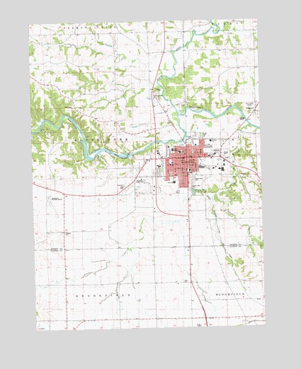
Maquoketa, IA USGS Topographic Map
Click on map above to begin viewing in our Map Viewer.

This topographic map contains these locations and features:
Feature Name Type Latitude Longitude GNIS ID View Map
Assembly of God ChurchChurchN42.0664°W90.6618°2000934View Map
Bi-Centennial ParkParkN42.0742°W90.6696°2000947View Map
Black Hawk Wildlife AreaParkN42.0834°W90.7335°2000871View Map
Briarwood Care CenterHospitalN42.0634°W90.6590°2000928View Map
BridgeportPopulated PlaceN42.0895°W90.6271°454821View Map
Bridgeport CemeteryCemeteryN42.0905°W90.6266°2001063View Map
Bridgeport Post Office (historical)Post OfficeN42.0895°W90.6271°2000879View Map
Briggs Elementary SchoolSchoolN42.0715°W90.6696°1825076View Map
Brookfield Wildlife RefugeParkN42.0139°W90.6654°2000626View Map
Cardinal Elementary SchoolSchoolN42.0756°W90.6524°2000943View Map
City Ball ParkParkN42.0742°W90.6665°2000948View Map
City of MaquoketaCivilN42.0599°W90.6651°2395848View Map
Crawford ParkParkN42.0767°W90.6579°2000949View Map
Elwood CreekStreamN42.0325°W90.6985°456355View Map
Faith Community ChurchChurchN42.0611°W90.6726°2000938View Map
Fifth Ward ParkParkN42.0625°W90.6737°2000946View Map
First Baptist ChurchChurchN42.0695°W90.6754°2000930View Map
First Lutheran ChurchChurchN42.0695°W90.6632°2000931View Map
First Ward ParkParkN42.0717°W90.6624°2000944View Map
Goddard CemeteryCemeteryN42.0392°W90.7331°456940View Map
Hillcrest SchoolSchoolN42.0695°W90.6646°2000942View Map
Horseshoe Pond County ParkParkN42.0556°W90.6612°1825070View Map
HurstvillePopulated PlaceN42.0975°W90.6832°457736View Map
Hurstville BranchStreamN42.0984°W90.6790°457737View Map
Hurstville Post Office (historical)Post OfficeN42.0975°W90.6832°2000880View Map
Jackson County CourthouseBuildingN42.0689°W90.6671°2000914View Map
Jackson County Detention Center / JailBuildingN42.0689°W90.6675°2333472View Map
Jackson County FairgroundsLocaleN42.0717°W90.6501°2000919View Map
Jackson County Historical Society MuseumBuildingN42.0717°W90.6501°2000920View Map
Jackson County Regional Health CenterHospitalN42.0730°W90.6734°2000923View Map
Jackson County Sheriff's OfcBuildingN42.0689°W90.6679°2000913View Map
KMAQ-AM (Maquoketa)TowerN42.0906°W90.6287°467276View Map
KMAQ-FM (Maquoketa)TowerN42.0906°W90.6287°463712View Map
Lakehurst DamDamN42.0702°W90.6980°1825077View Map
Little Bear ParkParkN42.0717°W90.6682°2000945View Map
MaquoketaPopulated PlaceN42.0689°W90.6657°458789View Map
Maquoketa (historical)LocaleN42.0695°W90.6585°2000921View Map
Maquoketa Care CenterHospitalN42.0725°W90.6807°2000926View Map
Maquoketa City HallBuildingN42.0678°W90.6640°463617View Map
Maquoketa Country ClubLocaleN42.0597°W90.6890°1825071View Map
Maquoketa Family ClinicHospitalN42.0717°W90.6746°2000925View Map
Maquoketa Fire DepartmentBuildingN42.0685°W90.6682°2577494View Map
Maquoketa High SchoolSchoolN42.0593°W90.6727°2000941View Map
Maquoketa Middle SchoolSchoolN42.0642°W90.6643°2000940View Map
Maquoketa Municipal AirportAirportN42.0520°W90.7408°466862View Map
Maquoketa Police DepartmentBuildingN42.0690°W90.6681°2000912View Map
Maquoketa Post OfficePost OfficeN42.0709°W90.6660°2000917View Map
Maquoketa Public LibraryBuildingN42.0681°W90.6668°2000915View Map
Meadowbrook II PlaygroundParkN42.0761°W90.6543°2000951View Map
Mount Hope CemeteryCemeteryN42.0600°W90.6618°1825072View Map
North Fork Maquoketa RiverStreamN42.0870°W90.6696°459587View Map
Orthopaedic Specialists CenterHospitalN42.0722°W90.6732°2000924View Map
Prairie CreekStreamN42.0817°W90.6318°460397View Map
Pumpkin CreekStreamN42.0800°W90.7496°460473View Map
Reorganized Church of Jesus Christ of Latter Day SaintsChurchN42.0667°W90.6793°2000937View Map
Sacred Heart CemeteryCemeteryN42.0583°W90.6618°1825073View Map
Sacred Heart ConventBuildingN42.0653°W90.6751°2000939View Map
Sacred Heart ParishChurchN42.0664°W90.6735°2000935View Map
Sacred Heart SchoolSchoolN42.0664°W90.6746°1825075View Map
Saint Marks Episcopal ChurchChurchN42.0664°W90.6676°2000933View Map
Silver CreekStreamN42.0534°W90.6493°461612View Map
Third Ward ParkParkN42.0625°W90.6632°2000950View Map
Tilton CemeteryCemeteryN42.1236°W90.6797°1958323View Map
Timber City Golf CourseLocaleN42.0495°W90.6549°2000916View Map
Total Foot Care CenterHospitalN42.0695°W90.6737°2000927View Map
Township of South ForkCivilN42.0767°W90.7239°468729View Map
Union CemeteryCemeteryN42.0188°W90.6694°462428View Map
Union CreekStreamN42.0434°W90.6712°462452View Map
United Church of ChristChurchN42.0695°W90.6637°2000932View Map
United Methodist Church of MaquoketaChurchN42.0661°W90.6810°2000936View Map
United Pentecostal ChurchChurchN42.0664°W90.6676°2000929View Map
Wagoner Familly Foot ClinicHospitalN42.0639°W90.6843°2000922View Map
Woods Farm CemeteryCemeteryN42.1084°W90.7112°2001053View Map
Youth Center SchoolSchoolN42.0631°W90.6635°1825074View Map

Note: Coordinates in the location and feature list above are referenced to NAD83 datum.


Copyright (C) 2008-2024 Ryan Niemi / Sunset Dynamics ... All Rights Reserved