TopoQuest Logo
Do you find TopoQuest useful?
Help keep TopoQuest running and adding new maps/features by donating!
Bitcoin:  19c7KJd3qBynnjoSw5npx9KScwjBe4ifkT
Litecoin:  LXs6TkuXGGXo1vDsWCkWVdjQX94eUKd6ui
Home View Maps Find Maps Find Places Resources & Links


Maple Creek, California Topographic Map

USGS Map Title: Maple Creek, CA
USGS Map MRC: 40123G7
DRG (GeoTIFF) Download: o40123g7.tif


Neighboring USGS Topographic Map Quads:


  Blue Lake, CA  
40123H8
 

  Lord-Ellis Summit, CA  
40123H7
 

  Willow Creek, CA  
40123H6
 

  Korbel, CA  
40123G8
 

  Maple Creek, CA  
40123G7
 

  Grouse Mountain, CA  
40123G6
 

  Iaqua Buttes, CA  
40123F8
 

  Mad River Buttes, CA  
40123F7
 

  Board Camp Mountain, CA  
40123F6


Map MRC Location:

N41°
W124°
N41°
W123°
H8 H7 H6 H5 H4 H3 H2 H1
G8 G7 G6 G5 G4 G3 G2 G1
F8 F7 F6 F5 F4 F3 F2 F1
E8 E7 E6 E5 E4 E3 E2 E1
D8 D7 D6 D5 D4 D3 D2 D1
C8 C7 C6 C5 C4 C3 C2 C1
B8 B7 B6 B5 B4 B3 B2 B1
A8 A7 A6 A5 A4 A3 A2 A1
N40°
W124°
N40°
W123°

Maple Creek, CA USGS 1:24K Topographic Map Preview:
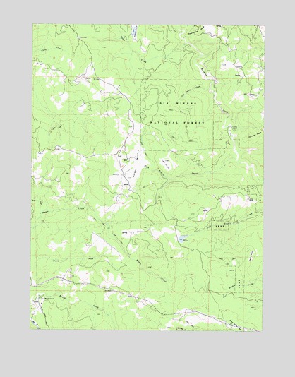
Maple Creek, CA USGS Topographic Map
Click on map above to begin viewing in our Map Viewer.

This topographic map contains these locations and features:
Feature Name Type Latitude Longitude GNIS ID View Map
Ayres CabinLocaleN40.8326°W123.7673°256386View Map
Bear CreekStreamN40.7982°W123.8701°256647View Map
Beckstine RanchLocaleN40.7615°W123.8745°1682561View Map
Carson RanchLocaleN40.8037°W123.7587°258008View Map
Christmas PrairieAreaN40.8743°W123.8212°258355View Map
Cool Spring CreekStreamN40.8485°W123.7803°258675View Map
Dolalr RanchLocaleN40.7737°W123.8734°277119View Map
FernwoodPopulated PlaceN40.8690°W123.8506°1658533View Map
Fernwood CDF Fire StationLocaleN40.8690°W123.8514°277118View Map
Gunderson RanchLocaleN40.7996°W123.7823°1682572View Map
Gunrack RidgeRidgeN40.8310°W123.7520°260984View Map
Hemphill RanchLocaleN40.8107°W123.8623°1682573View Map
Heustis PrairieAreaN40.7810°W123.7567°261290View Map
High PrairieAreaN40.8185°W123.8034°261328View Map
High Prairie CreekStreamN40.8207°W123.7653°261330View Map
Kerr Ranch (historical)LocaleN40.8010°W123.7692°1682570View Map
Kerr Ranch (historical)LocaleN40.7899°W123.8206°1682571View Map
Lake PrairieLakeN40.7874°W123.7948°265023View Map
Maple CreekPopulated PlaceN40.7624°W123.8692°263168View Map
Maple Creek Elementary SchoolSchoolN40.7605°W123.8700°1681914View Map
Maple Creek Volunteer Fire CompanyBuildingN40.7604°W123.8701°2621888View Map
McElahan Cabin (historical)BuildingN40.8512°W123.7948°1665254View Map
Murphy MeadowFlatN40.8182°W123.8192°263977View Map
Noisy CreekStreamN40.8674°W123.7931°264110View Map
Rock RanchLocaleN40.7662°W123.8320°265511View Map
Russ RanchLocaleN40.8201°W123.8242°265684View Map
Snow Camp MountainSummitN40.7526°W123.7687°267309View Map
Wilson Ranch (historical)LocaleN40.7999°W123.8170°1682582View Map

Note: Coordinates in the location and feature list above are referenced to NAD83 datum.


Copyright (C) 2008-2024 Ryan Niemi / Sunset Dynamics ... All Rights Reserved