TopoQuest Logo
Do you find TopoQuest useful?
Help keep TopoQuest running and adding new maps/features by donating!
Bitcoin:  19c7KJd3qBynnjoSw5npx9KScwjBe4ifkT
Litecoin:  LXs6TkuXGGXo1vDsWCkWVdjQX94eUKd6ui
Home View Maps Find Maps Find Places Resources & Links


Malad City East, Idaho Topographic Map

USGS Map Title: Malad City East, ID
USGS Map MRC: 42112B2
DRG (GeoTIFF) Download: o42112b2.tif


Neighboring USGS Topographic Map Quads:


  Elkhorn Peak, ID  
42112C3
 

  Malad Summit, ID  
42112C2
 

  Oxford, ID  
42112C1
 

  Malad City West, ID  
42112B3
 

  Malad City East, ID  
42112B2
 

  Clifton, ID  
42112B1
 

  Samaria, ID  
42112A3
 

  Henderson Creek, ID  
42112A2
 

  Weston Canyon, ID  
42112A1


Map MRC Location:

N43°
W113°
N43°
W112°
H8 H7 H6 H5 H4 H3 H2 H1
G8 G7 G6 G5 G4 G3 G2 G1
F8 F7 F6 F5 F4 F3 F2 F1
E8 E7 E6 E5 E4 E3 E2 E1
D8 D7 D6 D5 D4 D3 D2 D1
C8 C7 C6 C5 C4 C3 C2 C1
B8 B7 B6 B5 B4 B3 B2 B1
A8 A7 A6 A5 A4 A3 A2 A1
N42°
W113°
N42°
W112°

Malad City East, ID USGS 1:24K Topographic Map Preview:
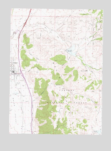
Malad City East, ID USGS Topographic Map
Click on map above to begin viewing in our Map Viewer.

This topographic map contains these locations and features:
Feature Name Type Latitude Longitude GNIS ID View Map
Chicken Coop HollowValleyN42.2374°W112.1325°379251View Map
City of Malad CityCivilN42.1903°W112.2500°2410911View Map
Deep Creek DamDamN42.2110°W112.1725°398612View Map
Deep Creek ReservoirReservoirN42.2084°W112.1675°397616View Map
Deep Creek Reservoir Public Fishing AreaLocaleN42.2049°W112.1619°401282View Map
Dry CreekStreamN42.2266°W112.1961°380814View Map
Evans CreekStreamN42.2499°W112.2205°381506View Map
First CreekStreamN42.2124°W112.1672°381729View Map
Fourmile CanyonValleyN42.1271°W112.2200°381961View Map
Little ValleyValleyN42.2085°W112.2391°384981View Map
Malad City CemeteryCemeteryN42.1793°W112.2328°386397View Map
Malad City Police DepartmentBuildingN42.1865°W112.2439°2722433View Map
Malad City Post OfficePost OfficeN42.1883°W112.2469°2781775View Map
Malad City Volunteer Fire DepartmentBuildingN42.1825°W112.2478°2619314View Map
Malad Junior-Senior High SchoolSchoolN42.1785°W112.2377°400977View Map
Maple HollowValleyN42.1833°W112.2336°386443View Map
Oneida County Ambulance ServiceBuildingN42.1857°W112.2421°2642821View Map
Oneida County FairgroundsLocaleN42.1755°W112.2391°394872View Map
Oneida County Volunteer Fire DepartmentBuildingN42.1863°W112.2456°2619231View Map
Pine HollowValleyN42.2291°W112.1330°388521View Map
Second CreekStreamN42.2055°W112.1652°390081View Map
Susan HollowValleyN42.2041°W112.1680°391692View Map
Third CreekStreamN42.1952°W112.1489°392000View Map
Trail HollowValleyN42.1544°W112.1266°392322View Map
Twomile CanyonValleyN42.1571°W112.2208°392566View Map
Twomile CreekStreamN42.1558°W112.2350°392568View Map
Upper Deep Creek DamDamN42.1927°W112.1466°398609View Map
Upper Deep Creek ReservoirReservoirN42.1901°W112.1445°398295View Map

Note: Coordinates in the location and feature list above are referenced to NAD83 datum.


Copyright (C) 2008-2024 Ryan Niemi / Sunset Dynamics ... All Rights Reserved