TopoQuest Logo
Do you find TopoQuest useful?
Help keep TopoQuest running and adding new maps/features by donating!
Bitcoin:  19c7KJd3qBynnjoSw5npx9KScwjBe4ifkT
Litecoin:  LXs6TkuXGGXo1vDsWCkWVdjQX94eUKd6ui
Home View Maps Find Maps Find Places Resources & Links


Henderson Creek, Idaho Topographic Map

USGS Map Title: Henderson Creek, ID
USGS Map MRC: 42112A2
DRG (GeoTIFF) Download: o42112a2.tif


Neighboring USGS Topographic Map Quads:


  Malad City West, ID  
42112B3
 

  Malad City East, ID  
42112B2
 

  Clifton, ID  
42112B1
 

  Samaria, ID  
42112A3
 

  Henderson Creek, ID  
42112A2
 

  Weston Canyon, ID  
42112A1
 

  Limekiln Knoll, UT  
41112H3
 

  Portage, UT  
41112H2
 

  Clarkston, UT  
41112H1


Map MRC Location:

N43°
W113°
N43°
W112°
H8 H7 H6 H5 H4 H3 H2 H1
G8 G7 G6 G5 G4 G3 G2 G1
F8 F7 F6 F5 F4 F3 F2 F1
E8 E7 E6 E5 E4 E3 E2 E1
D8 D7 D6 D5 D4 D3 D2 D1
C8 C7 C6 C5 C4 C3 C2 C1
B8 B7 B6 B5 B4 B3 B2 B1
A8 A7 A6 A5 A4 A3 A2 A1
N42°
W113°
N42°
W112°

Henderson Creek, ID USGS 1:24K Topographic Map Preview:
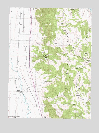
Henderson Creek, ID USGS Topographic Map
Click on map above to begin viewing in our Map Viewer.

This topographic map contains these locations and features:
Feature Name Type Latitude Longitude GNIS ID View Map
Burnett CanyonValleyN42.0230°W112.2036°378528View Map
Cherry CreekPopulated PlaceN42.0983°W112.2289°379220View Map
Cold SpringSpringN42.0835°W112.1599°2785812View Map
Deer House SpringSpringN42.0729°W112.1680°380464View Map
Dry Creek CampgroundLocaleN42.0580°W112.1433°380831View Map
Dry Creek SpringSpringN42.0744°W112.1354°380834View Map
Henderson CreekStreamN42.0558°W112.2222°383097View Map
Jenkins Hollow SpringSpringN42.0264°W112.1417°383879View Map
Left Fork Dry CanyonValleyN42.0652°W112.1261°384528View Map
Malad RangeRangeN42.0530°W112.1427°386398View Map
Muddy CreekStreamN42.0377°W112.2175°387364View Map
Picnic SpringSpringN42.0656°W112.1842°388425View Map
Race TrackValleyN42.0224°W112.1325°389015View Map
Red KnollSummitN42.1208°W112.1580°389203View Map
Red Knoll SpringSpringN42.1239°W112.1523°389204View Map
Right Fork Dry CanyonValleyN42.0649°W112.1261°389368View Map
Sheep Dip HollowValleyN42.0019°W112.1394°1445502View Map
Sheep Dip HollowValleyN42.0019°W112.1394°390224View Map
Trail CreekStreamN42.0108°W112.2008°392270View Map
West Cherry CreekStreamN42.0930°W112.2011°393024View Map
Willow SpringSpringN42.0845°W112.1808°393528View Map
WoodruffLocaleN42.0305°W112.2327°398383View Map
WoodruffPopulated PlaceN42.0360°W112.2147°398384View Map

Note: Coordinates in the location and feature list above are referenced to NAD83 datum.


Copyright (C) 2008-2024 Ryan Niemi / Sunset Dynamics ... All Rights Reserved