TopoQuest Logo
Do you find TopoQuest useful?
Help keep TopoQuest running and adding new maps/features by donating!
Bitcoin:  19c7KJd3qBynnjoSw5npx9KScwjBe4ifkT
Litecoin:  LXs6TkuXGGXo1vDsWCkWVdjQX94eUKd6ui
Home View Maps Find Maps Find Places Resources & Links


Mahogany Butte, Idaho Topographic Map

USGS Map Title: Mahogany Butte, ID
USGS Map MRC: 42114A2
DRG (GeoTIFF) Download: o42114a2.tif


Neighboring USGS Topographic Map Quads:


  Pike Mountain, ID  
42114B3
 

  Trapper Peak, ID  
42114B2
 

  Severe Spring, ID  
42114B1
 

  Timber Butte, ID  
42114A3
 

  Mahogany Butte, ID  
42114A2
 

  Ibex Peak, ID  
42114A1
 

  Stratton Spring, NV  
41114H3
 

  Fivemile Gulch, NV  
41114H2
 

  Nile Spring, NV  
41114H1


Map MRC Location:

N43°
W115°
N43°
W114°
H8 H7 H6 H5 H4 H3 H2 H1
G8 G7 G6 G5 G4 G3 G2 G1
F8 F7 F6 F5 F4 F3 F2 F1
E8 E7 E6 E5 E4 E3 E2 E1
D8 D7 D6 D5 D4 D3 D2 D1
C8 C7 C6 C5 C4 C3 C2 C1
B8 B7 B6 B5 B4 B3 B2 B1
A8 A7 A6 A5 A4 A3 A2 A1
N42°
W115°
N42°
W114°

Mahogany Butte, ID USGS 1:24K Topographic Map Preview:
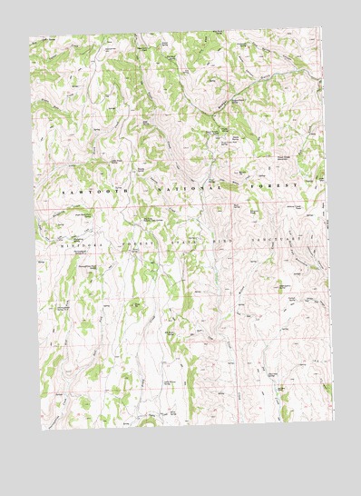
Mahogany Butte, ID USGS Topographic Map
Click on map above to begin viewing in our Map Viewer.

This topographic map contains these locations and features:
Feature Name Type Latitude Longitude GNIS ID View Map
Badger CreekStreamN42.1080°W114.1264°393929View Map
Badger GulchValleyN42.1080°W114.1264°398462View Map
Badger Gulch SpringSpringN42.1027°W114.1589°376834View Map
Buck SpringSpringN42.0690°W114.1652°378392View Map
Burn SpringSpringN42.0562°W114.2064°378526View Map
Carlson SpringSpringN42.0390°W114.1398°378943View Map
Cherry CreekStreamN42.0032°W114.2089°379221View Map
Cold Spring CanyonValleyN42.1121°W114.1364°379534View Map
Coldwater SpringSpringN42.1200°W114.1571°379565View Map
Crystal SpringSpringN42.0931°W114.1657°380131View Map
Dads HumpSummitN42.0907°W114.1617°380203View Map
Deerhorn PassGapN42.1199°W114.1995°380480View Map
Dry Fork Swanty Creek SpringSpringN42.0656°W114.2042°396420View Map
East Fork Thoroughbred CreekStreamN42.0149°W114.2381°381186View Map
Elk Basin CreekStreamN42.0271°W114.1700°381329View Map
Elk Basin SpringSpringN42.0294°W114.1919°381330View Map
Gravel SpringSpringN42.1213°W114.1942°382595View Map
Humphrey CreekStreamN42.0671°W114.2478°383542View Map
Humphrey SpringSpringN42.0606°W114.2339°383543View Map
Jay Creek CorralLocaleN42.0105°W114.1495°383861View Map
Jay Creek SpringSpringN42.0152°W114.1530°383862View Map
Joes BasinBasinN42.0669°W114.1270°383937View Map
Joes MountainSummitN42.0766°W114.1261°396710View Map
Kidd SpringSpringN42.0958°W114.2030°384211View Map
Little Piney SpringSpringN42.0844°W114.2171°384915View Map
Little Willow CreekStreamN42.0732°W114.1784°373688View Map
Little Willow SpringSpringN42.0138°W114.1975°384994View Map
Mahogany ButteSummitN42.0430°W114.1475°386377View Map
Phantom FallsFallsN42.0910°W114.1316°400962View Map
Pine TitSummitN42.0385°W114.2092°388528View Map
Red Bluff SpringSpringN42.1169°W114.1881°389182View Map
Right Hand Fork SpringSpringN42.0676°W114.2254°389383View Map
Rim Rock SpringSpringN42.1249°W114.1672°389388View Map
South TitSummitN42.0796°W114.1628°391080View Map
Swanty CreekStreamN42.0610°W114.1747°391742View Map
Swanty PeakSummitN42.0671°W114.1589°397227View Map
Swanty SpringSpringN42.0815°W114.2060°391743View Map
Thoroughbred Pond SpringSpringN42.0509°W114.2240°392064View Map
Thoroughbred Spring Number OneSpringN42.0556°W114.2284°400305View Map
Thoroughbred Spring Number TwoSpringN42.0385°W114.2422°400306View Map
Trout Creek MountainSummitN42.0835°W114.1472°397271View Map
Trout Creek PassGapN42.0924°W114.1709°392423View Map
Trout Creek Pass SpringSpringN42.0896°W114.1696°392424View Map
Trout SpringSpringN42.0773°W114.1754°392430View Map
Tub SpringSpringN42.1117°W114.1823°392437View Map
W P A SpringSpringN42.0046°W114.1954°392755View Map
Water CanyonValleyN42.1088°W114.1539°392932View Map
West Fork Thoroughbred CreekStreamN42.0149°W114.2381°393211View Map
Willow CreekStreamN42.0335°W114.1722°393483View Map
Willow Creek PeakSummitN42.0680°W114.1356°397312View Map

Note: Coordinates in the location and feature list above are referenced to NAD83 datum.


Copyright (C) 2008-2024 Ryan Niemi / Sunset Dynamics ... All Rights Reserved