TopoQuest Logo
Do you find TopoQuest useful?
Help keep TopoQuest running and adding new maps/features by donating!
Bitcoin:  19c7KJd3qBynnjoSw5npx9KScwjBe4ifkT
Litecoin:  LXs6TkuXGGXo1vDsWCkWVdjQX94eUKd6ui
Home View Maps Find Maps Find Places Resources & Links


Madrid, Maine Topographic Map

USGS Map Title: Madrid, ME
USGS Map MRC: 44070G4
DRG (GeoTIFF) Download: o44070g4.tif


Neighboring USGS Topographic Map Quads:


  Saddleback Mountain, ME  
44070H5
 

  Redington, ME  
44070H4
 

  Mount Abraham, ME  
44070H3
 

  Jackson Mountain, ME  
44070G5
 

  Madrid, ME  
44070G4
 

  Phillips, ME  
44070G3
 

  Roxbury, ME  
44070F5
 

  Weld, ME  
44070F4
 

  Mount Blue, ME  
44070F3


Map MRC Location:

N45°
W71°
N45°
W70°
H8 H7 H6 H5 H4 H3 H2 H1
G8 G7 G6 G5 G4 G3 G2 G1
F8 F7 F6 F5 F4 F3 F2 F1
E8 E7 E6 E5 E4 E3 E2 E1
D8 D7 D6 D5 D4 D3 D2 D1
C8 C7 C6 C5 C4 C3 C2 C1
B8 B7 B6 B5 B4 B3 B2 B1
A8 A7 A6 A5 A4 A3 A2 A1
N44°
W71°
N44°
W70°

Madrid, ME USGS 1:24K Topographic Map Preview:
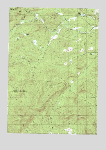
Madrid, ME USGS Topographic Map
Click on map above to begin viewing in our Map Viewer.

This topographic map contains these locations and features:
Feature Name Type Latitude Longitude GNIS ID View Map
Adley PondLakeN44.8301°W70.3818°561097View Map
Bear HillSummitN44.8647°W70.4402°561781View Map
Beech HillSummitN44.8711°W70.4883°561986View Map
Blodgett CemeteryCemeteryN44.7911°W70.4109°2736273View Map
Blueberry MountainSummitN44.7676°W70.4798°562612View Map
Bog PondLakeN44.8477°W70.4095°562689View Map
Butterfield (historical)Populated PlaceN44.8317°W70.3909°1908285View Map
Butterfield SchoolSchoolN44.8317°W70.3873°563311View Map
Byron Annex CemeteryCemeteryN44.8674°W70.3769°2736276View Map
Byron CemeteryCemeteryN44.8669°W70.3767°2736277View Map
Cottle BrookStreamN44.8517°W70.3878°564385View Map
Crossman StreamStreamN44.8526°W70.4948°564575View Map
Field CemeteryCemeteryN44.8605°W70.4272°2736288View Map
Harnden CemeteryCemeteryN44.7910°W70.4238°2736290View Map
Jont StreamStreamN44.8187°W70.4637°568977View Map
Lufkin PondLakeN44.8405°W70.4629°570580View Map
MadridPopulated PlaceN44.8645°W70.4620°570646View Map
Madrid CemeteryCemeteryN44.8684°W70.4653°1908360View Map
Madrid JunctionPopulated PlaceN44.8698°W70.3998°579492View Map
Mud PondLakeN44.8444°W70.4879°571903View Map
Orbeton StreamStreamN44.8564°W70.4176°572755View Map
Pearl PondLakeN44.8264°W70.4811°573111View Map
Pinkham Hill CemeteryCemeteryN44.8338°W70.4139°2736305View Map
Pope MountainSummitN44.7689°W70.3980°573630View Map
Prescott SchoolSchoolN44.8595°W70.4137°573788View Map
Reed SchoolSchoolN44.8439°W70.4403°574131View Map
Rowe HillSummitN44.8654°W70.4809°574547View Map
Saddleback StreamStreamN44.8639°W70.4617°574672View Map
South Branch Sandy RiverStreamN44.8489°W70.4348°575798View Map
Stetson PondLakeN44.8482°W70.4775°576306View Map
Toothaker PondLakeN44.8686°W70.3963°577200View Map
Town of PhillipsCivilN44.8402°W70.3825°582674View Map
Weld Road CemeteryCemeteryN44.7999°W70.4163°2736613View Map
Winship SchoolSchoolN44.7953°W70.4176°578591View Map

Note: Coordinates in the location and feature list above are referenced to NAD83 datum.


Copyright (C) 2008-2024 Ryan Niemi / Sunset Dynamics ... All Rights Reserved