TopoQuest Logo
Do you find TopoQuest useful?
Help keep TopoQuest running and adding new maps/features by donating!
Bitcoin:  19c7KJd3qBynnjoSw5npx9KScwjBe4ifkT
Litecoin:  LXs6TkuXGGXo1vDsWCkWVdjQX94eUKd6ui
Home View Maps Find Maps Find Places Resources & Links


Littleton, West Virginia Topographic Map

USGS Map Title: Littleton, WV
USGS Map MRC: 39080F5
DRG (GeoTIFF) Download: o39080f5.tif


Neighboring USGS Topographic Map Quads:


  Glen Easton, WV  
39080G6
 

  Cameron, WV  
39080G5
 

  New Freeport, PA  
39080G4
 

  Wileyville, WV  
39080F6
 

  Littleton, WV  
39080F5
 

  Hundred, WV  
39080F4
 

  Pine Grove, WV  
39080E6
 

  Big Run, WV  
39080E5
 

  Glover Gap, WV  
39080E4


Map MRC Location:

N40°
W81°
N40°
W80°
H8 H7 H6 H5 H4 H3 H2 H1
G8 G7 G6 G5 G4 G3 G2 G1
F8 F7 F6 F5 F4 F3 F2 F1
E8 E7 E6 E5 E4 E3 E2 E1
D8 D7 D6 D5 D4 D3 D2 D1
C8 C7 C6 C5 C4 C3 C2 C1
B8 B7 B6 B5 B4 B3 B2 B1
A8 A7 A6 A5 A4 A3 A2 A1
N39°
W81°
N39°
W80°

Littleton, WV USGS 1:24K Topographic Map Preview:
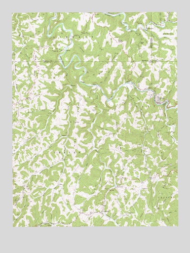
Littleton, WV USGS Topographic Map
Click on map above to begin viewing in our Map Viewer.

This topographic map contains these locations and features:
Feature Name Type Latitude Longitude GNIS ID View Map
Amos HollowValleyN39.7365°W80.5795°1534928View Map
Anderson Bethel CemeteryCemeteryN39.7081°W80.5367°1534932View Map
AnthemPopulated PlaceN39.6467°W80.5284°1553731View Map
BannenPopulated PlaceN39.7284°W80.5867°1553798View Map
Bat RunStreamN39.6998°W80.5365°1535304View Map
Bear RunStreamN39.6712°W80.5645°1535397View Map
Bear Run School (historical)SchoolN39.6701°W80.5637°1717658View Map
Beaverdam School (historical)SchoolN39.6990°W80.5520°1717659View Map
Bellton Mill School (historical)SchoolN39.7398°W80.5512°1717520View Map
Board TreeLocaleN39.7342°W80.5276°1536165View Map
Board Tree CemeteryCemeteryN39.7287°W80.5259°1717398View Map
Board Tree TunnelTunnelN39.7270°W80.5290°1536166View Map
Camp RunStreamN39.6590°W80.5551°1536952View Map
Carney CemeteriesCemeteryN39.6462°W80.5329°1537042View Map
Carney ForkStreamN39.7073°W80.5820°1537043View Map
Carney Fork Church (historical)ChurchN39.6790°W80.6065°1717663View Map
Cliff RunStreamN39.7048°W80.5234°1537404View Map
Coon RunStreamN39.7448°W80.5065°1172415View Map
Crooked RunStreamN39.6854°W80.5645°1537853View Map
DeanPopulated PlaceN39.6495°W80.5901°1554274View Map
Denver HeightsPopulated PlaceN39.7323°W80.5448°1554293View Map
Denver Heights School (historical)SchoolN39.7315°W80.5404°1717527View Map
Dewey School (historical)SchoolN39.7001°W80.5731°1717668View Map
East View CemeteryCemeteryN39.6554°W80.5062°1717739View Map
East View ChurchChurchN39.6542°W80.5106°1538523View Map
East View School (historical)SchoolN39.6542°W80.5092°1717671View Map
EndicottPopulated PlaceN39.6781°W80.5837°1538710View Map
Fall RunStreamN39.7442°W80.5106°1174584View Map
Fall Run-Wild Cat Hollow School (historical)SchoolN39.7462°W80.5223°1717531View Map
Fanlight School (historical)SchoolN39.7117°W80.6054°1717676View Map
GeorgetownPopulated PlaceN39.7398°W80.5237°1549699View Map
Green Valley School (historical)SchoolN39.6701°W80.6201°1717681View Map
Hays School (historical)SchoolN39.6467°W80.5937°1717683View Map
Hickman RunStreamN39.7320°W80.5801°1540197View Map
Horner CemeteryCemeteryN39.6287°W80.5481°1717742View Map
Isaac RunStreamN39.6792°W80.6056°1717687View Map
Johnson RidgeRidgeN39.7131°W80.6220°1540989View Map
Jolliffee CemeteryCemeteryN39.6937°W80.6195°1540998View Map
Kirk RidgeRidgeN39.6812°W80.5784°1541240View Map
Kirk Ridge ChurchChurchN39.6862°W80.5787°1541241View Map
Knob ForkPopulated PlaceN39.6487°W80.5468°1554893View Map
Knob ForkStreamN39.7076°W80.5609°1541272View Map
Knob RunStreamN39.7390°W80.5242°1541274View Map
Knob RunStreamN39.7390°W80.5231°1178612View Map
Liston HollowValleyN39.6701°W80.5284°1542011View Map
Liston School (historical)SchoolN39.6692°W80.5267°1717692View Map
Little Laurel RunStreamN39.7298°W80.6165°1542155View Map
LittletonPopulated PlaceN39.6979°W80.5170°1542266View Map
Littleton CemeteryCemeteryN39.6976°W80.5087°1717750View Map
Littleton Census Designated PlaceCensusN39.7024°W80.5147°2586846View Map
Littleton Church of GodChurchN39.7081°W80.5326°1717693View Map
Littleton Post OfficePost OfficeN39.7000°W80.5170°1717694View Map
Long DrainStreamN39.6931°W80.5095°1542367View Map
Long Valley CemeteryCemeteryN39.6279°W80.6004°1717696View Map
Long Valley ChurchChurchN39.6270°W80.6006°1542429View Map
Low Gap CemeteryCemeteryN39.6379°W80.5720°1717751View Map
Low Gap ChurchChurchN39.6345°W80.5734°1542506View Map
Martin TunnelTunnelN39.6965°W80.5095°1542820View Map
McCabe CemeteryCemeteryN39.7245°W80.5451°1717429View Map
McCabe ChurchChurchN39.7251°W80.5456°1542922View Map
Meadowdale CemeteryCemeteryN39.7284°W80.5876°1717430View Map
Meadowdale ChurchChurchN39.7281°W80.5884°1543082View Map
Miller ChapelChurchN39.6995°W80.6137°1543377View Map
Miller ForkStreamN39.6773°W80.5848°1543384View Map
Miller RidgeRidgeN39.7179°W80.6068°1543391View Map
Miller RunStreamN39.6773°W80.5848°1543395View Map
Moore CemeteryCemeteryN39.6398°W80.6120°1717752View Map
Morris CemeteryCemeteryN39.6645°W80.5881°1717755View Map
Morris RunStreamN39.6634°W80.5876°1543581View Map
Morris Run ChurchChurchN39.6637°W80.5881°1543582View Map
Morris Run School (historical)SchoolN39.6567°W80.6048°1717703View Map
Mount Herman CemeteryCemeteryN39.6331°W80.5373°1717756View Map
Mount Hermon ChurchChurchN39.6329°W80.5381°1543654View Map
Mount Zion CemeteryCemeteryN39.6467°W80.5526°1717759View Map
Mount Zion ChurchChurchN39.6465°W80.5531°1543848View Map
Mudlick RunStreamN39.6912°W80.5948°1543971View Map
Potts School (historical)SchoolN39.6273°W80.6012°1717712View Map
Rice RidgeRidgeN39.7190°W80.5523°1545531View Map
Rice School (historical)SchoolN39.7251°W80.5448°1717547View Map
Ride Ridge Church (historical)ChurchN39.7284°W80.5295°1717548View Map
Ridge Ridge CemeteryCemeteryN39.7281°W80.5295°1717442View Map
Robinson RidgeRidgeN39.6737°W80.5415°1545870View Map
Robinson Ridge ChurchChurchN39.6781°W80.5529°1545871View Map
Robinson Ridge School (historical)SchoolN39.6812°W80.5470°1717713View Map
RockportPopulated PlaceN39.7076°W80.5812°1555507View Map
Rocky RunStreamN39.7170°W80.5854°1546033View Map
Stottlemire RunStreamN39.6829°W80.5034°1547512View Map
Strosnider Hill CemeteryCemeteryN39.6923°W80.5517°1547589View Map
Sugar Grove School (historical)SchoolN39.6776°W80.5031°1717722View Map
Sugar RunStreamN39.7081°W80.5398°1547653View Map
Tan Trough RunStreamN39.7076°W80.5598°1547886View Map
UniontownPopulated PlaceN39.6337°W80.5581°1555853View Map
WadePopulated PlaceN39.7079°W80.5617°1549975View Map
Wade CemeteryCemeteryN39.6926°W80.5648°1548696View Map
Walnut Grove School (historical)SchoolN39.7273°W80.6043°1717563View Map
WheatPopulated PlaceN39.6265°W80.5948°1555963View Map
White RunStreamN39.6495°W80.5906°1549080View Map
Windy RidgeRidgeN39.6715°W80.5165°1549244View Map
Wolf RunStreamN39.7145°W80.5001°1191668View Map
Wolf RunStreamN39.6987°W80.5087°1549300View Map

Note: Coordinates in the location and feature list above are referenced to NAD83 datum.


Copyright (C) 2008-2024 Ryan Niemi / Sunset Dynamics ... All Rights Reserved