TopoQuest Logo
Do you find TopoQuest useful?
Help keep TopoQuest running and adding new maps/features by donating!
Bitcoin:  19c7KJd3qBynnjoSw5npx9KScwjBe4ifkT
Litecoin:  LXs6TkuXGGXo1vDsWCkWVdjQX94eUKd6ui
Home View Maps Find Maps Find Places Resources & Links


Hundred, West Virginia Topographic Map

USGS Map Title: Hundred, WV
USGS Map MRC: 39080F4
DRG (GeoTIFF) Download: o39080f4.tif


Neighboring USGS Topographic Map Quads:


  Cameron, WV  
39080G5
 

  New Freeport, PA  
39080G4
 

  Holbrook, PA  
39080G3
 

  Littleton, WV  
39080F5
 

  Hundred, WV  
39080F4
 

  Wadestown, WV  
39080F3
 

  Big Run, WV  
39080E5
 

  Glover Gap, WV  
39080E4
 

  Mannington, WV  
39080E3


Map MRC Location:

N40°
W81°
N40°
W80°
H8 H7 H6 H5 H4 H3 H2 H1
G8 G7 G6 G5 G4 G3 G2 G1
F8 F7 F6 F5 F4 F3 F2 F1
E8 E7 E6 E5 E4 E3 E2 E1
D8 D7 D6 D5 D4 D3 D2 D1
C8 C7 C6 C5 C4 C3 C2 C1
B8 B7 B6 B5 B4 B3 B2 B1
A8 A7 A6 A5 A4 A3 A2 A1
N39°
W81°
N39°
W80°

Hundred, WV USGS 1:24K Topographic Map Preview:
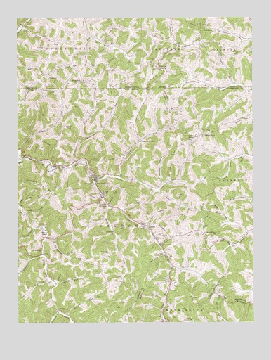
Hundred, WV USGS Topographic Map
Click on map above to begin viewing in our Map Viewer.

This topographic map contains these locations and features:
Feature Name Type Latitude Longitude GNIS ID View Map
Ashcamp RunStreamN39.6601°W80.4848°1535057View Map
Barger CemeteryCemeteryN39.7304°W80.4701°1168706View Map
Bartrug CemeteryCemeteryN39.6606°W80.4234°1535298View Map
Bee HollowValleyN39.6648°W80.4306°1535488View Map
Billygoat HollowValleyN39.6737°W80.4509°1536015View Map
Briar RunStreamN39.6915°W80.3862°1536328View Map
Brown CemeteryCemeteryN39.6904°W80.4854°1536408View Map
Browns RunStreamN39.6945°W80.4984°1170395View Map
Burner RunStreamN39.6751°W80.4542°1536747View Map
BurtonPopulated PlaceN39.6640°W80.4306°1536773View Map
Burton Elementary School (historical)SchoolN39.6654°W80.4304°1717733View Map
Butcher CemeteryCemeteryN39.6990°W80.4067°1536794View Map
Butcher ForkStreamN39.6812°W80.4229°1717735View Map
Butcher HollowValleyN39.6812°W80.4226°1536796View Map
Buzzard RunStreamN39.7423°W80.4604°1170828View Map
Cappo RunStreamN39.6842°W80.4465°1537029View Map
Cappo Run School (historical)SchoolN39.7037°W80.4256°1717736View Map
Carney School (historical)SchoolN39.6423°W80.4820°1717737View Map
Church ForkStreamN39.6831°W80.4595°1537337View Map
CottontownPopulated PlaceN39.6570°W80.4242°1554199View Map
Cusicks CrossingPopulated PlaceN39.6731°W80.4515°1554246View Map
Dawson CemeteryCemeteryN39.6645°W80.4015°1538073View Map
Earnshaw CemeteryCemeteryN39.6304°W80.4745°1538498View Map
Edgell HollowValleyN39.6531°W80.4226°1538554View Map
Fairview ChurchChurchN39.7354°W80.3817°1174508View Map
Fish Creek Covered BridgeBridgeN39.6723°W80.4520°1717740View Map
Frog PondReservoirN39.6254°W80.4217°1539276View Map
Garner CemeteryCemeteryN39.6356°W80.4587°1539339View Map
GarrisonPopulated PlaceN39.7295°W80.4226°1175468View Map
Gilmore CemeteryCemeteryN39.7206°W80.3915°1539406View Map
Glover CemeteryCemeteryN39.6256°W80.4126°1539472View Map
Harmony CemeteryCemeteryN39.6604°W80.4262°1539977View Map
Harmony ChurchChurchN39.6598°W80.4265°1539981View Map
Honsocker KnobSummitN39.7012°W80.4062°1540429View Map
HundredPopulated PlaceN39.6837°W80.4590°1540584View Map
Hundred CemeteryCemeteryN39.6851°W80.4573°1717743View Map
Hundred Cover BridgeBridgeN39.6725°W80.4523°2647348View Map
Hundred High SchoolSchoolN39.6784°W80.4547°1717744View Map
Hundred Police DepartmentBuildingN39.6840°W80.4567°2728190View Map
Hundred Post OfficePost OfficeN39.6838°W80.4591°1717745View Map
Hundred Public LibraryBuildingN39.6785°W80.4557°2727391View Map
Hundred United Methodist ChurchChurchN39.6848°W80.4576°1717746View Map
Hundred Volunteer Fire DepartmentBuildingN39.6840°W80.4570°2577680View Map
Jobes HollowValleyN39.6737°W80.4990°1540915View Map
Joy RunStreamN39.6823°W80.4190°1541032View Map
Joy Run School (historical)SchoolN39.6834°W80.4187°1717747View Map
Kerns HollowValleyN39.6701°W80.4959°1541164View Map
Leezer CemeteryCemeteryN39.6615°W80.4148°1541615View Map
Liming Ridge ChurchChurchN39.6609°W80.3945°1541985View Map
Long Drain ChurchChurchN39.6540°W80.4870°1542368View Map
Long Drain SchoolSchoolN39.6616°W80.4844°2088253View Map
Lost RunStreamN39.6567°W80.4251°1542469View Map
Lough KnobSummitN39.7054°W80.4742°1542480View Map
Marshall TunnelTunnelN39.6931°W80.4973°1542796View Map
McNicholas CemeteryCemeteryN39.7376°W80.4856°1180796View Map
Moses RunStreamN39.6415°W80.4787°1543596View Map
NedPopulated PlaceN39.7259°W80.4823°1182207View Map
Oak Forest Church CemeteryCemeteryN39.7034°W80.3975°2586268View Map
Oak Forest School (historical)SchoolN39.7037°W80.3965°1728257View Map
Oak Forest United Methodist ChurchChurchN39.7037°W80.3970°1544275View Map
Old Harmony CemeteryCemeteryN39.6470°W80.4131°1544356View Map
Pigeon RunStreamN39.7467°W80.4970°1183720View Map
Pleasant Hill ChurchChurchN39.7245°W80.4642°1184034View Map
Renner CemeteryCemeteryN39.7243°W80.3996°1184899View Map
Roberts RunStreamN39.6531°W80.4862°1545848View Map
Rockcamp RunStreamN39.6902°W80.4700°1199404View Map
Rockcamp School (historical)SchoolN39.7017°W80.4631°1717766View Map
Round BottomPopulated PlaceN39.6998°W80.4356°1546102View Map
Rush RunStreamN39.6723°W80.4523°1546179View Map
Rush Run ChurchChurchN39.6620°W80.4490°1546186View Map
Rush Run School (historical)SchoolN39.6617°W80.4484°1717767View Map
Saint CloudPopulated PlaceN39.7020°W80.4009°1549909View Map
Sancho ChurchChurchN39.6829°W80.4192°1546335View Map
Sand Hill ChurchChurchN39.7292°W80.4790°1193280View Map
SandrockPopulated PlaceN39.7451°W80.3998°1204580View Map
Santee RunStreamN39.6792°W80.4256°1546426View Map
Scritchfield CemeteryCemeteryN39.6537°W80.4517°1546532View Map
Seller CemeteryCemeteryN39.7397°W80.4498°1187244View Map
Shriver CemeteryCemeteryN39.6648°W80.4895°1546749View Map
Shriver RunStreamN39.6637°W80.4923°1546753View Map
Soles TunnelTunnelN39.6892°W80.4779°1547055View Map
Stottlemeier Run CemeteryCemeteryN39.6808°W80.4797°2586337View Map
Styles RunStreamN39.6426°W80.4823°1547617View Map
Taylor CemeteryCemeteryN39.6506°W80.4662°1547929View Map
Taylor RunStreamN39.7223°W80.3854°1189310View Map
Tea Garden ForkStreamN39.6301°W80.4790°1547944View Map
Thomas CemeteryCemeteryN39.6604°W80.4854°1717769View Map
Thomas CemeteryCemeteryN39.7304°W80.4748°1189472View Map
Thomas Chapel United Methodist ChurchChurchN39.6606°W80.4851°1548027View Map
Thomas School (historical)SchoolN39.6593°W80.4862°1717770View Map
Town of HundredCivilN39.6836°W80.4576°2390252View Map
Township of FreeportCivilN39.7496°W80.4195°1216488View Map
Trail ForkStreamN39.6276°W80.4740°1548250View Map
Upper Furbee School (historical)SchoolN39.6298°W80.4240°1717987View Map
West Virginia State Police Troop 1 - Hundred DetachmentBuildingN39.6792°W80.4569°2728189View Map
Wetzel County Emergency Ambulance Authority Incorporated Station 60BuildingN39.6840°W80.4570°2581146View Map
Whisler RunStreamN39.6620°W80.3776°1549014View Map

Note: Coordinates in the location and feature list above are referenced to NAD83 datum.


Copyright (C) 2008-2024 Ryan Niemi / Sunset Dynamics ... All Rights Reserved