TopoQuest Logo
Do you find TopoQuest useful?
Help keep TopoQuest running and adding new maps/features by donating!
Bitcoin:  19c7KJd3qBynnjoSw5npx9KScwjBe4ifkT
Litecoin:  LXs6TkuXGGXo1vDsWCkWVdjQX94eUKd6ui
Home View Maps Find Maps Find Places Resources & Links


Lincoln, Tennessee Topographic Map

USGS Map Title: Lincoln, TN
USGS Map MRC: 35086A5
DRG (GeoTIFF) Download: o35086a5.tif


Neighboring USGS Topographic Map Quads:


  Boonshill, TN  
35086B6
 

  Fayetteville, TN  
35086B5
 

  Mulberry, TN  
35086B4
 

  Taft, TN  
35086A6
 

  Lincoln, TN  
35086A5
 

  Flintville, TN  
35086A4
 

  Toney, AL  
34086H6
 

  Fisk, AL  
34086H5
 

  New Market, AL  
34086H4


Map MRC Location:

N36°
W87°
N36°
W86°
H8 H7 H6 H5 H4 H3 H2 H1
G8 G7 G6 G5 G4 G3 G2 G1
F8 F7 F6 F5 F4 F3 F2 F1
E8 E7 E6 E5 E4 E3 E2 E1
D8 D7 D6 D5 D4 D3 D2 D1
C8 C7 C6 C5 C4 C3 C2 C1
B8 B7 B6 B5 B4 B3 B2 B1
A8 A7 A6 A5 A4 A3 A2 A1
N35°
W87°
N35°
W86°

Lincoln, TN USGS 1:24K Topographic Map Preview:
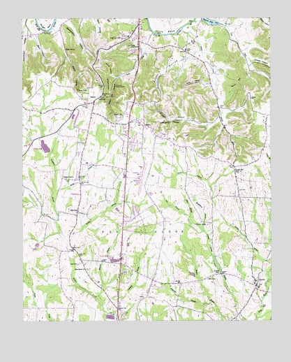
Lincoln, TN USGS Topographic Map
Click on map above to begin viewing in our Map Viewer.

This topographic map contains these locations and features:
Feature Name Type Latitude Longitude GNIS ID View Map
Bane HillSummitN35.0976°W86.5169°1276262View Map
Beard CemeteryCemeteryN35.1145°W86.5678°1645171View Map
Beard HollowValleyN35.1086°W86.6019°1276640View Map
Beech HollowValleyN35.1213°W86.6213°1276846View Map
BelleviewPopulated PlaceN35.0454°W86.5969°1276962View Map
Belleview Division (historical)CensusN35.0393°W86.5714°1648828View Map
Bellview School (historical)SchoolN35.0445°W86.5969°1316175View Map
Beverly CemeteryCemeteryN35.0184°W86.5217°1645174View Map
Blankenship HollowValleyN35.1242°W86.6028°1305287View Map
Boone FallsFallsN35.0956°W86.5967°1277980View Map
Bugger HollowValleyN35.0832°W86.5254°1278932View Map
Camp DunroaminLocaleN35.1143°W86.5700°1279386View Map
Campers BranchStreamN35.0040°W86.5806°1305647View Map
Chapman FarmLocaleN35.0664°W86.5825°2724581View Map
Childress Lake DamDamN35.0251°W86.5800°1301482View Map
Circle H Ranch LakeReservoirN35.0252°W86.5787°1301483View Map
Commissioner District 3CivilN35.1197°W86.5253°2464169View Map
Commissioner District 4CivilN35.0416°W86.5870°2464060View Map
Commissioner District 5CivilN35.1163°W86.6077°2464467View Map
Commissioner District 8CivilN35.0306°W86.5037°2464686View Map
Concord Church (historical)ChurchN35.1187°W86.6131°1316186View Map
Corder-McCullock CemeteryCemeteryN35.0884°W86.5067°1645198View Map
Cottrell SpringSpringN35.0398°W86.5380°1281370View Map
Cowley HollowValleyN35.1078°W86.5092°1281474View Map
Davis CemeteryCemeteryN35.0387°W86.5875°1645205View Map
Davis CemeteryCemeteryN35.0054°W86.5125°1645206View Map
Donneby BranchStreamN35.0162°W86.5014°117375View Map
Duncan FarmsLocaleN35.0783°W86.5208°2724576View Map
Dunns Store (historical)LocaleN35.0879°W86.5261°1316191View Map
Eastwood EstatesPopulated PlaceN35.0140°W86.5567°1310343View Map
Fayetteville Municipal AirportAirportN35.0584°W86.5661°1301298View Map
Fayetteville Pumping StationBuildingN35.0970°W86.5775°1284177View Map
Goshen (historical)Populated PlaceN35.0418°W86.5736°1643958View Map
Greenwood EstatesPopulated PlaceN35.0456°W86.5683°1310345View Map
Grills CemeteryCemeteryN35.0834°W86.5103°1645228View Map
Hairston CemeteryCemeteryN35.1212°W86.6186°1645236View Map
Hancock BranchStreamN35.0093°W86.5867°1286715View Map
Hancock CemeteryCemeteryN35.0154°W86.5892°1645233View Map
Hancock CemeteryCemeteryN35.0176°W86.5914°1645234View Map
Hanks CemeteryCemeteryN35.0931°W86.5958°1645235View Map
Harper BranchStreamN35.0543°W86.6081°1286911View Map
Harris CemeteryCemeteryN35.0962°W86.5919°1286950View Map
Henderson CemeteryCemeteryN35.0201°W86.5933°1645239View Map
Hendersons SubdivisionPopulated PlaceN35.0873°W86.6017°1310347View Map
Henry BendBendN35.1248°W86.5508°1287433View Map
High Point SubdivisionPopulated PlaceN35.0423°W86.5722°1310348View Map
Highland RimPopulated PlaceN35.0840°W86.5978°1310349View Map
Highland Rim Elementary SchoolSchoolN35.0654°W86.5925°1316206View Map
Highland Rim Falls SubdivisionPopulated PlaceN35.0820°W86.5806°1310350View Map
Hilldale EstatesPopulated PlaceN35.0381°W86.5678°1310351View Map
Hog BranchStreamN35.0429°W86.5405°1287973View Map
Hornet HollowValleyN35.1013°W86.5807°1288374View Map
Howell HillPopulated PlaceN35.0620°W86.5178°1288560View Map
Howell Hill Baptist ChurchChurchN35.0618°W86.5178°1643960View Map
Howell Hill School (historical)SchoolN35.0612°W86.5175°1316210View Map
Huckleberry BranchStreamN35.0370°W86.5333°1288587View Map
Hutchinson HollowValleyN35.1213°W86.6227°1288865View Map
Johnson School (historical)SchoolN35.0737°W86.5947°1316214View Map
Keith SpringSpringN35.1120°W86.6028°1289980View Map
Lamarsons Plantation (historical)LocaleN35.1168°W86.5528°1316217View Map
Land CemeteryCemeteryN35.0540°W86.5158°1290580View Map
Lees CreekStreamN35.1237°W86.5369°1290979View Map
LibertyPopulated PlaceN35.1120°W86.5419°1291104View Map
Liberty School (historical)SchoolN35.1118°W86.5428°1316219View Map
LincolnPopulated PlaceN35.0151°W86.5075°1291303View Map
Lincoln Baptist ChurchChurchN35.0143°W86.5072°1643962View Map
Lincoln CemeteryCemeteryN35.0148°W86.5064°1645264View Map
Lincoln School (historical)SchoolN35.0162°W86.5078°1316223View Map
Locker HillSummitN35.1126°W86.5850°1291770View Map
Locker SpringSpringN35.0823°W86.5506°1291771View Map
Macedonia CemeteryCemeteryN35.0217°W86.5930°1645266View Map
Macedonia ChurchChurchN35.0218°W86.5922°1292407View Map
McAlister FarmsLocaleN35.0636°W86.5919°2724588View Map
McDaniel CemeteryCemeteryN35.0329°W86.6119°1645275View Map
McGee-McCartney CemeteryCemeteryN35.0895°W86.5272°1645280View Map
Mire BranchStreamN35.0431°W86.5408°1294075View Map
Oakwood Acres LakeReservoirN35.1237°W86.5304°1296209View Map
Park CityPopulated PlaceN35.0820°W86.5711°1310354View Map
Park City Census Designated PlaceCensusN35.0782°W86.5834°2584589View Map
Park City HeightsPopulated PlaceN35.0831°W86.5756°1310355View Map
Park City Shopping CenterLocaleN35.0754°W86.5708°1316235View Map
Park City Volunteer Fire RescueBuildingN35.0832°W86.5707°2653672View Map
Parks City Baptist ChurchChurchN35.0690°W86.5733°1643966View Map
Pea RidgeRidgeN35.0381°W86.5675°1269846View Map
Percy HollowValleyN35.0980°W86.5305°1297177View Map
Plada HeightsPopulated PlaceN35.0715°W86.5694°1310356View Map
Plainfield SubdivisionPopulated PlaceN35.0723°W86.5658°1310357View Map
Pleasant GrovePopulated PlaceN35.0593°W86.6044°1315730View Map
Pleasant Grove CemeteryCemeteryN35.0581°W86.6033°1645300View Map
Pleasant Grove ChurchChurchN35.0590°W86.6028°1316239View Map
Pleasant Grove SubdivisionPopulated PlaceN35.0690°W86.5967°1310358View Map
Porter HollowValleyN35.1105°W86.5372°1298263View Map
ProspectPopulated PlaceN35.0806°W86.5631°1298570View Map
Prospect Baptist ChurchChurchN35.0818°W86.5658°1643967View Map
Prospect CemeteryCemeteryN35.0812°W86.5661°1645303View Map
Prospect School (historical)SchoolN35.0818°W86.5661°1316240View Map
Pryor CemeteryCemeteryN35.0145°W86.5108°1645305View Map
Quick School (historical)SchoolN35.0004°W86.5772°1316242View Map
Rambo Lake DamDamN35.1248°W86.5344°1301583View Map
Rebecca LakeReservoirN35.0720°W86.6136°1299023View Map
Rebecca Lake DamDamN35.0701°W86.6125°1307051View Map
Rogers CemeteryCemeteryN35.0234°W86.5972°1299983View Map
Roland Hill Church (historical)ChurchN35.0715°W86.5492°1316243View Map
Rolling HillsPopulated PlaceN35.0826°W86.5650°1310360View Map
Routt BranchStreamN35.1065°W86.5094°1310362View Map
Routt-Wells CemeteryCemeteryN35.1104°W86.5653°1645315View Map
Rowland Hill CemeteryCemeteryN35.0773°W86.5505°1645317View Map
Rozells MillPopulated PlaceN35.0193°W86.5253°1300218View Map
Shingle HollowValleyN35.1012°W86.5816°1270102View Map
Simms CemeteryCemeteryN35.0173°W86.5319°1303632View Map
SkinemPopulated PlaceN35.0906°W86.5886°1270438View Map
Smith CemeteryCemeteryN35.1031°W86.5683°1645324View Map
Smith CemeteryCemeteryN35.0917°W86.5861°1270582View Map
Southcrest SubdivisionPopulated PlaceN35.0759°W86.5681°1310364View Map
Southgate SubdivisionPopulated PlaceN35.0895°W86.5658°1310365View Map
Steam Mill HollowValleyN35.1005°W86.5773°1271293View Map
Stewart CemeteryCemeteryN35.0842°W86.5469°1303833View Map
Stewart CreekStreamN35.1212°W86.5433°1271369View Map
Stonecreek FarmLocaleN35.1083°W86.5428°2724585View Map
Thomison CemeteryCemeteryN35.1154°W86.5042°1645335View Map
Three OaksPopulated PlaceN35.0368°W86.5411°1314400View Map
Three Oaks (historical)LocaleN35.0376°W86.5444°1316248View Map
Towry CemeteryCemeteryN35.0381°W86.5119°1645337View Map
Towry CemeteryCemeteryN35.0451°W86.5880°1645338View Map
Travis CemeteryCemeteryN35.0095°W86.5217°1645339View Map
Triple Bar RanchLocaleN35.0661°W86.5203°2724596View Map
Triple T DairyLocaleN35.1047°W86.5281°2724600View Map
Walker BranchStreamN35.0245°W86.5989°1273559View Map
Walker CemeteryCemeteryN35.0312°W86.5992°1273580View Map
Washburn BranchStreamN35.0331°W86.6019°1273857View Map
Wells CreekStreamN35.1187°W86.5578°1274109View Map
Wells Hill (historical)Populated PlaceN35.1029°W86.5667°1643970View Map
Wells Hill CemeteryCemeteryN35.0898°W86.5919°1274111View Map
WestbrookPopulated PlaceN35.0601°W86.5972°1310368View Map
Williams BranchStreamN35.0079°W86.5303°1274624View Map
Woodlawn SubdivisionPopulated PlaceN35.0404°W86.5764°1310369View Map

Note: Coordinates in the location and feature list above are referenced to NAD83 datum.


Copyright (C) 2008-2024 Ryan Niemi / Sunset Dynamics ... All Rights Reserved