TopoQuest Logo
Do you find TopoQuest useful?
Help keep TopoQuest running and adding new maps/features by donating!
Bitcoin:  19c7KJd3qBynnjoSw5npx9KScwjBe4ifkT
Litecoin:  LXs6TkuXGGXo1vDsWCkWVdjQX94eUKd6ui
Home View Maps Find Maps Find Places Resources & Links


Liberty, Texas Topographic Map

USGS Map Title: Liberty, TX
USGS Map MRC: 30094A7
DRG (GeoTIFF) Download: o30094a7.tif


Neighboring USGS Topographic Map Quads:


  Simmons Bottom, TX  
30094B8
 

  Capers Ridge, TX  
30094B7
 

  Hardin, TX  
30094B6
 

  Dayton, TX  
30094A8
 

  Liberty, TX  
30094A7
 

  Daisetta, TX  
30094A6
 

  Sheeks, TX  
29094H8
 

  Moss Bluff, TX  
29094H7
 

  Shiloh, TX  
29094H6


Map MRC Location:

N31°
W95°
N31°
W94°
H8 H7 H6 H5 H4 H3 H2 H1
G8 G7 G6 G5 G4 G3 G2 G1
F8 F7 F6 F5 F4 F3 F2 F1
E8 E7 E6 E5 E4 E3 E2 E1
D8 D7 D6 D5 D4 D3 D2 D1
C8 C7 C6 C5 C4 C3 C2 C1
B8 B7 B6 B5 B4 B3 B2 B1
A8 A7 A6 A5 A4 A3 A2 A1
N30°
W95°
N30°
W94°

Liberty, TX USGS 1:24K Topographic Map Preview:
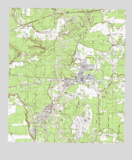
Liberty, TX USGS Topographic Map
Click on map above to begin viewing in our Map Viewer.

This topographic map contains these locations and features:
Feature Name Type Latitude Longitude GNIS ID View Map
Abbott CreekStreamN30.0363°W94.7844°1329167View Map
AtascositoPopulated PlaceN30.0919°W94.7627°1377115View Map
Beards MarshSwampN30.0256°W94.7890°1330259View Map
Big BayouStreamN30.0597°W94.8177°1330561View Map
Bowie CreekStreamN30.0774°W94.8608°1331121View Map
Branch CemeteryCemeteryN30.0734°W94.7981°1331192View Map
Champ d'Asile (historical)Populated PlaceN30.0752°W94.8169°1377116View Map
City of LibertyCivilN30.0491°W94.7903°2410832View Map
City of Liberty Fire DepartmentBuildingN30.0597°W94.7985°2470871View Map
Clayton BayouLakeN30.0096°W94.7825°1373125View Map
Cleveland-Partlow HouseBuildingN30.0638°W94.7852°2031373View Map
Cross BayouStreamN30.1222°W94.7921°1333710View Map
Cypress LakeLakeN30.0389°W94.8492°1377095View Map
Daniel RanchLocaleN30.1083°W94.7652°1334030View Map
Daniels LakeReservoirN30.1135°W94.7719°1861953View Map
Daniels Lake DamDamN30.1135°W94.7719°1861952View Map
Day LakeLakeN30.0172°W94.8417°1334114View Map
Duncan LakeLakeN30.0220°W94.8150°1334782View Map
Duncan LakeLakeN30.0169°W94.8183°1377097View Map
Fairlawn CemeteryCemeteryN30.0427°W94.7769°1335616View Map
Fairlawn Memorial ParkParkN30.0422°W94.7774°2028390View Map
First United Methodist Church of LibertyChurchN30.0726°W94.7971°2470834View Map
French BayouStreamN30.0344°W94.8496°1336192View Map
French CreekStreamN30.0641°W94.8730°1336195View Map
Gillen BayouStreamN30.1241°W94.8244°1336529View Map
Graveyard HillCliffN30.1013°W94.7669°1336874View Map
Gulf Coast High SchoolSchoolN30.0633°W94.7999°2003365View Map
Gulf Coast High SchoolSchoolN30.0743°W94.7721°2005343View Map
Gulf Coast High School - ClevelandSchoolN30.0588°W94.8133°2007892View Map
Gulf Coast High School - DaytonSchoolN30.0633°W94.7999°2007893View Map
Gulf Coast High School - LibertySchoolN30.0780°W94.7774°2007895View Map
Gum SloughGutN30.0358°W94.7996°1337125View Map
Hardin - Chambers CenterSchoolN30.0744°W94.7724°2005345View Map
Hardin - Chambers Education CenterSchoolN30.0802°W94.7735°2006117View Map
Hardin - Chambers Learning CenterSchoolN30.0744°W94.7724°2007899View Map
Hayes ParkParkN30.0669°W94.7952°1337496View Map
Horse Shoe Bend BayouBendN30.0502°W94.8544°1377107View Map
Horseshoe LakeLakeN30.1220°W94.8106°1338124View Map
Horseshoe LakeLakeN30.1198°W94.8113°1338131View Map
Immaculate Conception ChurchChurchN30.0589°W94.7987°2471028View Map
Josie BayouStreamN30.1133°W94.7899°1338890View Map
Josie LakeLakeN30.1024°W94.7939°1338891View Map
Josie LakeReservoirN30.1035°W94.8135°1861955View Map
Josie Lake LeveeDamN30.1035°W94.8135°1861954View Map
KenefickPopulated PlaceN30.1091°W94.8583°1378522View Map
Kenefick City HallBuildingN30.1042°W94.8578°2753979View Map
Kenefick Police DepartmentBuildingN30.1042°W94.8578°2375998View Map
Kenefick Volunteer Fire and RescueBuildingN30.1060°W94.8592°2655514View Map
Kersting HospitalHospitalN30.0691°W94.7985°1339061View Map
KPXE-AM (Liberty)TowerN30.0013°W94.7591°1385613View Map
Lake BayouStreamN30.1085°W94.7944°1339484View Map
Lake LibertyReservoirN30.0785°W94.7605°1331016View Map
LibertyPopulated PlaceN30.0580°W94.7955°1339866View Map
Liberty City HallBuildingN30.0593°W94.7974°2753251View Map
Liberty City Volunteer Fire DepartmentBuildingN30.0744°W94.7788°2334459View Map
Liberty County Constable's Office Precinct 1BuildingN30.0593°W94.7965°2751418View Map
Liberty County CourthouseBuildingN30.0591°W94.7971°2030546View Map
Liberty County JailBuildingN30.0587°W94.7911°2738750View Map
Liberty County Sheriff's Department - DetectiveBuildingN30.0588°W94.7909°2376004View Map
Liberty County Sheriff's Department - IdentificationBuildingN30.0593°W94.7966°2375832View Map
Liberty County Sheriff's OfficeBuildingN30.0588°W94.7909°2375948View Map
Liberty Dayton Regional Medical CenterHospitalN30.0688°W94.7987°2015811View Map
Liberty Elementary SchoolSchoolN30.0663°W94.8017°2007904View Map
Liberty High SchoolSchoolN30.0744°W94.7879°2007905View Map
Liberty Middle SchoolSchoolN30.0747°W94.7911°2007814View Map
Liberty Police DepartmentBuildingN30.0742°W94.7781°2375882View Map
Liberty Post OfficePost OfficeN30.0591°W94.8014°2731613View Map
Liberty StadiumParkN30.0633°W94.7996°2027771View Map
Liberty-Dayton DivisionCivilN30.0055°W94.7822°1938920View Map
Linney CreekStreamN30.0333°W94.8519°1339985View Map
Mill CreekStreamN30.1127°W94.8169°1377103View Map
My HeliportAirportN30.1063°W94.8558°1386514View Map
Negros Liberty SettlementPopulated PlaceN30.0127°W94.7849°1377117View Map
Neyland CemeteryCemeteryN30.0722°W94.8021°1342580View Map
North Height TabernacleChurchN30.0730°W94.7899°1342751View Map
Old Hardin CemeteryCemeteryN30.1013°W94.7655°1343156View Map
Palmer BayouStreamN30.0974°W94.7974°1343467View Map
Pleasant Hill ChurchChurchN30.0013°W94.7552°1344214View Map
Pruett BayouStreamN30.0502°W94.8627°1377108View Map
Saint Johns ChurchChurchN30.0833°W94.7688°1345945View Map
Saint Pauls ChurchChurchN30.0641°W94.7844°1346089View Map
Saint Stephens Episcopal ChurchChurchN30.0600°W94.7955°2471151View Map
San Jacinto Elementary SchoolSchoolN30.0639°W94.8000°2007817View Map
SandunePopulated PlaceN30.1244°W94.7744°1379022View Map
Snag LakeLakeN30.0286°W94.8201°1347316View Map
South LibertyPopulated PlaceN30.0291°W94.7921°1379094View Map
South Liberty Oil FieldOilfieldN30.0110°W94.8085°1376219View Map
South Liberty Oil FieldOilfieldN30.0085°W94.8169°1347431View Map
Spring BranchStreamN30.0627°W94.8544°1377138View Map
State Highway 3 BridgeBridgeN30.0577°W94.8194°2031627View Map
Town of KenefickCivilN30.1069°W94.8501°2412826View Map
Trinity Valley Baptist ChurchChurchN30.0588°W94.8109°2471300View Map
Turkey CreekStreamN30.0060°W94.7571°1348856View Map
Turkey Creek ChurchChurchN30.0183°W94.7763°1348878View Map
Twin LakeLakeN30.0686°W94.8161°1348945View Map
West Liberty High SchoolSchoolN30.0633°W94.7999°2004631View Map
Wood Spring CreekStreamN30.0947°W94.7738°1350518View Map

Note: Coordinates in the location and feature list above are referenced to NAD83 datum.


Copyright (C) 2008-2024 Ryan Niemi / Sunset Dynamics ... All Rights Reserved